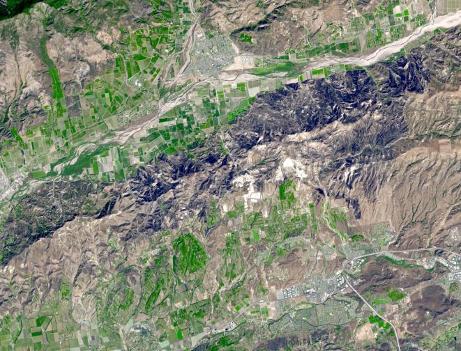
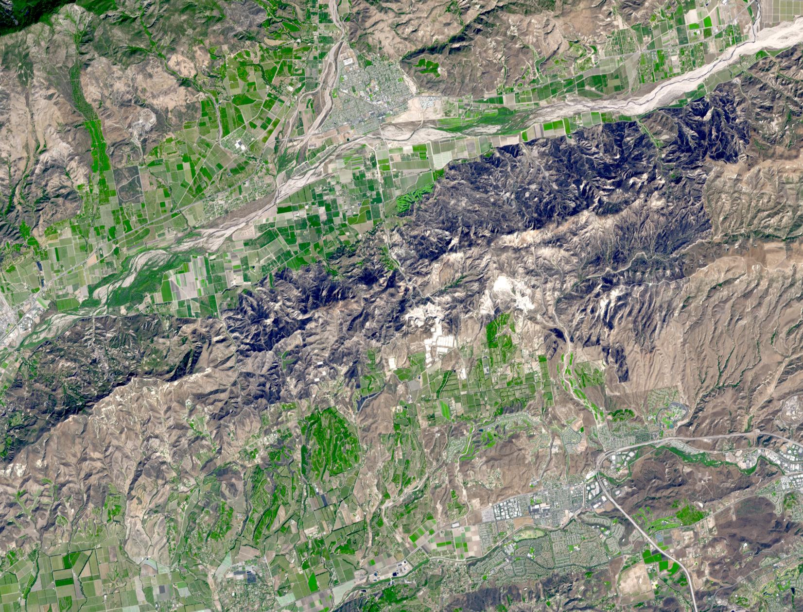
The Guiberson Fire in Ventura County, west of Los Angeles, burned more than 16,000 acres (25 square miles) before firefighters were able to contain the blaze on Sept. 28, 2009. Started on Sept. 22, the fire burned and spread for six days before favorable weather and efforts by more than 1,800 firefighters contained it. The fire threatened valuable agricultural properties in the area, including orchards and avocado groves. In this image from the Advanced Spaceborne Thermal Emission and Reflection Radiometer (ASTER) instrument on NASA's Terra satellite, the burned areas appear dark gray, agricultural fields are green and hills with dry vegetation are buff colored.
With its 14 spectral bands from the visible to the thermal infrared wavelength region and its high spatial resolution of 15 to 90 meters (about 50 to 300 feet), ASTER images Earth to map and monitor the changing surface of our planet. ASTER is one of five Earth-observing instruments launched December 18, 1999, on NASA's Terra satellite. The instrument was built by Japan's Ministry of Economy, Trade and Industry. A joint U.S./Japan science team is responsible for validation and calibration ofthe instrument and the data products.
The broad spectral coverage and high spectral resolution of ASTER provides scientists in numerous disciplines with critical information for surface mapping and monitoring of dynamic conditions and temporal change. Example applications are: monitoring glacial advances and retreats; monitoring potentially active volcanoes; identifying crop stress; determining cloud morphology and physical properties; wetlands evaluation; thermal pollution monitoring; coral reef degradation; surface temperature mapping of soils and geology; and measuring surface heat balance.
The U.S. science team is located at NASA's Jet Propulsion Laboratory, Pasadena, Calif. The Terra mission is part of NASA's Science Mission Directorate.
More information about ASTER is available at http://asterweb.jpl.nasa.gov/.
Image acquired: October 1, 2009
Area covered: 15.4 by 12.3 miles (24.8 by 19.9 kilometers)
Location of image: 34.2 degrees north latitude, 118.8 degrees west longitude
Image resolution: 50 feet (15 meters)