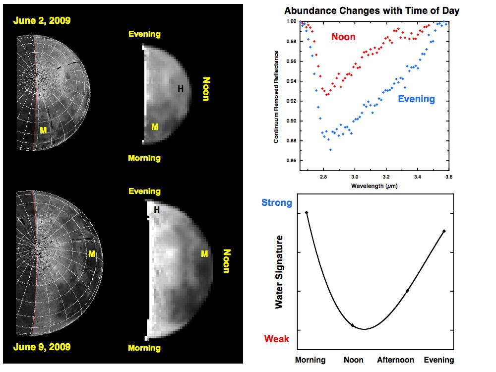
Observations from NASA's Deep Impact mission of the moon's north pole from June 2 to 9, 2009 reveal changes in the amounts of water and hydroxyl. In the week between these datasets, the moon had rotated 90 degrees (one-quarter of a lunar day). For example, a volcanic mare terrain (labeled 'M') is observed in the morning on June 2, but by June 9 is at local noon. Similarly, a highland unit ('H') begins at noon and rotates to evening on June 9.
Deep Impact observed a significant change in the strength of a water and hydroxyl signature as the moon rotated around. The highland unit, for example, has a weaker signal near noon (red) and a stronger signal by evening (blue). Taken together, the data show a systematic change in water loss from morning to noon, recovery through the afternoon, and a return to a steady state by evening. This daytime cycle suggests that hydrogen ions in the solar wind may be a source for re-hydration.
