 |  |
| MODIS Infrared Imagery (IR) | 89 GHz AMSR-E |
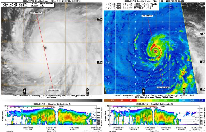
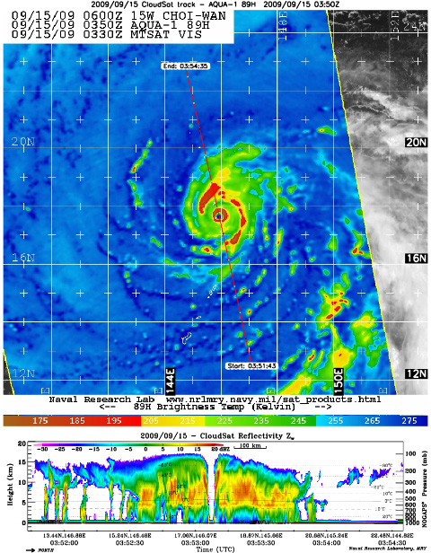
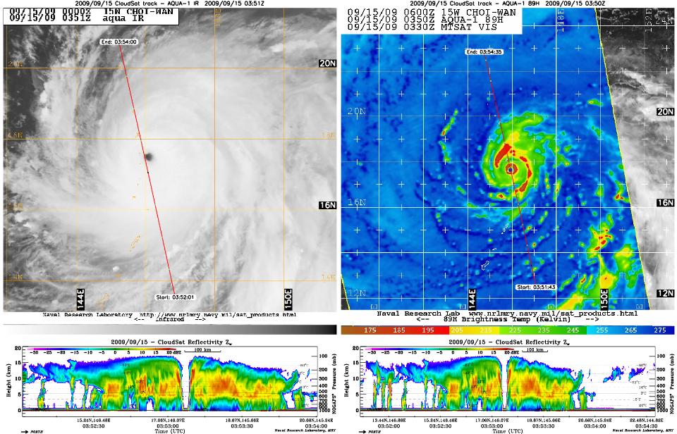
NASA's CloudSat satellite captured an eye overpass of Super Typhoon Choi-Wan in the Western Pacific on September 15, 2009 at 0352Z. The storm is the strongest typhoon of the year to date, with maximum sustained winds of 155 miles per hour (135 knots), which puts Choi-Wan on the verge of becoming a Category 5 storm on the Saffir-Simpson hurricane scale.
The CloudSat overpass (the lower images below the MODIS and ASMR-E images above) shows a vertical cross-section right through the center of the storm. The eye center is free of cirrus clouds, with eyewall edges that slope outward toward the top of the storm and "hot towers" on both sides (denoted by the bright red bands outside the eye center in the NASA Aqua satellite AMSR-E 89 gigahertz image). Hot towers are cumulonimbus clouds that penetrate the tropical troposphere layer.
The storm has a well-developed, fully-enclosed circular eyewall (red circle) around the eye center, with intense convection and precipitation extending outwards, shown in oranges and reds. The Aqua infrared image depicts cloud cover throughout the overpass, but the CloudSat image reveals convection-free areas known as "moats" that contain a thick cirrus cloud canopy between the storm's spiral rain bands. This is one of a few inner-eye images that CloudSat has captured of a storm of this intensity.
Quicklook Images can viewed at the CloudSat Data Processing Center.
