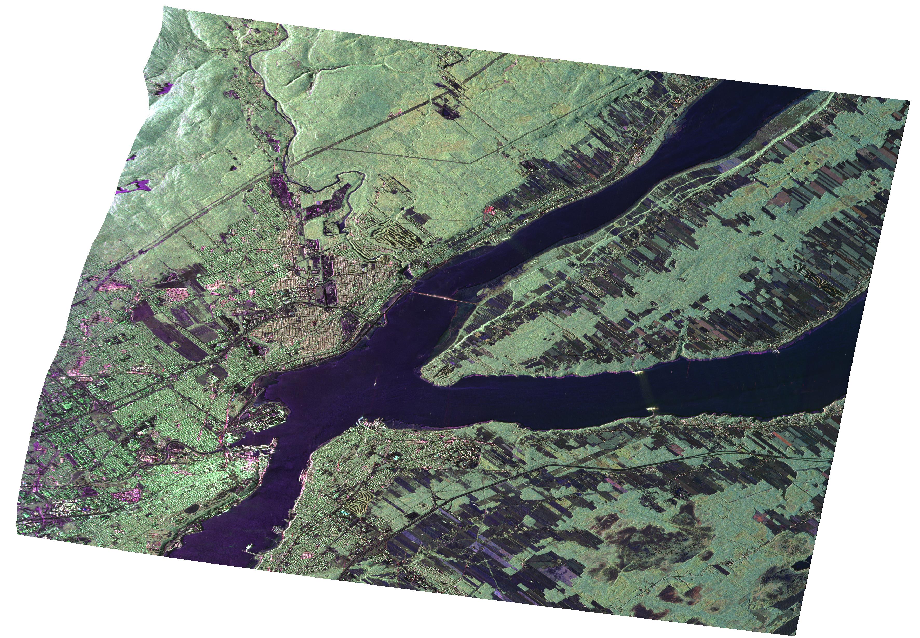
JPL's Uninhabited Aerial Vehicle Synthetic Aperture Radar (UAVSAR) collected this composite radar image around Québec City, Canada, during an 11-day campaign to study the structure of temperate and boreal forests. The campaign was funded by NASA's Terrestrial Ecology Program to develop a methodology to estimate vegetation 3-D structure using radar and lidar. Dr. Marc Simard, the principal investigator, chose the "Réserve Faunique des Laurentides" just North of Québec City as an ideal site to study boreal forests. The Reserve covers an area of nearly 8,000 square kilometers and includes a high-altitude plateau with a boreal climate.
The image has a 5-meter resolution and shows an enormous amount of details. The St. Lawrence river is clearly visible (dark) with the large island called "Ile D'Orléans" (center right). Agricultural fields are darker than forested areas (e.g. region northwest corner) due to a relatively low biomass. The green color indicates "volume scattering," which is due to microwave (radar) interaction with forest structures. Tones of green are due to differences in forest canopy architecture and biomass. The urban areas, have bright (white) features due to structures such as buildings. The roads are the fine dark lines.
UAVSAR is a reconfigurable polarimetric L-band synthetic aperture radar (SAR) specifically designed to acquire airborne repeat track SAR data for differential interferometric measurements. For more information about radar polarimetry, see http://www.ccrs.nrcan.gc.ca/resource/tutor/polarim/index_e.php. The radar is currently operating on a NASA Gulfstream-III aircraft based at Dryden and will eventually be ported to fly on an uninhabited, remote-piloted aircraft such as the Northrop Grumman Global Hawk. The radar was built at the Jet Propulsion Laboratory (JPL) with funding by the NASA Earth Science Technology Office (ESTO). UAVSAR is managed and operated by JPL under contract with the NASA Science Directorate.
