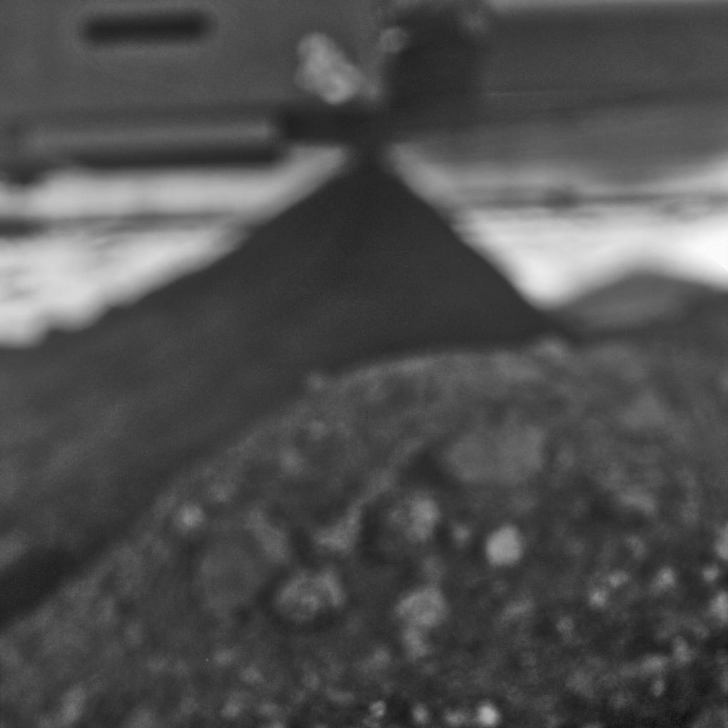
This mosaic image was taken with the microscopic imager on NASA's Mars Exploration Rover Spirit to accomplish something never intended during the design of the rover or that camera -- getting a look underneath the rover. The dark triangular shape is a rock that is either touching or nearly touching the rover's underbelly.
Rover team members used Spirit's microscopic imager during the 1,990th Martian day, or sol, of the rover's mission on Mars (Aug. 8, 2009) to look beneath Spirit for only the second time since before it left Earth in 2003. They did so to get a better understanding of Spirit's predicament, with wheels embedded deeply enough in soft soil at a site called "Troy" for the rover to be at risk of getting hung up on the rock beneath the belly.
The microscopic imager is designed to focus on rock or soil targets 6 centimeters (2.4 inches) away. It rides on the end of the rover's robotic arm so that it can be placed close to targets for inspection. It cannot focus on objects as far away as the rover underbelly and rocks that are visible in this image despite being out of focus. However, its position on the maneuverable arm enables positioning it for a view that none of the other cameras on the rover could get. The rover team used this technique for an initial view underneath Spirit on Sol 1925 (June 2, 2009) after trying out the technique first with an Earthbound test rover and with Spirit's twin, Opportunity. The Sol 1990 imaging viewed the rock from slightly different camera positions for improved three-dimensional understanding of its location.
