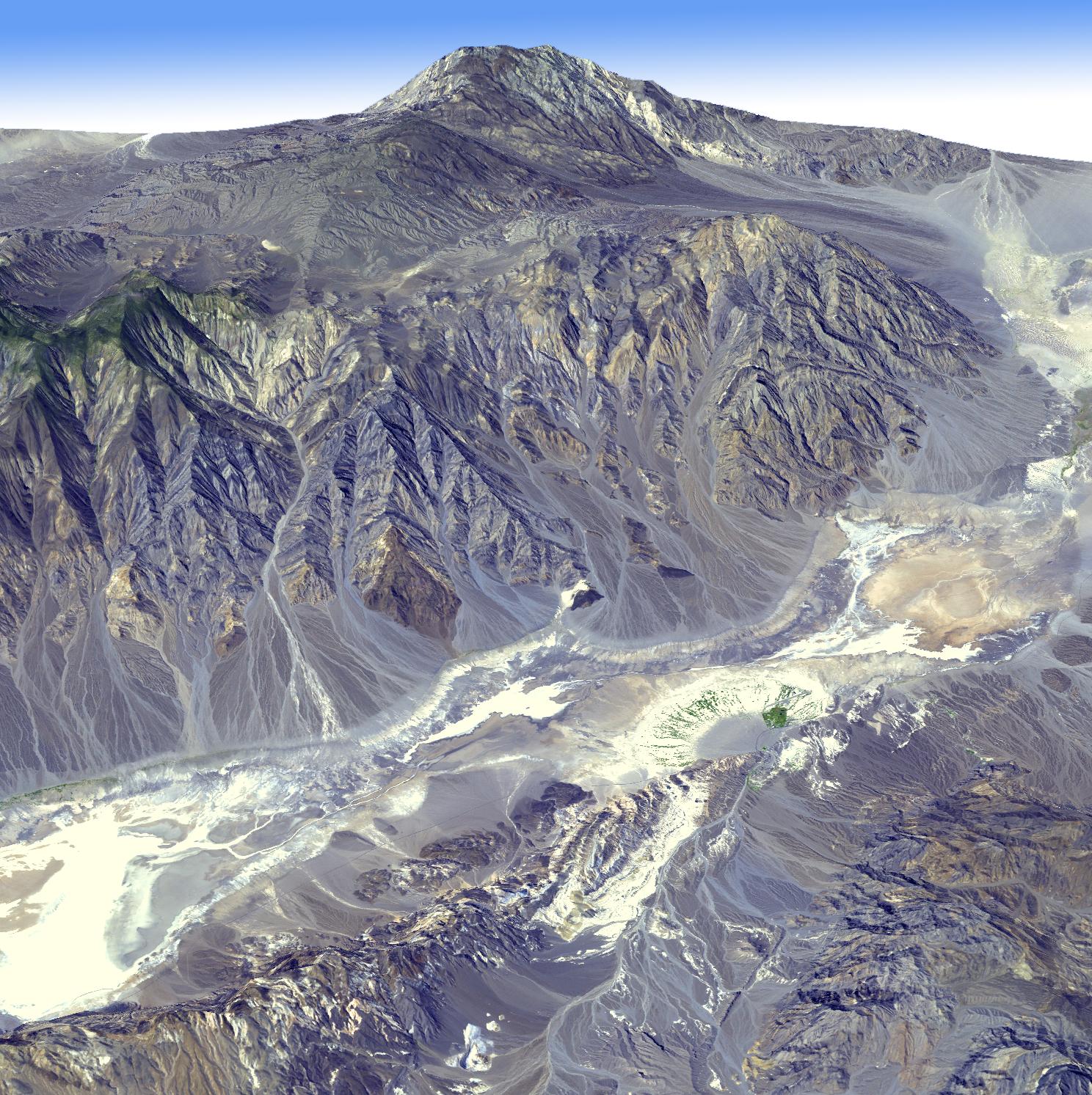
Death Valley, Calif., has the lowest point in North America, Badwater at 85.5 meters (282 feet) below sea level. It is also the driest and hottest location in North America. Located in eastern California and western Nevada, Death Valley forms part of Death Valley National Park. The region is characterized by deep valleys and high mountain ranges, located in the large Basin and Range province of the western United States. This view looking towards the northwest was created by draping an Advanced Spaceborne Thermal Emission and Reflection Radiometer (ASTER) simulated natural color image over digital topography from the ASTER Global Digital Elevation Model (GDEM) data set. Furnace Creek ranch in the right foreground is the only place on the valley floor where vegetation grows year-round due to water channeled through Furnace Creek. The ASTER scene was acquired September 24, 2003, and is located near 36.4 degrees north latitude, 116.9 degrees west longitude.
With its 14 spectral bands from the visible to the thermal infrared wavelength region and its high spatial resolution of 15 to 90 meters (about 50 to 300 feet), ASTER images Earth to map and monitor the changing surface of our planet. ASTER is one of five Earth-observing instruments launched December 18, 1999, on NASA's Terra satellite. The instrument was built by Japan's Ministry of Economy, Trade and Industry. A joint U.S./Japan science team is responsible for validation and calibration of the instrument and the data products.
The broad spectral coverage and high spectral resolution of ASTER provides scientists in numerous disciplines with critical information for surface mapping and monitoring of dynamic conditions and temporal change. Example applications are: monitoring glacial advances and retreats; monitoring potentially active volcanoes; identifying crop stress; determining cloud morphology and physical properties; wetlands evaluation; thermal pollution monitoring; coral reef degradation; surface temperature mapping of soils and geology; and measuring surface heat balance.
The U.S. science team is located at NASA's Jet Propulsion Laboratory, Pasadena, Calif. The Terra mission is part of NASA's Science Mission Directorate.
More information about ASTER is available at http://asterweb.jpl.nasa.gov/.
