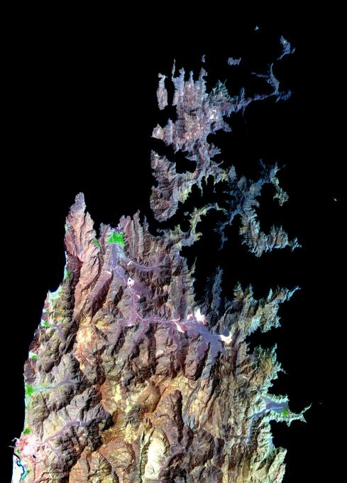
The Musandam Peninsula is part of Oman, separated from the rest of the country by the United Arab Emirates. It forms the southern part of the Strait of Hormuz, with the Persian Gulf to the west, and the Gulf of Oman to the east. The capital city Khasab has 18,000 inhabitants. Fishing is the peninsula's main industry, and transportation is mostly by sea. The peninsula's distinctive fjord-like physiography is due to submergence of the land from the tectonic collision between the Arabian Plate and the Eurasian Plate.
The image covers an area of 46.6 x 64.8 km, was acquired on March 27, 2004, and is located near 26.2 degrees north latitude, 56.4 degrees east longitude.
With its 14 spectral bands from the visible to the thermal infrared wavelength region and its high spatial resolution of 15 to 90 meters (about 50 to 300 feet), ASTER images Earth to map and monitor the changing surface of our planet.
ASTER is one of five Earth-observing instruments launched December 18, 1999, on NASA's Terra satellite. The instrument was built by Japan's Ministry of Economy, Trade and Industry. A joint U.S./Japan science team is responsible for validation and calibration of the instrument and the data products.
The broad spectral coverage and high spectral resolution of ASTER provides scientists in numerous disciplines with critical information for surface mapping and monitoring of dynamic conditions and temporal change. Example applications are: monitoring glacial advances and retreats; monitoring potentially active volcanoes; identifying crop stress; determining cloud morphology and physical properties; wetlands evaluation; thermal pollution monitoring; coral reef degradation; surface temperature mapping of soils and geology; and measuring surface heat balance.
The U.S. science team is located at NASA's Jet Propulsion Laboratory, Pasadena, Calif. The Terra mission is part of NASA's Science Mission Directorate.
More information about ASTER is available at http://asterweb.jpl.nasa.gov/.