Click on image for
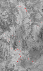
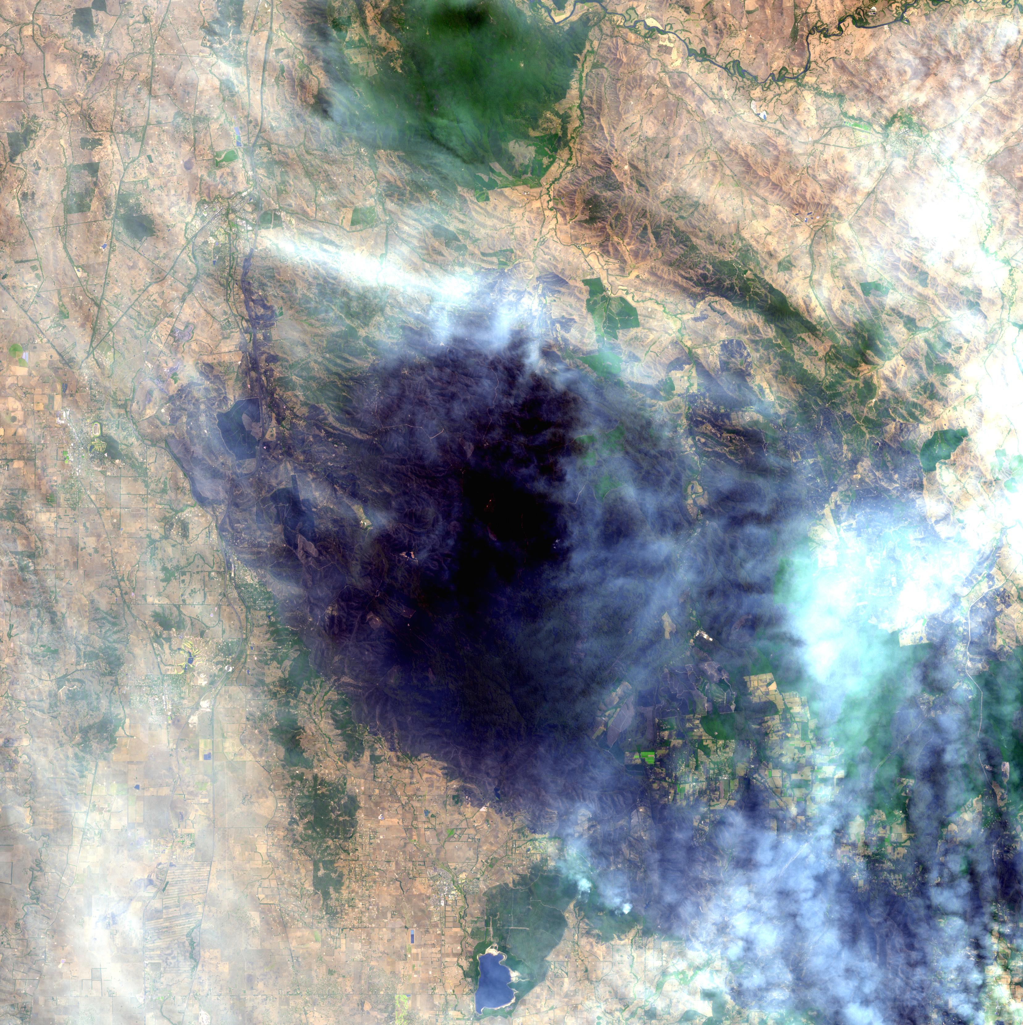
thermal infrared night-time imageThe bushfires burning in Victoria Australia have claimed almost 200 lives, destroyed more than 1,800 homes and scorched more than 1,500 square miles (3,900 square kilometers). A daytime image from the Advanced Spaceborne Thermal Emission and Reflection Radiometer (ASTER) instrument on NASA's Terra spacecraft captured on February 14 shows a large burned area about 50 kilometers (30 miles) northeast of Melbourne near Kinglake National Park. The area is still smoke-covered due to active fires. The night of February 17, ASTER captured a thermal infared image of an area just east of the daytime image. Active fires have been highlighted in red color and show the burning perimeter of several different fires.
With its 14 spectral bands from the visible to the thermal infrared wavelength region and its high spatial resolution of 15 to 90 meters (about 50 to 300 feet), ASTER images Earth to map and monitor the changing surface of our planet. ASTER is one of five Earth-observing instruments launched December 18, 1999, on NASA's Terra satellite. The instrument was built by Japan's Ministry of Economy, Trade and Industry. A joint U.S./Japan science team is responsible for validation and calibration of the instrument and the data products.
The broad spectral coverage and high spectral resolution of ASTER provides scientists in numerous disciplines with critical information for surface mapping and monitoring of dynamic conditions and temporal change. Example applications are: monitoring glacial advances and retreats; monitoring potentially active volcanoes; identifying crop stress; determining cloud morphology and physical properties; wetlands evaluation; thermal pollution monitoring; coral reef degradation; surface temperature mapping of soils and geology; and measuring surface heat balance.
The U.S. science team is located at NASA's Jet Propulsion Laboratory, Pasadena, Calif. The Terra mission is part of NASA's Science Mission Directorate.
More information about ASTER is available at http://asterweb.jpl.nasa.gov/.
Size: 49 by 49 kilometers (30 by 30 miles), and 40.6 by 67.4 kilometers (25.2 by 41.8 miles)
Location: 37.5 degrees South latitude, 145 degrees East longitude
Orientation: North up
Image Data: ASTER Bands 1,2,3, and 12
Original Data Resolution: 15 meters (49.2 feet), and 90 meters (300 feet) Date Acquired: February 14 and 17, 2009
