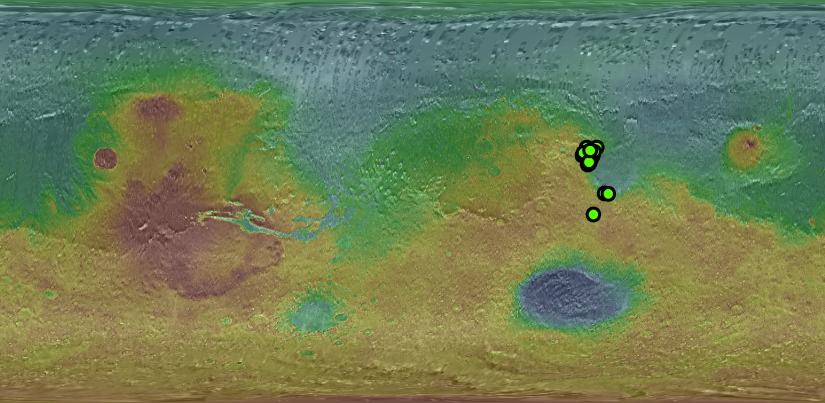
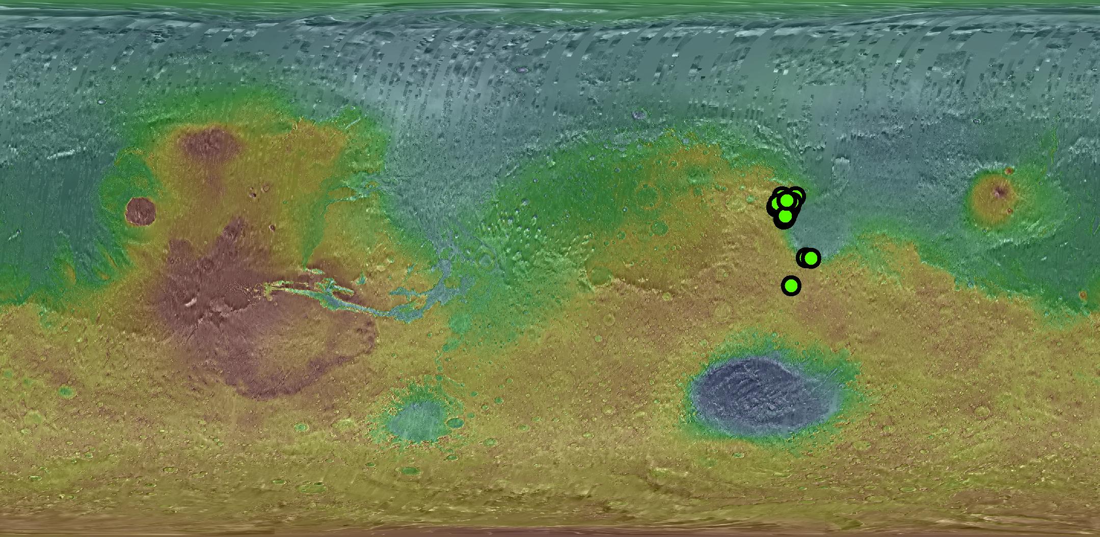
Green dots show the locations of orbital detections of carbonate-bearing rocks on Mars, determined by analysis of targeted observations by the Compact Reconnaissance Imaging Spectrometer for Mars (CRISM) acquired through January 2008. The spectrometer is on NASA's Mars Reconnaissance Orbiter.
The base map is color-coded global topography (red is high, blue is low) overlain on mosaicked daytime thermal infrared images. The topography data are from the Mars Orbiter Laser Altimeter on NASA's Mars Global Surveyor. The thermal infrared imagery is from the Thermal Emission Imaging System camera on NASA's Mars Odyssey orbiter.
The CRISM team, led by The Johns Hopkins University Applied Physics Laboratory, Laurel, Md., includes expertise from universities, government agencies and small businesses in the United States and abroad. Arizona State University, Tempe, operates the Thermal Emission Imaging System, which the university developed in collaboration with Raytheon Santa Barbara Remote Sensing.
NASA's Jet Propulsion Laboratory, a division of the California Institute of Technology in Pasadena, manages the Mars Reconnaissance Orbiter and Mars Odyssey projects for the NASA Science Mission Directorate, Washington. Lockheed Martin Space Systems, Denver, built the orbiters.