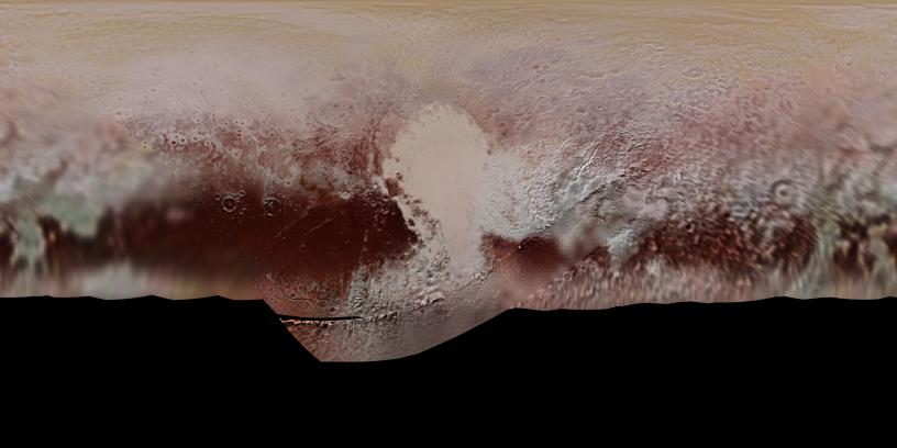
This new, detailed global mosaic color map of Pluto is based on a series of three color filter images obtained by the Ralph/Multispectral Visual Imaging Camera aboard New Horizons during the NASA spacecraft's close flyby of Pluto in July 2015. The mosaic shows how Pluto's large-scale color patterns extend beyond the hemisphere facing New Horizons at closest approach- which were imaged at the highest resolution. North is up; Pluto's equator roughly bisects the band of dark red terrains running across the lower third of the map. Pluto's giant, informally named Sputnik Planitia glacier - the left half of Pluto's signature "heart" feature -- is at the center of this map.
The Johns Hopkins University Applied Physics Laboratory in Laurel, Maryland, designed, built, and operates the New Horizons spacecraft, and manages the mission for NASA's Science Mission Directorate. The Southwest Research Institute, based in San Antonio, leads the science team, payload operations and encounter science planning. New Horizons is part of the New Frontiers Program managed by NASA's Marshall Space Flight Center in Huntsville, Alabama.