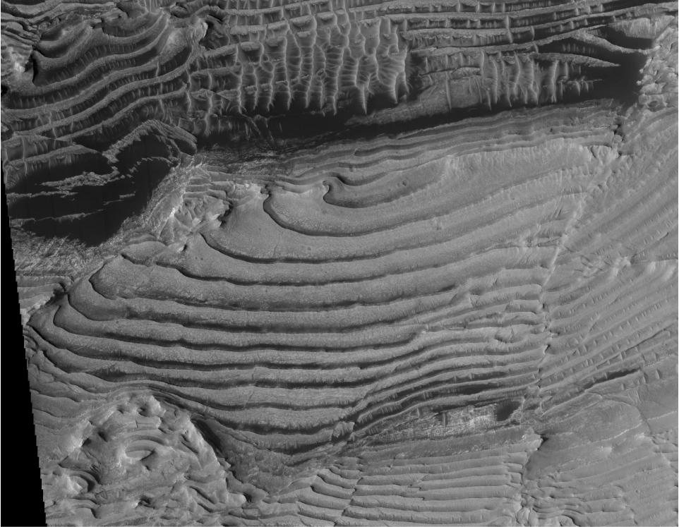
This image from the High Resolution Imaging Science Experiment (HiRISE) camera on NASA's Mars Reconnaissance Orbiter shows sedimentary-rock layering in which a series of layers are all approximately the same thickness.
Three-dimensional analysis using stereo pairs of HiRISE images has confirmed the periodic nature of the layering. Individual layers in the area average about 10 meters (33 feet) in thickness.
This image, taken on Feb. 25, 2007, is a portion of the HiRISE image catalogued as PSP_002733_1880. The location of the imaged area is at 8 degrees north latitude, 353 degrees east longitude, within the Arabia Terra region.
The view covers an area about 2 kilometers (1.2 miles) across, within an unnamed crater in the Arabia Terra region of Mars. An oblique view created from three-dimensional modeling (see PIA11442) shows the repetitive thickness of some of the same layers visible in this image.
NASA's Jet Propulsion Laboratory, a division of the California Institute of Technology in Pasadena, manages the Mars Reconnaissance Orbiter for NASA's Science Mission Directorate, Washington. Lockheed Martin Space Systems, Denver, is the prime contractor for the project and built the spacecraft. The High Resolution Imaging Science Experiment is operated by the University of Arizona, Tucson, and the instrument was built by Ball Aerospace & Technologies Corp., Boulder, Colo.
