- Original Caption Released with Image:
-
 |  | | Figure 1 | Figure 2 |
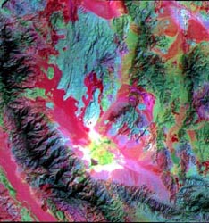
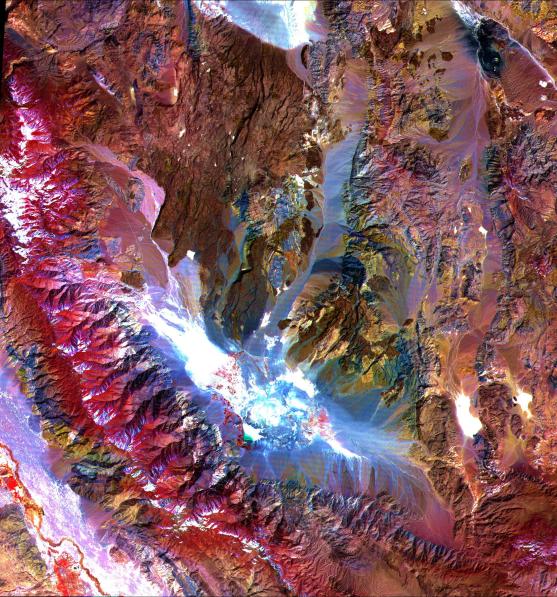
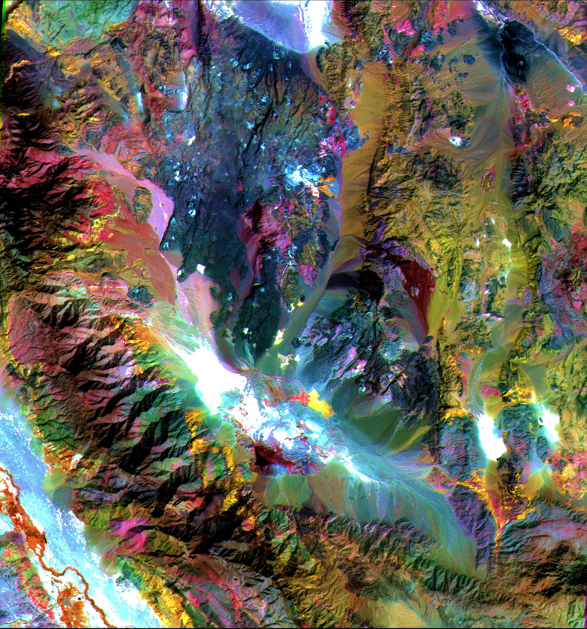
These images of the Saline Valley area, California, were acquired March 30, 2000 and cover a full ASTER scene (60 by 60 km). Each image displays data from a different spectral region, and illustrates the complementary nature of surface compositional information available as a function of wavelength. This image displays visible and near infrared bands 3, 2, and 1 in red, green, and blue (RGB). Vegetation appears red, snow and dry salt lakes are white, and exposed rocks are brown, gray, yellow and blue. Rock colors mainly reflect the presence of iron minerals, and variations in albedo. Figure 1 displays short wavelength infrared bands 4, 6, and 8 as RGB. In this wavelength region, clay, carbonate, and sulfate minerals have diagnostic absorption features, resulting in distinct colors on the image. For example, limestones are yellow-green, and purple areas are kaolinite-rich. Figure 2 displays thermal infrared bands 13, 12 and 10 as RGB. In this wavelength region, variations in quartz content appear as more or less red; carbonate rocks are green, and mafic volcanic rocks are purple. The image is located at 36.8 degrees north latitude and 117.7 degrees west longitude. The U.S. science team is located at NASA's Jet Propulsion Laboratory, Pasadena, Calif. The Terra mission is part of NASA's Science Mission Directorate.
- Image Credit:
-
NASA/GSFC/METI/ERSDAC/JAROS, and U.S./Japan ASTER Science Team
Image Addition Date: -
2001-10-22
|