- Original Caption Released with Image:
-
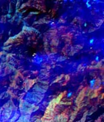
Figure 1
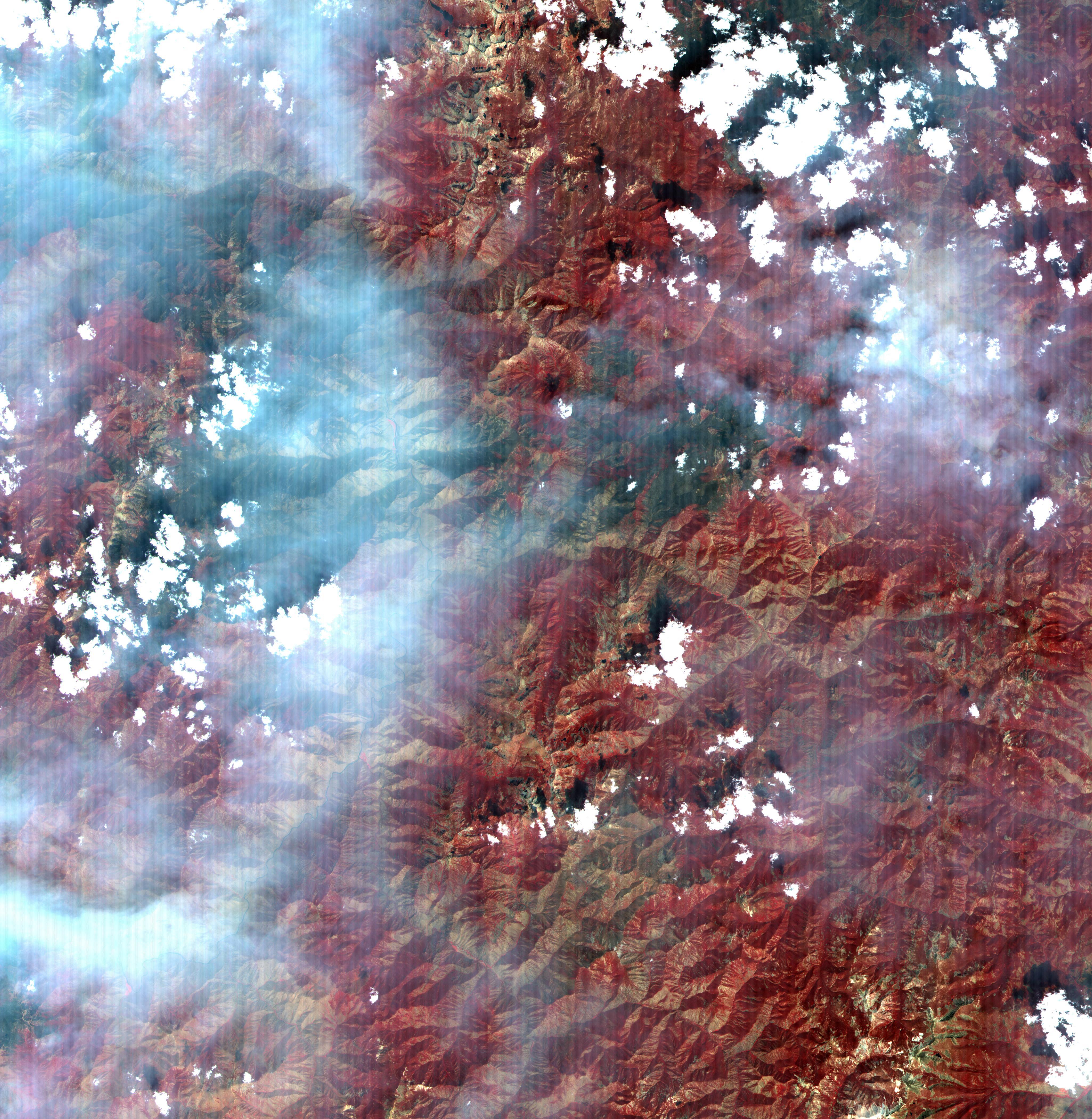
Click on image for larger versionThis full-frame ASTER image, acquired August 30, 2000, covers an area of 60 by 60 km in the Salmon River Mountains, Idaho. In this color infrared composite, vegetation is red, clouds are white, and smoke from forest fires is blue. An enlargement (Figure 1) covers an area of 12 x 15 km. A thermal infrared band is displayed in red, a short wave infrared band is displayed in green, and a visible band is displayed in blue. In this combination, fires larger than about 50 m appear yellow because they are bright in both infrared bands. Smaller fires appear green because they are too small to be seen by the 90 m thermal pixels, but large enough to be detected in the 30 m short wave infrared pixels. We are able to see through the smoke in the infrared bands, whereas in the visible bands, the smoke obscures detection of the active fires. This image is located at 44.8 degrees north latitude and 114.8 degrees west longitude. The U.S. science team is located at NASA's Jet Propulsion Laboratory, Pasadena, Calif. The Terra mission is part of NASA's Science Mission Directorate.
- Image Credit:
-
NASA/GSFC/METI/ERSDAC/JAROS, and U.S./Japan ASTER Science Team
Image Addition Date: -
2001-10-22
|
