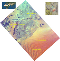
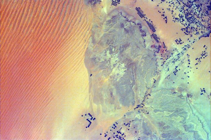
Click on image for larger annotated versionThis image shows pivot irrigation near the city of As Sulayyil (Sulayel), Saudi Arabia. The edge of the Rub' al-Khali or Empty Quarter is visible in the southeast.
Modern drilling, pumping, and distribution systems have permitted many arid and semiarid regions of the world to become productive farmlands. The circular features that dot the desert landscape are created by pivoting sprinklers, a method of irrigation whereby water from a central well is spread by a sprinkler pivoting around that well. Center-pivot irrigation is most often used in arid and semiarid regions of the world. The diameter of these circular fields can vary from several hundred feet to over a mile. Dark circles represent fields where crops are presently grown; faint circles outline field patterns where no crops are being grown. Some fields have been taken out of production to lie fallow, some have been harvested or planted with a new crop, and some have been taken out of production indefinitely. The water is being extracted from subsurface reserves that infiltrated deep aquifers during geological periods when the climate was much wetter than at present. Center-pivot irrigation is not unique to Saudi Arabia, and there is danger in that there is a finite supply of "fossil" water for irrigation use.
The Rub' al-Khali is a vast desert in the southern Arabian Peninsula, covering about 250,000 square miles in a structural basin lying mainly in southeastern Saudi Arabia, with lesser portions in Yemen, Oman, and the United Arab Emirates. It is the largest area of continuous sand in the world. It occupies more than one-quarter of Saudi Arabia. The topography is varied. In the west the elevation is as high as 2,000 feet and the sand is fine and soft, while in the east the elevation drops to 600 feet with sand dunes, salt flats, and sand sheets. One of the driest regions in the world, it is virtually uninhabited and largely unexplored.
Photojournal note:
EarthKAM was formerly known as KidSat. To see images of KidSat, see https://photojournal.jpl.nasa.gov/mission/KidSat .
