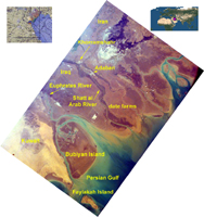
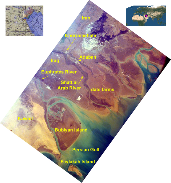
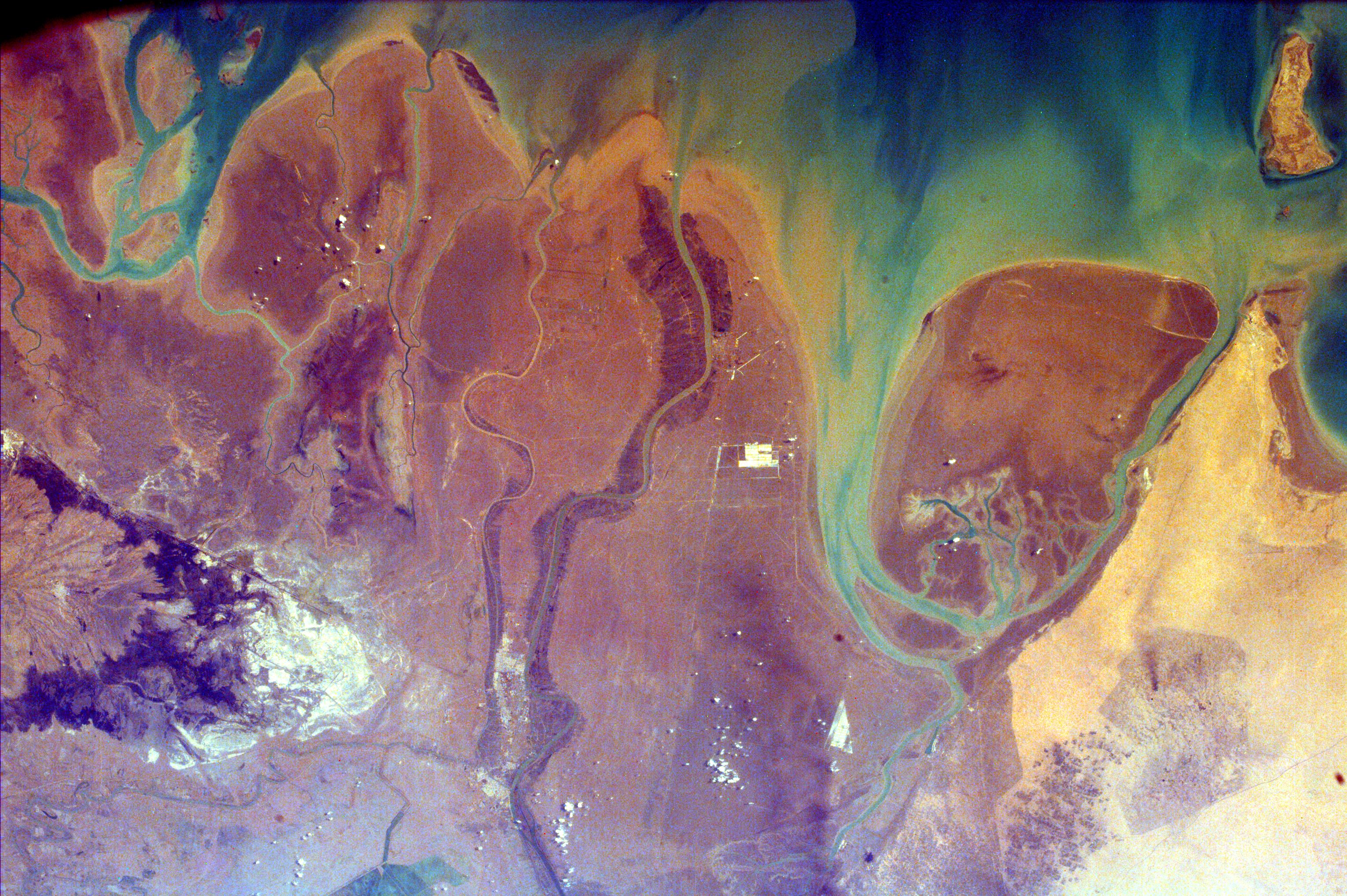
Click on image for larger annotated versionThis image of the northern end of the Persian Gulf and the broad delta complex of the Tigris, Euphrates, Shatt al Arab, and Karun rivers has captured the arid-looking wetlands of northeast Kuwait (Bubiyan Island), the narrow corridor that is Iraq's only access to the Persian Gulf, and the west-southwest marshes of Iran. Date groves line the Shatt al Arab River in the center of the image. The city of Abadan is visible at the top of the image along the Shatt al Arab River. The broad deltaic plain is noticeably asymmetrical in profile, with the deepest water occurring along the Iranian coast and a broad shallow area, which is usually less than 120 feet deep, along the Arabian coast. The Tigris-Euphrates delta complex is mainly floored with gray-green mud rich in calcium carbonate.
The delta of the Tigris and Euphrates Rivers has suffered substantial environmental changes because of drainage, pollution, and urban and industrial development. Water normally supplied to the region has been diverted for irrigation and domestic and industrial consumption; wetlands have been drained for agriculture and industrial purposes; and the construction of dams has decreased the amount of fresh water from the Tigris and Euphrates Rivers, resulting in small quantities of silt being deposited in the delta of these once mighty rivers. Because natural materials are used for construction, the few towns and villages within the delta area tend to blend with the natural environment.
This image was taken from the Space Shuttle on February 14, 2000.
Photojournal note:
EarthKAM was formerly known as KidSat. To see images of KidSat, see https://photojournal.jpl.nasa.gov/mission/KidSat .