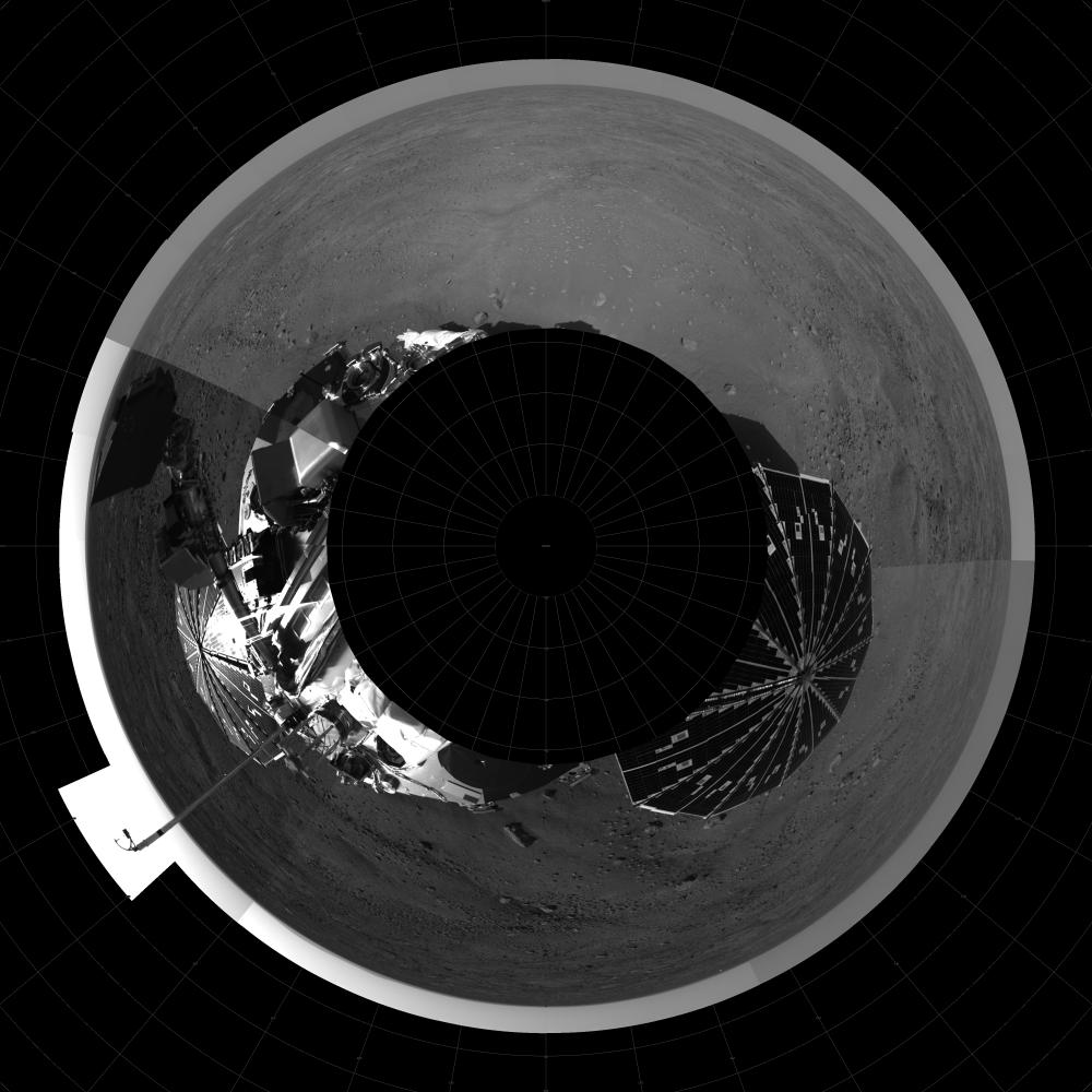
North is up (12 o'clock position) in this seam-corrected 360 degree polar projection using downsampled images from sols 1 and 3. Seam boundaries show different times of day, e.g. 9 o'clock (west) position shows scoop of RA, 7 o'clock view shows the MET mast with telltale (mast contains three temperature sensors).
Note: hummocky terrain with troughs, typical of Earth polar terrain where we would see permafrost and ice beneath surface.
The Phoenix Mission is led by the University of Arizona, Tucson, on behalf of NASA. Project management of the mission is by NASA's Jet Propulsion Laboratory, Pasadena, Calif. Spacecraft development is by Lockheed Martin Space Systems, Denver.
Photojournal Note: As planned, the Phoenix lander, which landed May 25, 2008 23:53 UTC, ended communications in November 2008, about six months after landing, when its solar panels ceased operating in the dark Martian winter.