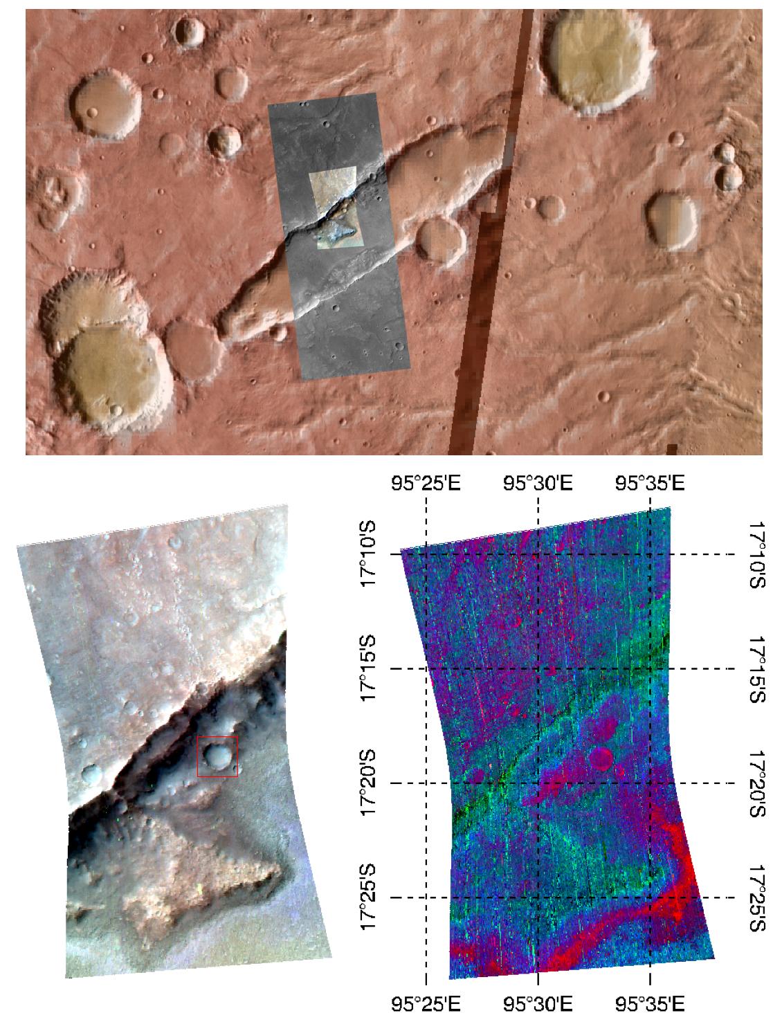
This image of the wall of a graben—a depressed block of land between two parellel faults—in Tyrrhena Terra, in Mars' ancient southern highlands, was taken by the Compact Reconnaissance Imaging Spectrometer for Mars (CRISM) at 0914 UTC (4:14 a.m. EST) on February 6, 2008, near 17.3 degrees south latitude, 95.5 degrees east longitude. CRISM's image was taken in 544 colors covering 0.36-3.92 micrometers, and shows features as small as 35 meters (115 feet) across. The region covered is just over 10 kilometers (6.2 miles) wide at its narrowest point.
This image was part of an investigation planned by students in four high schools in Durham, North Carolina. The students are working with the CRISM science team in a project called the Mars Exploration Student Data Teams (MESDT), which is part of NASA's Mars Public Engagement Program and Arizona State University's Mars Education Program. Starting with a medium-resolution map of the area, taken as part of CRISM's "multispectral survey" campaign to map Mars in 72 colors at 200 meters (660 feet) per pixel, the students identified a key rock outcrop to test their hypothesis that the irregular depression was formed by Martian volcanism. They provided the coordinates of the target to CRISM's operations team, who took a high-resolution image of the site. The Context Imager (CTX) accompanied CRISM with a 6 meter (20 feet) per pixel, high-resolution image to sharpen the relationship of spectral variations to the underlying surface structures. The Durham students worked with a mentor on the CRISM team to analyze the data, and presented their results at the 39th Lunar and Planetary Science Conference, held in League City, Texas, on March 10-14, 2008.
The upper panel of the image shows the location of the CRISM data and the surrounding, larger CTX image, overlain on an image mosaic taken by the Thermal Emission Imaging System (THEMIS) on Mars Odyssey. The mosaic has been color-coded for elevation using data from the Mars Orbiter Laser Altimeter (MOLA) instrument on the Mars Global Surveyor (MGS) spacecraft. Redder colors indicate higher elevations. The bottom left image shows infrared brightness of the surface measured by CRISM at 2.5, 1.5, and 1.1 micrometers. In the lower right image, the data have been transformed into a map of spectral features indicating the presence of different minerals. Redder areas have a stronger signature of the iron-containing mineral olivine, and green and blue areas show the signature of the mineral pyroxene.
These data sets, acquired over the last ten years, allow increasingly detailed and higher-resolution view of Mars' surface that provide scientists with a variety of measurements to understand Mars' past evolution. The same data provide teenage amateur geologists a fascinating and exciting "field site" at which to exercise the principles of earth science in a real-life, hands-on science investigation.
CRISM is one of six science instruments on NASA's Mars Reconnaissance Orbiter. Led by The Johns Hopkins University Applied Physics Laboratory, Laurel, Md., the CRISM team includes expertise from universities, government agencies and small businesses in the United States and abroad. NASA's Jet Propulsion Laboratory, a division of the California Institute of Technology in Pasadena, manages the Mars Reconnaissance Orbiter and the Mars Science Laboratory for NASA's Science Mission Directorate, Washington. Lockheed Martin Space Systems, Denver, built the orbiter.
