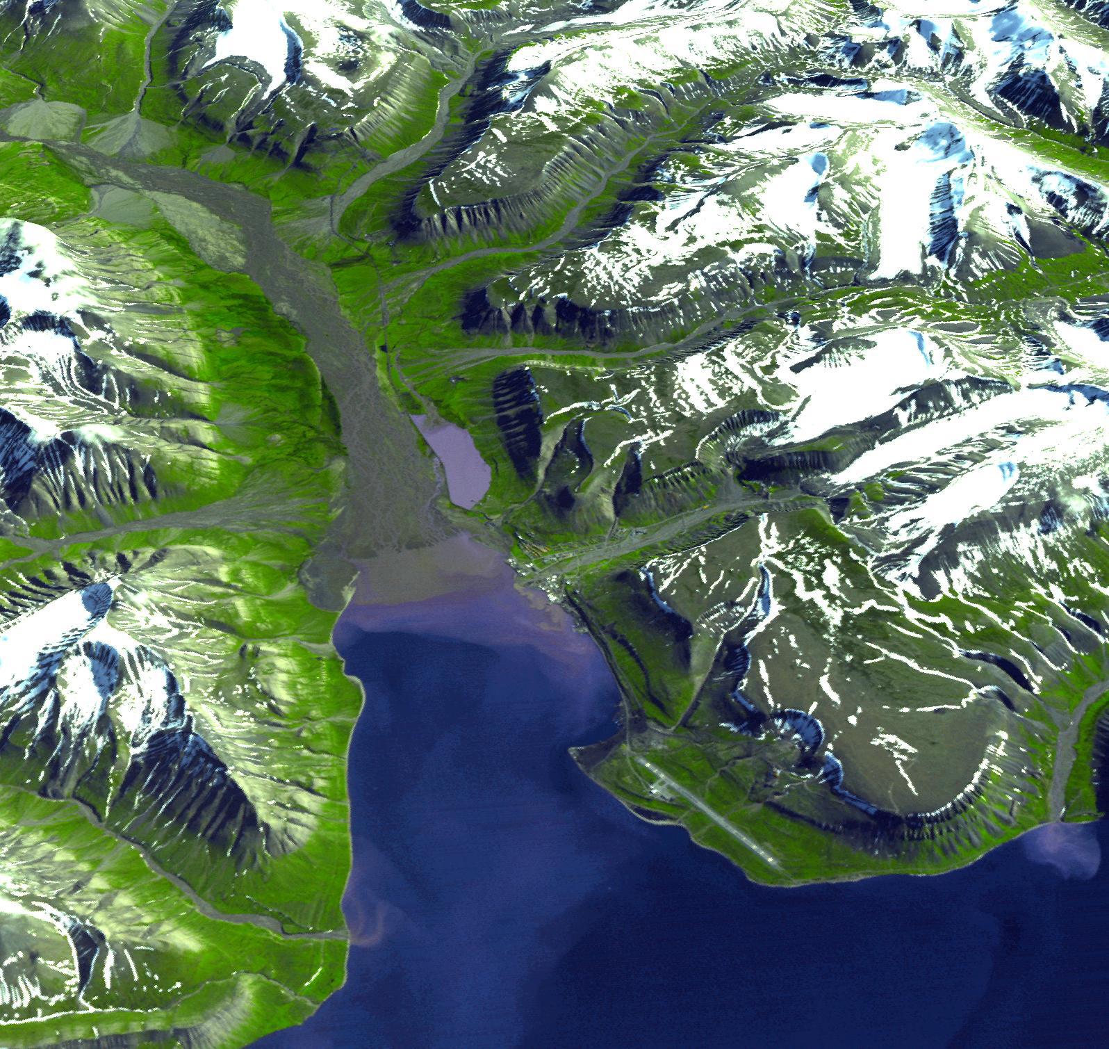
Longyearbyen is the administrative center of Svalbard and is located on Spitsbergen, the largest island of the Svalbard archipelago, part of the Kingdom of Norway. It is the world's northernmost town with over 1000 people. The settlement was founded in 1906 by John Longyear, owner of the Arctic Coal Company. Until the early 1990s the coal mining industry was the major employer of Longyearbyen. Near Longyearbyen, the Global Crop Diversity Trust administers the Svalbard Global Seed Vault, an Arctic safe capable of storing millions of crop seeds as a safeguard against natural and human disasters. Last week, the first deposit of 250,000 different species of crop seeds was made into the repository. The perspective view was created by draping a simulated natural color image over an ASTER-derived digital elevation model.
The image was acquired July 12, 2003, and is located at 78.2 degrees north latitude, 15.6 degrees east longitude.
The U.S. science team is located at NASA's Jet Propulsion Laboratory, Pasadena, Calif. The Terra mission is part of NASA's Science Mission Directorate.
