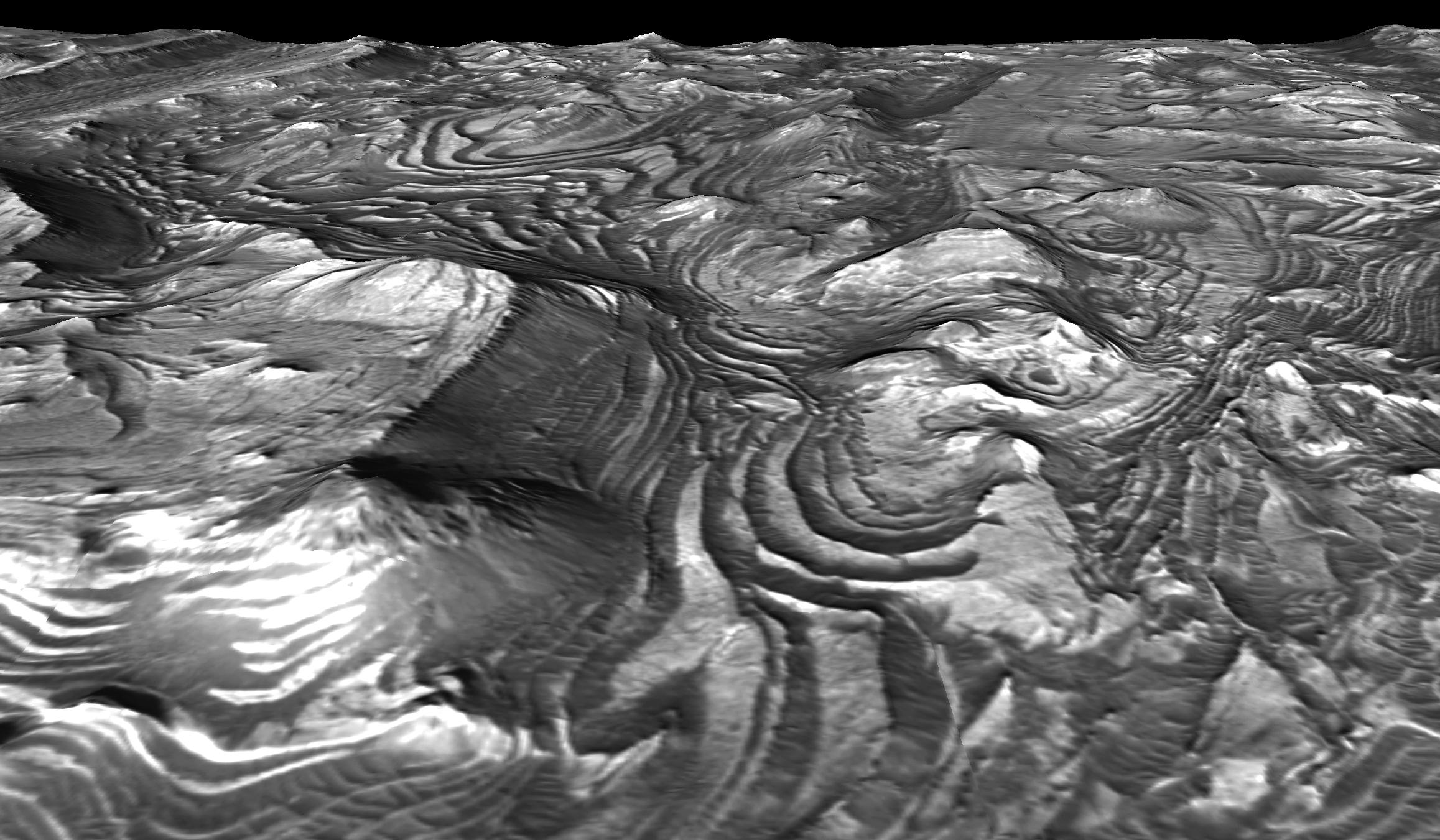
This is a eastward-looking perspective view of a scene within Mars' Candor Chasma based on stereo imaging by the High Resolution Imaging Science Experiment (HiRISE) camera aboard NASA's Mars Reconnaissance Orbiter. It shows how the surface would look like from a viewpoint at few hundred meters or yards above the surface.
In the pictured area, layers of bedrock have been folded into a series of elliptical dome-like structures. The upper surfaces of these folds have been stripped away by erosion, leaving behind concentric patterns of layers and a 'stair-stepped' terrain morphology. The dark-toned material is a surficial layer of windblown sand that has been trapped against the 'steps' in the terrain. Patterns of layer deformation such as this record the geologic history of the region. The width of the scene at the bottom of the image is approximately 600 meters (about 2,000 feet). There is no vertical exaggeration.
The detailed three-dimensional information about the area comes from a pair of HiRISE observations. Those full observations are available online at http://hirise.lpl.arizona.edu/PSP_001918_1735 and http://hirise.lpl.arizona.edu/PSP_001984_1735.
