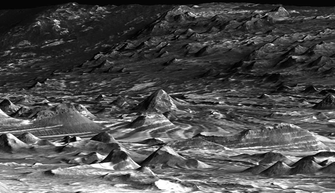
This is a perspective view of a scene within Mars' Candor Chasma based on stereo imaging by the High Resolution Imaging Science Experiment (HiRISE) camera aboard NASA's Mars Reconnaissance Orbiter. It shows how the surface would appear to a person standing on top of one of the many hills in the region and facing southeast.
The hills in the foreground are several tens of meters to about 100 meters (tens of yards to about 100 yards) wide and several tens of meters or yards tall. The light-toned layers of rock likely consist of material laid down by the wind or under water. The dark-toned material is a layer of windblown sand on the surface. The orientations of these layers were measured in three dimensions in order to understand the region's geologic history. The particular patterns in which these rocks are oriented to the surrounding Candor Chasma are most consistent with the idea that the layers formed as basin-filling sediment, analogous to the sedimentary rocks of the Paradox Basin in southeastern Utah. This implies that these sediments are younger than the formation of the chasm, providing important constraints on the maximum age of groundwater (about 3.7 billion years) within the region.
The width of the scene at bottom of the image is approximately 500 meters (1,640 feet). There is no vertical exaggeration.
The detailed three-dimensional information of the area comes from a pair of HiRISE observations. Those full observations are available online at http://hirise.lpl.arizona.edu/PSP_003474_1735 and http://hirise.lpl.arizona.edu/PSP_003540_1735.