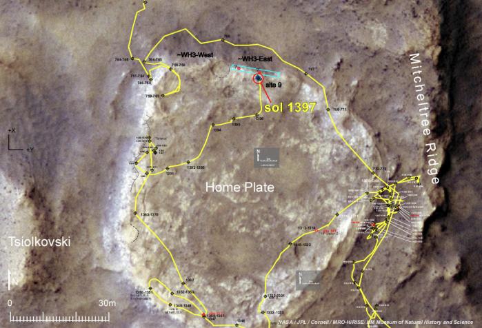
NASA's Mars Exploration Rover Spirit made daily progress in early December 2007 toward the northern edge of a low plateau called "Home Plate." The rover's operators selected an area with north-facing slope there (indicated by the blue-outlined rectangle) as a destination where Spirit would have its best chance of surviving low-solar-energy conditions of oncoming Martian winter.
As indicated by the yellow line tracing the path Spirit has driven, the rover was near the western edge of the plateau on Sol (Martian day) 1,390 of the mission (Nov. 30, 2007), but nearing the northern edge by Sol 1,397 (Dec. 8, 2007).
A north-facing slope helps Spirit maximizes electric output from its solar panels during winter months because Spirit is in the southern hemisphere of Mars, so the sun appears only in the northern sky during winter. For the third winter, which will reach its minimum solar-energy days in early June 2008, Spirit faces the challenge of having more dust on its solar panels than it had during its second winter.
The base image for this map is a portion of a color image taken on Jan. 9, 2007, by the High Resolution Imaging Science Experiment camera on NASA's Mars Reconnaissance Orbiter.