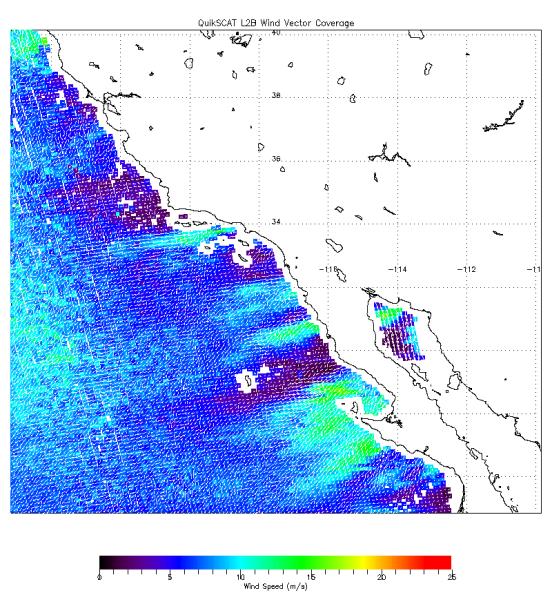
The scope and extent of the strong Santa Ana wind event in Southern California the week of Oct. 21, 2007, is visible in this image from NASA's QuikScat satellite. The image, obtained at about 7 a.m. October 22, depicts the wind speed (colors) and direction (white arrows) of the strong winds blowing offshore from Southern and Baja California. Higher wind speeds are depicted in green.
QuikScat, managed by JPL, measures ocean surface wind/stress by sending radar pulses to the surface and measuring the strength of the signals returned.
QuikScat Background
NASA's Quick Scatterometer (QuikScat spacecraft was launched from Vandenberg Air Force Base, California on June 19, 1999. QuikScat carries the SeaWinds scatterometer, a specialized microwave radar that measures near-surface wind speed and direction under all weather and cloud conditions over the Earth's oceans. More information about the QuikScat mission and observations is available at http://winds.jpl.nasa.gov/missions/quikscat/. QuikScat is managed for NASA's Science Mission Directorate, Washington, DC, by NASA's Jet Propulsion Laboratory, Pasadena, CA.