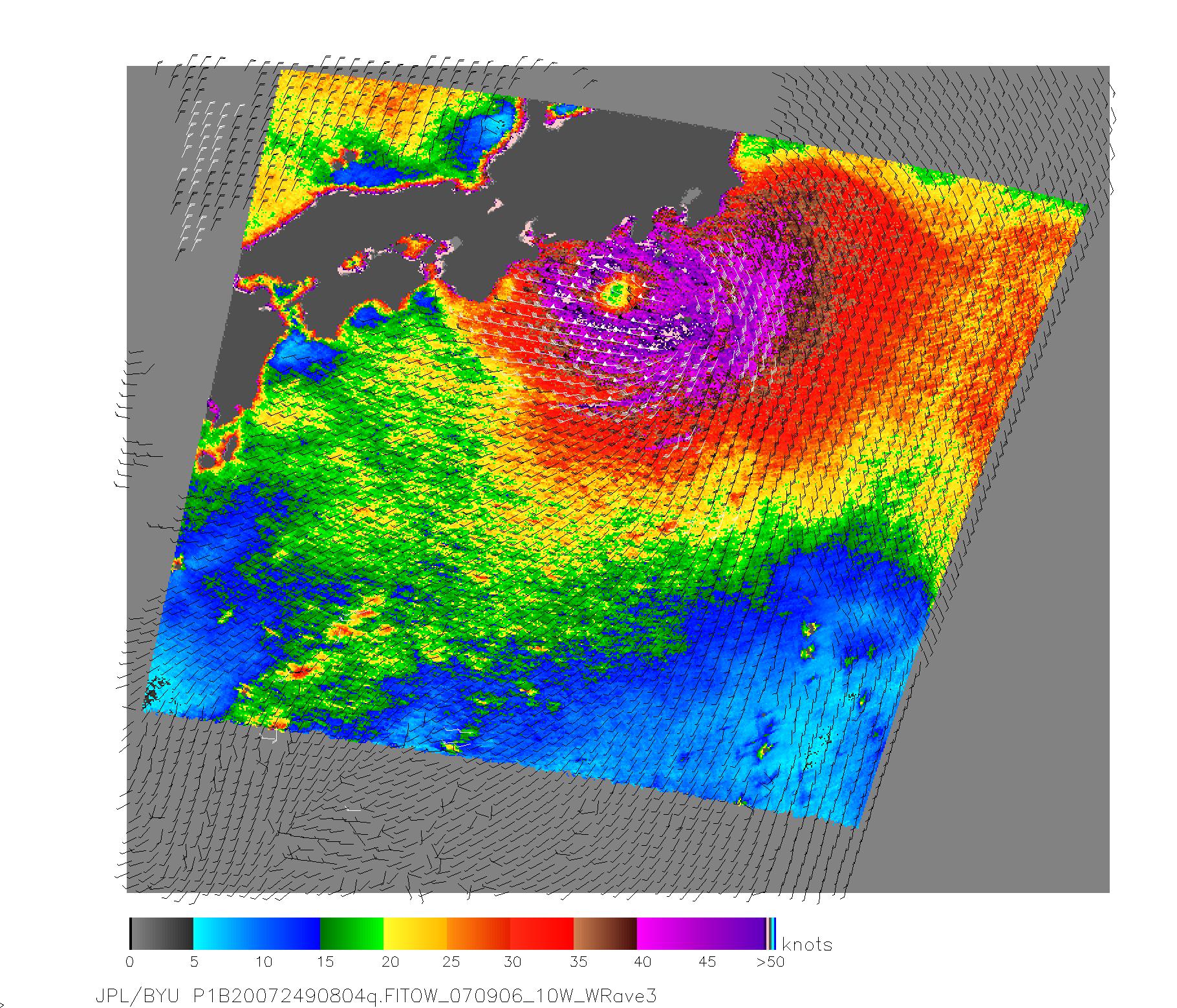
NASA's QuikScat satellite acquired this image of Category One Typhoon Fitow on Sept. 6, 2007, prior to the storm making landfall in Japan. The center of Fitow is indicated by the purple color. This image depicts wind speed in color and wind direction with small barbs. White barbs point to areas of heavy rain. The highest wind speeds, around the eye, are shown in purple.
QuikScat, managed by JPL, measures ocean surface wind/stress by sending radar pulses to the surface and measuring the strength of the signals returned.
QuikScat Background
NASA's Quick Scatterometer (QuikSCAT) spacecraft was launched from Vandenberg Air Force Base, California on June 19, 1999. QuikSCAT carries the SeaWinds scatterometer, a specialized microwave radar that measures near-surface wind speed and direction under all weather and cloud conditions over the Earth's oceans. More information about the QuikScat mission and observations is available at http://winds.jpl.nasa.gov/missions/quikscat/. QuikSCAT is managed for NASA's Science Mission Directorate, Washington, DC, by NASA's Jet Propulsion Laboratory, Pasadena, CA.
