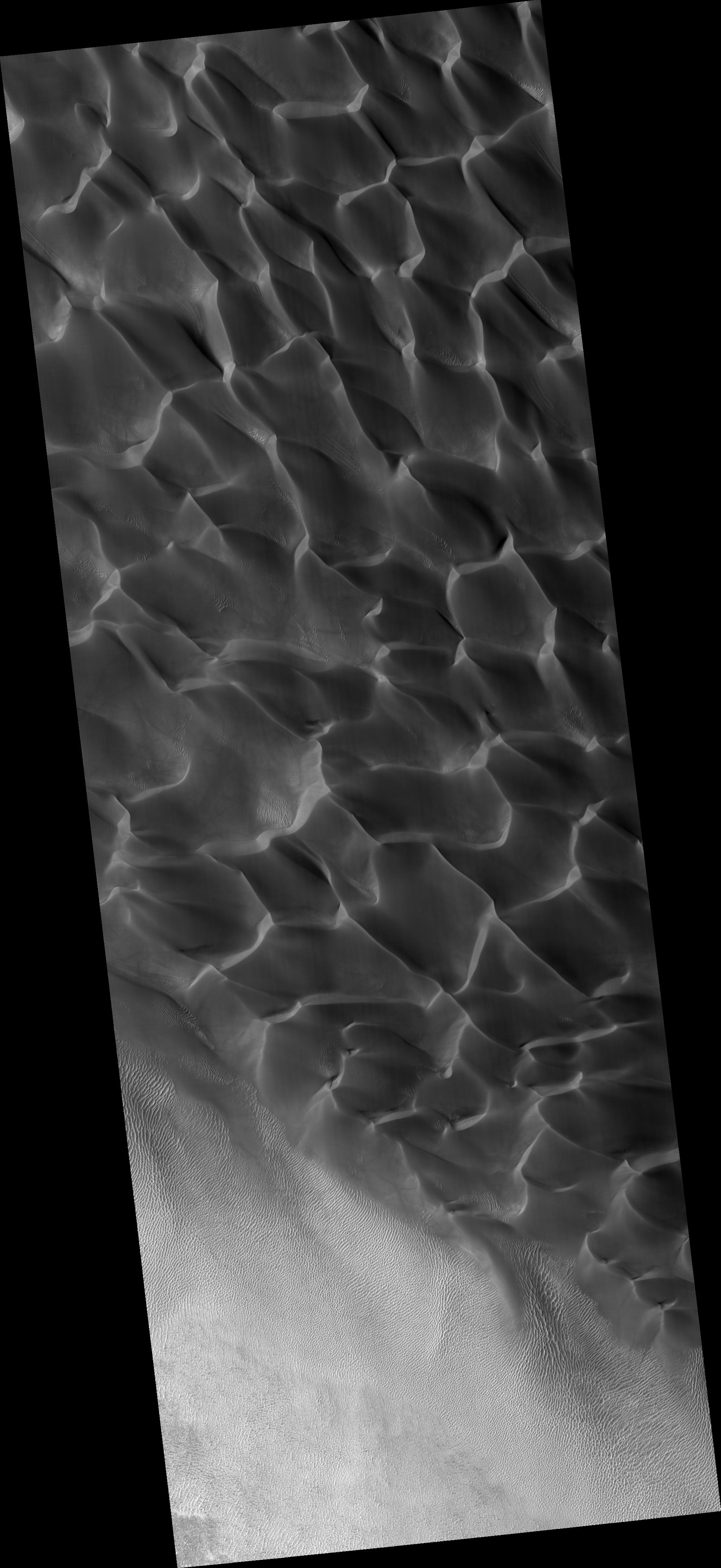
Click on image for larger versionThis HiRISE image (PSP_002824_1355) shows a sand dune field in Rabe Crater. Rabe crater is approximately 100 km in diameter and is located in the southern highlands of Mars.
The dune field within the crater has dimensions of roughly 50 km x 35 km, making it one of the largest dune fields in the region. It is composed mostly of barchanoid and transverse dunes that formed from uni-directional winds from the southeast. The sand grains are believed to be basalt, a common volcanic rock, that eroded from sedimentary units (made of eroded lava) exposed in a pit on the floor of Rabe Crater.
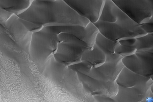
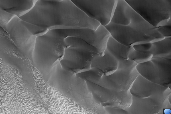
The dark toned streaks seen on the dune slip face in the subimage are believed to form from grain-flow events, or sand avalanches, that occur when wind carries sand grains over the crest of the dune and deposits them on the slip face oversteepening the slope. When compared with older images, the identification of new streaks in HiRISE images could indicate that these dunes are still active today. Also seen in the subimage are smaller secondary dunes superimposed on the surface of the large dunes.
Observation Toolbox
Acquisition date: 3 March 2007
Local Mars time: 3:50 PM
Degrees latitude (centered): -44.0°
Degrees longitude (East): 34.5°
Range to target site: 252.6 km (157.8 miles)
Original image scale range: 25.3 cm/pixel (with 1 x 1 binning) so objects ~76 cm across are resolved
Map-projected scale: 25 cm/pixel and north is up
Map-projection: EQUIRECTANGULAR
Emission angle: 5.2°
Phase angle: 67.7°
Solar incidence angle: 63°, with the Sun about 27° above the horizon
Solar longitude: 194.2°, Northern Autumn
NASA's Jet Propulsion Laboratory, a division of the California Institute of Technology in Pasadena, manages the Mars Reconnaissance Orbiter for NASA's Science Mission Directorate, Washington. Lockheed Martin Space Systems, Denver, is the prime contractor for the project and built the spacecraft. The High Resolution Imaging Science Experiment is operated by the University of Arizona, Tucson, and the instrument was built by Ball Aerospace and Technology Corp., Boulder, Colo.
