- Original Caption Released with Image:
-

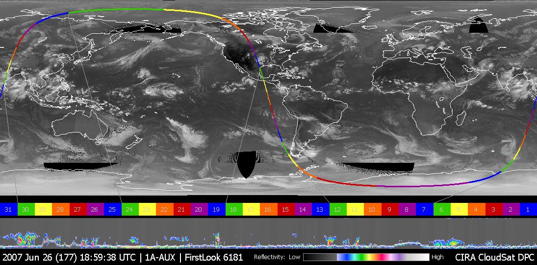
Figure 1This image was taken on June 26, 2007, UTC 20:00. In this image an obvious storm hangs over the middle of the United States. Figure 1 shows CloudSat data looking, in profile, at the cloud in this storm. The vertical axis represents the altitude from the ground to the top of the atmosphere. The variations of color intensity are differences in reflectivity and an indication of the differing amounts of water and ice in the storm clouds. The bright line at the bottom of the panel is the ground return from the radar. This indicates that the radar penetrated to the ground most of the time, even through heavy rainfall. Where the ground return disappears is an indication that the radar was attenuated by heavy precipitation, likely exceeding 30 mm/hr, based on previous studies. From one side to the other, the bottom panel is approximately 800 km, and the vertical scale from top to bottom is approximately 30 km. The CloudSat data provide analysts and forecasters with a view of storms never before available. Cross-sections like these provide a view of the internal structure of these storms, giving information about the intensity, rainfall rates, and cloud organization. Quicklook Images can viewed at the CloudSat Data Processing Center.
- Image Credit:
-
NASA/JPL/The Cooperative Institute for Research in the Atmosphere (CIRA),
Colorado State University
Image Addition Date: -
2007-06-28
|

