
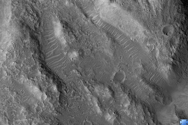
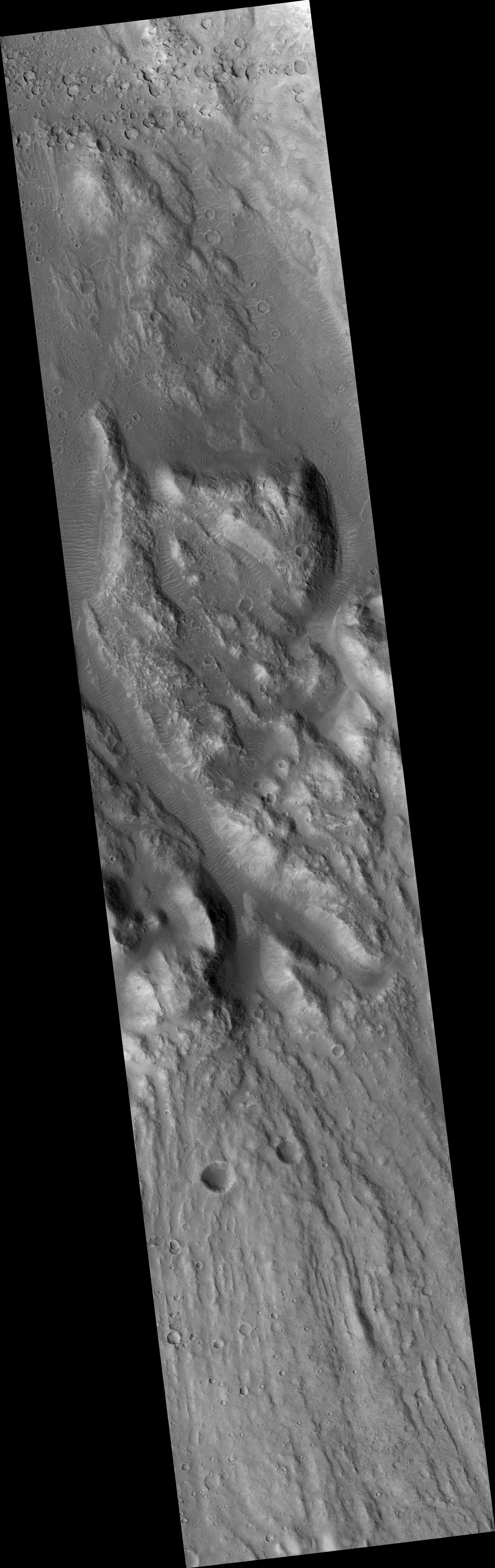
Click on image for larger versionThis HiRISE image (PSP_003538_1885) shows a dry cataract within Ares Vallis. A cataract is a large waterfall where there is a high, steep drop. The presence of this large cataract in Ares Vallis confirms that this channel was carved by water, probably in one or many large catastrophic flooding events.
This feature has many of the same characteristics as the cataracts on Earth associated with the flood that carved the Channelled Scablands in Washington state, including horseshoe-shaped headcuts and longitudinal grooves. These grooves in the lower portion of the image lead up to the cataract, with the water flowing from the south to the north in this image. It then flowed down the cataract into the smaller incised channel.
The horseshoe-shaped headcut here is only part of a larger cataract system, and probably formed during the last stage of flooding. The inner channels are now filled with dunes formed by wind blowing along the channel floor.
Observation Toolbox
Acquisition date: 4 April 2007
Local Mars time: 3:28 PM
Degrees latitude (centered): 8.4°
Degrees longitude (East): 335.6°
Range to target site: 276.0 km (172.5 miles)
Original image scale range: 27.6 cm/pixel (with 1 x 1 binning) so objects ~83 cm across are resolved
Map-projected scale: 25 cm/pixel and north is up
Map-projection: EQUIRECTANGULAR
Emission angle: 1.3°
Phase angle: 56.9°
Solar incidence angle: 58°, with the Sun about 32° above the horizon
Solar longitude: 228.1°, Northern Autumn
NASA's Jet Propulsion Laboratory, a division of the California Institute of Technology in Pasadena, manages the Mars Reconnaissance Orbiter for NASA's Science Mission Directorate, Washington. Lockheed Martin Space Systems, Denver, is the prime contractor for the project and built the spacecraft. The High Resolution Imaging Science Experiment is operated by the University of Arizona, Tucson, and the instrument was built by Ball Aerospace and Technology Corp., Boulder, Colo.
