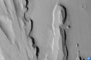
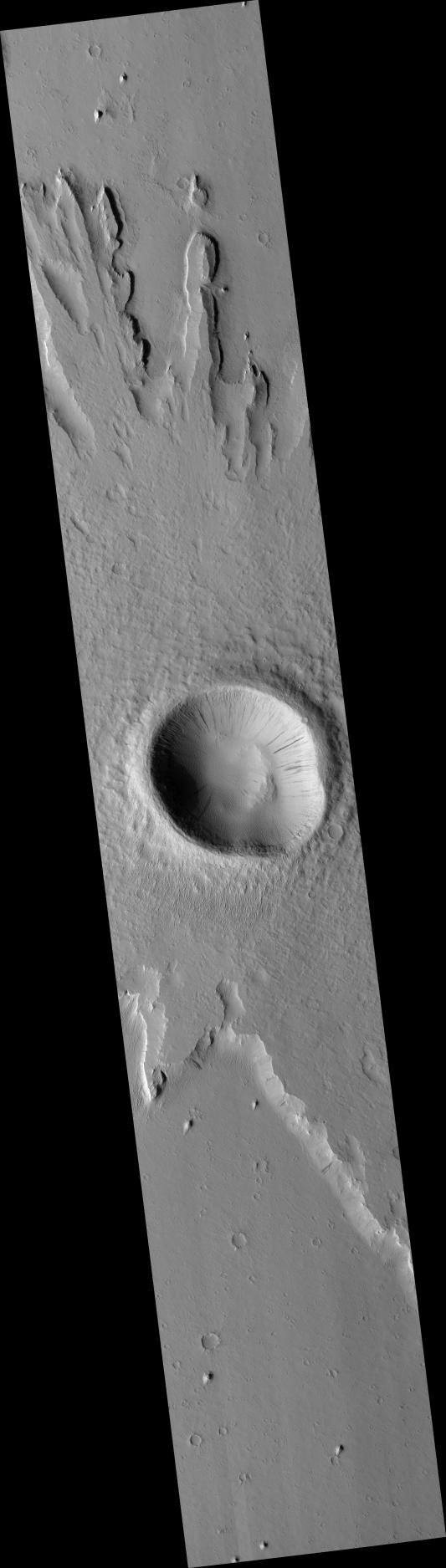
Click on image for larger versionThis HiRISE image (PSP_003253_1880) shows a pedestal crater located in a geologic unit on Mars called the Medusa Fossae Formation.
Pedestal craters are produced by differential erosion around impact craters. If the ejecta (material thrown out of the crater) is more resistant to erosion, then the crater and surrounding ejecta will be preserved while the surface is eroded nearby. This causes the ejecta blanket surrounding the crater to form a "pedestal," standing out in relief rather than gradually merging into its surroundings.
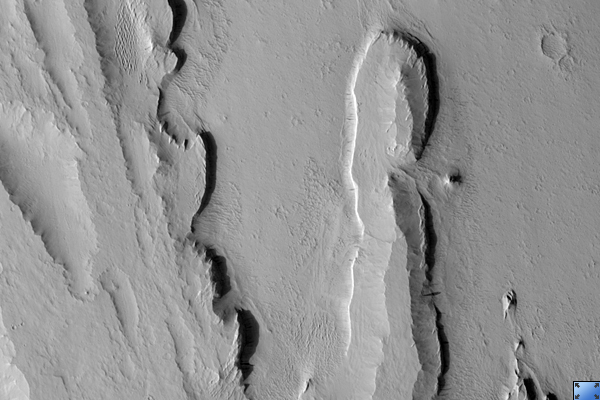
There appear to be at least two resistant layers in the material around this pedestal crater, as there are two "steps" in the topography of the pedestal. The cutout, from the long ridge near the top center of the image, shows these steps as well as possible smaller-scale layering.
Despite the detail resolved by HiRISE, it is not clear why the step-forming layers are more resistant. Much of the scene is coated with a mantle of dust which obscures details. Dark slope streaks, likely produced by small avalanches in the dust, are common here. Dust deposition and erosion are also likely the reason for the scalloped texture of mantling material in the crater.
Observation Toolbox
Acquisition date: 4 April 2007
Local Mars time: 3:35 PM
Degrees latitude (centered): 7.7°
Degrees longitude (East): 196.2°
Range to target site: 276.8 km (173.0 miles)
Original image scale range: 55.4 cm/pixel (with 2 x 2 binning) so objects ~166 cm across are resolved
Map-projected scale: 50 cm/pixel and north is up
Map-projection: EQUIRECTANGULAR
Emission angle: 1.1°
Phase angle: 58.8°
Solar incidence angle: 58°, with the Sun about 32° above the horizon
Solar longitude: 214.3°, Northern Autumn
NASA's Jet Propulsion Laboratory, a division of the California Institute of Technology in Pasadena, manages the Mars Reconnaissance Orbiter for NASA's Science Mission Directorate, Washington. Lockheed Martin Space Systems, Denver, is the prime contractor for the project and built the spacecraft. The High Resolution Imaging Science Experiment is operated by the University of Arizona, Tucson, and the instrument was built by Ball Aerospace and Technology Corp., Boulder, Colo.