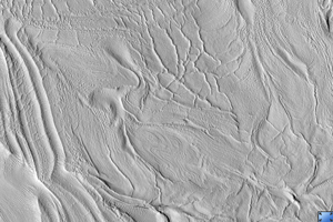
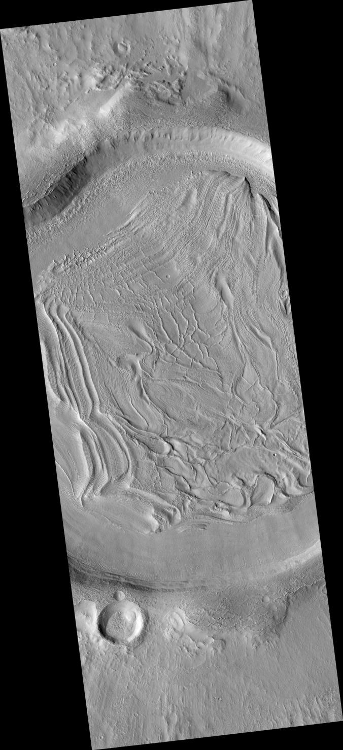
Click on image for larger versionThis HiRISE image (PSP_001926_2185) shows part of an unnamed crater located in the Northern Plains.
The intriguing landforms in the floor of this crater are known as "concentric crater fill." Such landforms are found at high latitudes (approximately above 30° from the equator), where theoretical calculations indicate that ice may exist under the surface, mixed with rocks and soil. Examples of concentric crater fill were first observed in the 1970s, in images acquired by cameras on board the Viking orbiters.
The roughly concentric ridges and throughs in the crater's floor are believed to result from compression caused by viscous flow of a thick mixture of rocks, soils, and ice inward from the crater's walls.
Impact craters with concentric fill are usually shallower than other craters. The crater shown here is approximately 12 km (7.5 miles) in diameter, and 200-400 m (220-440 yards) deep; other Martian craters (see PIA09659) of similar diameter but without concentric fill may be as deep as 700 m (765 yards). Unlike in "regular" craters, the slopes of the walls of craters with concentric fill tend to be convex, and the crater's rim is more rounded.
All these characteristics are consistent with deformation of an ice-rock mixture similar to what's observed in rock glaciers on Earth.
Observation Toolbox
Acquisition date: 12 December 2006
Local Mars time: 3:28 PM
Degrees latitude (centered): 38.3°
Degrees longitude (East): 60.5°
Range to target site: 295.0 km (184.4 miles)
Original image scale range: 29.5 cm/pixel (with 1 x 1 binning) so objects ~89 cm across are resolved
Map-projected scale: 25 cm/pixel and north is up
Map-projection: EQUIRECTANGULAR
Emission angle: 1.2°
Phase angle: 55.4°
Solar incidence angle: 54°, with the Sun about 36° above the horizon
Solar longitude: 155.5°, Northern Autumn
NASA's Jet Propulsion Laboratory, a division of the California Institute of Technology in Pasadena, manages the Mars Reconnaissance Orbiter for NASA's Science Mission Directorate, Washington. Lockheed Martin Space Systems, Denver, is the prime contractor for the project and built the spacecraft. The High Resolution Imaging Science Experiment is operated by the University of Arizona, Tucson, and the instrument was built by Ball Aerospace and Technology Corp., Boulder, Colo.
 Planetary Data System


