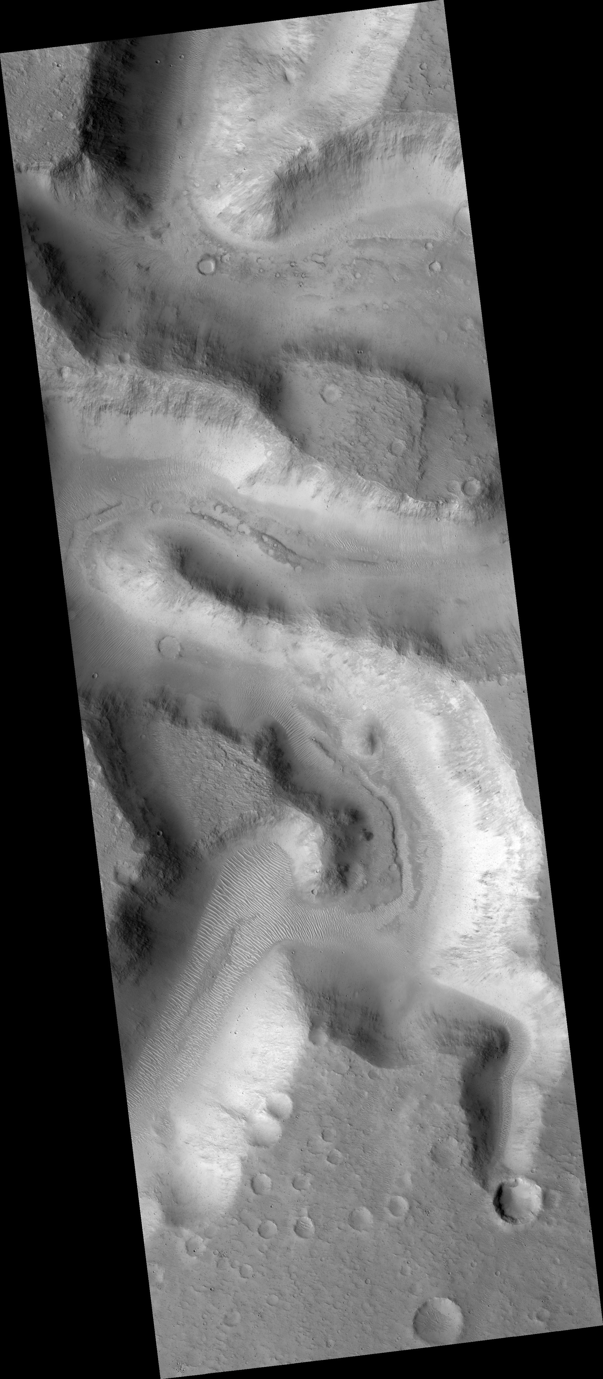
Click on image for larger versionThis HiRISE image (PSP_002840_1855) shows a portion of Nanedi Valles, an equatorial Martian valley network.
Valley networks are thought to have formed by groundwater sapping either in conjunction with an ice layer to cover the running water or during a past warmer, wetter climate regime on Mars. Glacial activity has also been proposed to form the valley networks.
Groundwater sapping is the leading theory because of the morphology of the valleys. They commonly have approximately constant width along their reaches, as seen here, as well as theater shaped heads, as seen in the tributary valley in the bottom right of the scene. The meandering nature of valleys suggests persistent or repeated flow as required to form meanders in streams on Earth.
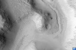
The subimage (approximately 1.1 km across) shows a potential remnant channel seen on the floor of Nanedi Valles just below the center of the image. If this is a remnant channel, it suggests that there was either repeated or waning flows in this valley. Winding dunes and abundant impact craters are found throughout the valley, as well as within this putative channel.
Dunes are thought to be transient features on Mars, although no movement has been detected to date. It is interesting to note that some of the dunes are superposed by craters indicating that the dunes were stable long enough for craters to form and not be erased.
It is possible that the craters on top of the dunes are secondary craters that formed as a product of a larger impact. Secondary craters from a single impact are clustered in space and form almost simultaneously, implying that the dunes were stable for a time period-long enough for a single crater, rather than multiple craters, to form.
Observation Toolbox
Acquisition date: 3 March 2007
Local Mars time: 3:41 PM
Degrees latitude (centered): 5.2°
Degrees longitude (East): 311.8°
Range to target site: 271.3 km (169.6 miles)
Original image scale range: 27.1 cm/pixel (with 1 x 1 binning) so objects ~81 cm across are resolved
Map-projected scale: 25 cm/pixel and north is up
Map-projection: EQUIRECTANGULAR
Emission angle: 2.2°
Phase angle: 54.4°
Solar incidence angle: 57°, with the Sun about 33° above the horizon
Solar longitude: 195.0°, Northern Autumn
NASA's Jet Propulsion Laboratory, a division of the California Institute of Technology in Pasadena, manages the Mars Reconnaissance Orbiter for NASA's Science Mission Directorate, Washington. Lockheed Martin Space Systems, Denver, is the prime contractor for the project and built the spacecraft. The High Resolution Imaging Science Experiment is operated by the University of Arizona, Tucson, and the instrument was built by Ball Aerospace and Technology Corp., Boulder, Colo.

