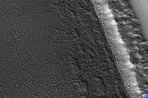
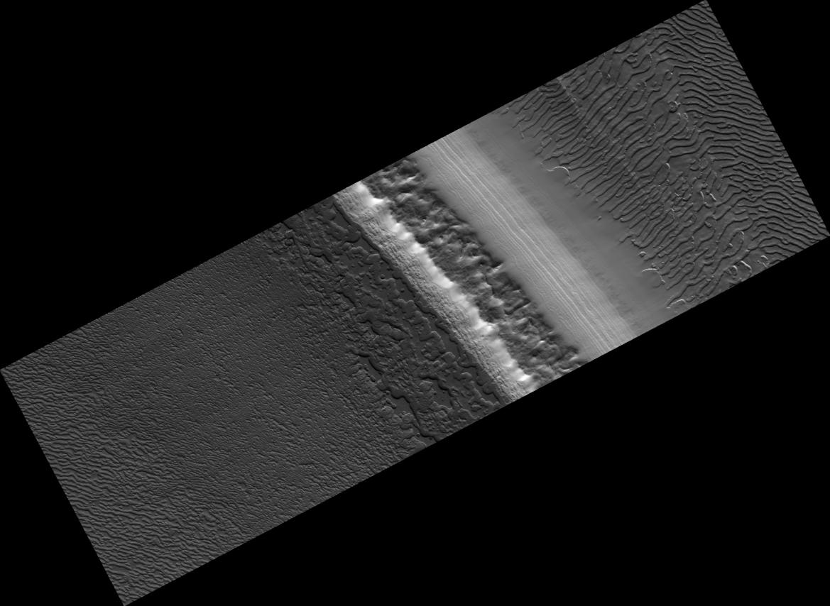
Click on image for larger versionThis HiRISE image (PSP_002856_0875) shows a variety of surface texture within the south polar residual cap of Mars.
It was taken during the southern spring, when the surface was covered by seasonal carbon dioxide frost, so that surface relief is easily seen. Illumination is from the bottom left, highlighting long troughs at to the right and round pits and irregular mesas to the left of center.
These unique landforms are common in the south polar residual cap, which is known from previous Mars Global Surveyor images to be eroding rapidly in places. Right of center, polar layered deposits are exposed on a sun-facing scarp. These deposits are older than the residual ice cap, and the layers are thought to record climate variations on Mars similar to ice ages on Earth.
Observation Toolbox
Acquisition date: 3 March 2007
Local Mars time: 10:14 PM
Degrees latitude (centered): -87.2°
Degrees longitude (East): 340.3°
Range to target site: 244.7 km (152.9 miles)
Original image scale range: 24.5 cm/pixel (with 1 x 1 binning) so objects ~73 cm across are resolved
Map-projected scale: 25 cm/pixel and north is up
Map-projection: POLAR STEREOGRAPHIC
Emission angle: 0.1°
Phase angle: 85.8°
Solar incidence angle: 86°, with the Sun about 4° above the horizon
Solar longitude: 195.7°, Northern Autumn
NASA's Jet Propulsion Laboratory, a division of the California Institute of Technology in Pasadena, manages the Mars Reconnaissance Orbiter for NASA's Science Mission Directorate, Washington. Lockheed Martin Space Systems, Denver, is the prime contractor for the project and built the spacecraft. The High Resolution Imaging Science Experiment is operated by the University of Arizona, Tucson, and the instrument was built by Ball Aerospace and Technology Corp., Boulder, Colo.
