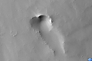
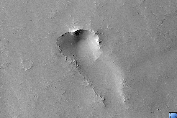
Click on image for larger versionPrevious images of this area by other space missions indicate that this is a shield volcano with very shallow slopes. What HiRISE reveals is that it is completely covered by a blanket of dust.
While volcanic featues remain obscure, the dust does exhibit some very strange patterns. As you zoom into the middle of the image, the ground appears covered with a fine network of light and dark polygons. But at full resolution, it can be seen that these polygons are actually the edges of small scallops.
The dust is apparently held together by some unknown means, giving it sufficient strength to be carved into this strange pattern.
This is HiRISE image is PSP_001840_1660.
Observation Toolbox
Acquisition date: 12 December 2006
Local Mars time: 3:40 PM
Degrees latitude (centered): -13.9°
Degrees longitude (East): 255.8°
Range to target site: 252.8 km (158.0 miles)
Original image scale range: 25.3 cm/pixel (with 1 x 1 binning) so objects ~76 cm across are resolved
Map-projected scale: 25 cm/pixel and north is up
Map-projection: EQUIRECTANGULAR
Emission angle: 5.3°
Phase angle: 55.7°
Solar incidence angle: 60°, with the Sun about 30° above the horizon
Solar longitude: 152.0°, Northern Summer
NASA's Jet Propulsion Laboratory, a division of the California Institute of Technology in Pasadena, manages the Mars Reconnaissance Orbiter for NASA's Science Mission Directorate, Washington. Lockheed Martin Space Systems, Denver, is the prime contractor for the project and built the spacecraft. The High Resolution Imaging Science Experiment is operated by the University of Arizona, Tucson, and the instrument was built by Ball Aerospace and Technology Corp., Boulder, Colo.