
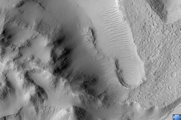
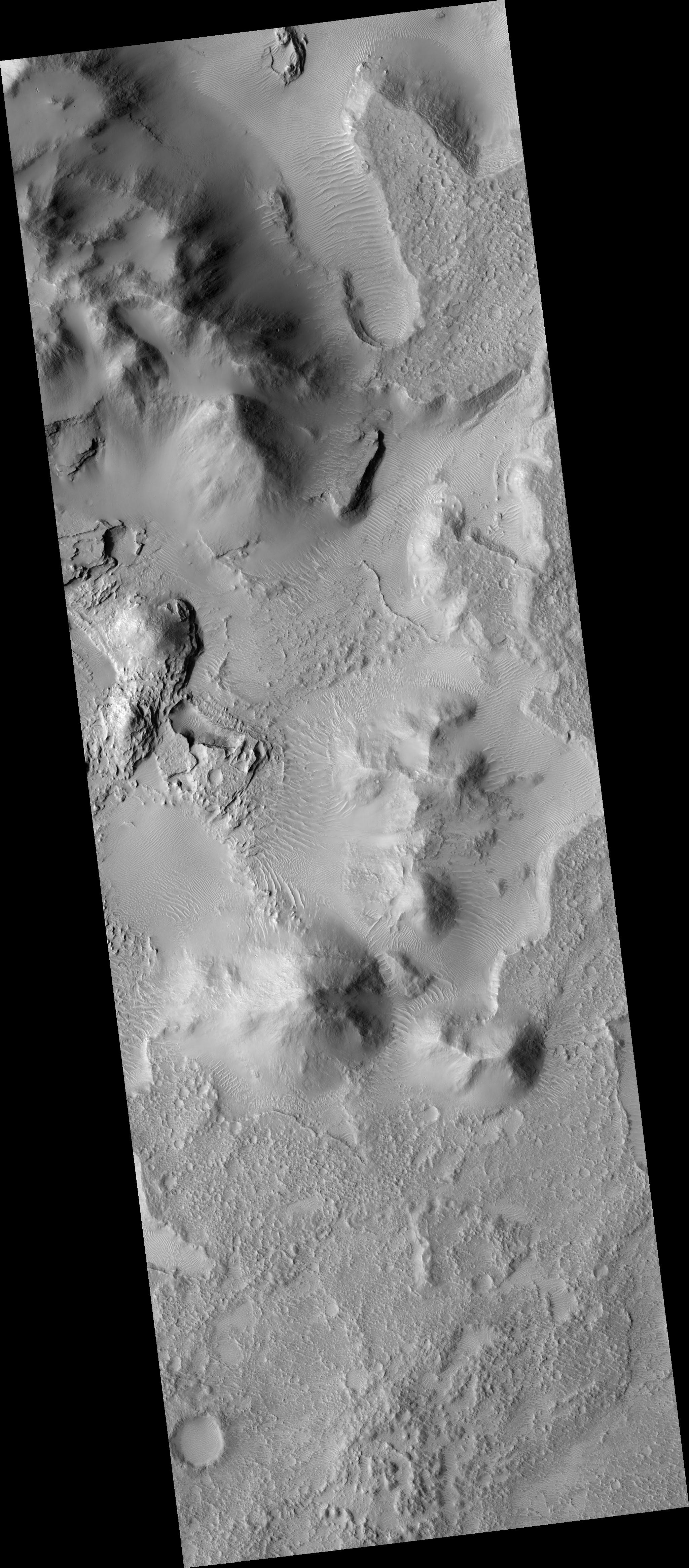
Click on image for larger versionThis HiRISE image (PSP_002478_1770) shows the edge of a mound of sediments in the center of a large impact crater near Amenthes Planum.
The mound probably once filled much more of the crater, but it is now eroding away. HiRISE shows a variety of layers. A broad view shows several small plateaus which have likely been preserved by a relatively resistant cap layer, while other levels are exposed elsewhere.
The subsection highlighted here shows several types of layers exposed in a pit. These variations point to a relatively complex geologic history at this site. Some layers appear to be fracturing into boulders which roll downslope, while others appear relatively smooth. There are also variations in tone, from light to dark. This diversity may be due to different types of rock, as well as varying strength.
Images such as this one indicate that rocks formed on Mars in a variety of ways, and by careful analysis it may be possible to deduce some of the history that has produced the geology at this site.
Observation Toolbox
Acquisition date: 2 February 2007
Local Mars time: 3:42 PM
Degrees latitude (centered): -3.0°
Degrees longitude (East): 115.9°
Range to target site: 266.1 km (166.3 miles)
Original image scale range: 26.6 cm/pixel (with 1 x 1 binning) so objects ~80 cm across are resolved
Map-projected scale: 25 cm/pixel and north is up
Map-projection: EQUIRECTANGULAR
Emission angle: 0.0°
Phase angle: 55.7°
Solar incidence angle: 56°, with the Sun about 34° above the horizon
Solar longitude: 178.7°, Northern Summer
NASA's Jet Propulsion Laboratory, a division of the California Institute of Technology in Pasadena, manages the Mars Reconnaissance Orbiter for NASA's Science Mission Directorate, Washington. Lockheed Martin Space Systems, Denver, is the prime contractor for the project and built the spacecraft. The High Resolution Imaging Science Experiment is operated by the University of Arizona, Tucson, and the instrument was built by Ball Aerospace and Technology Corp., Boulder, Colo.
