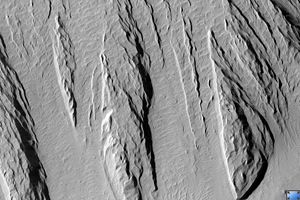
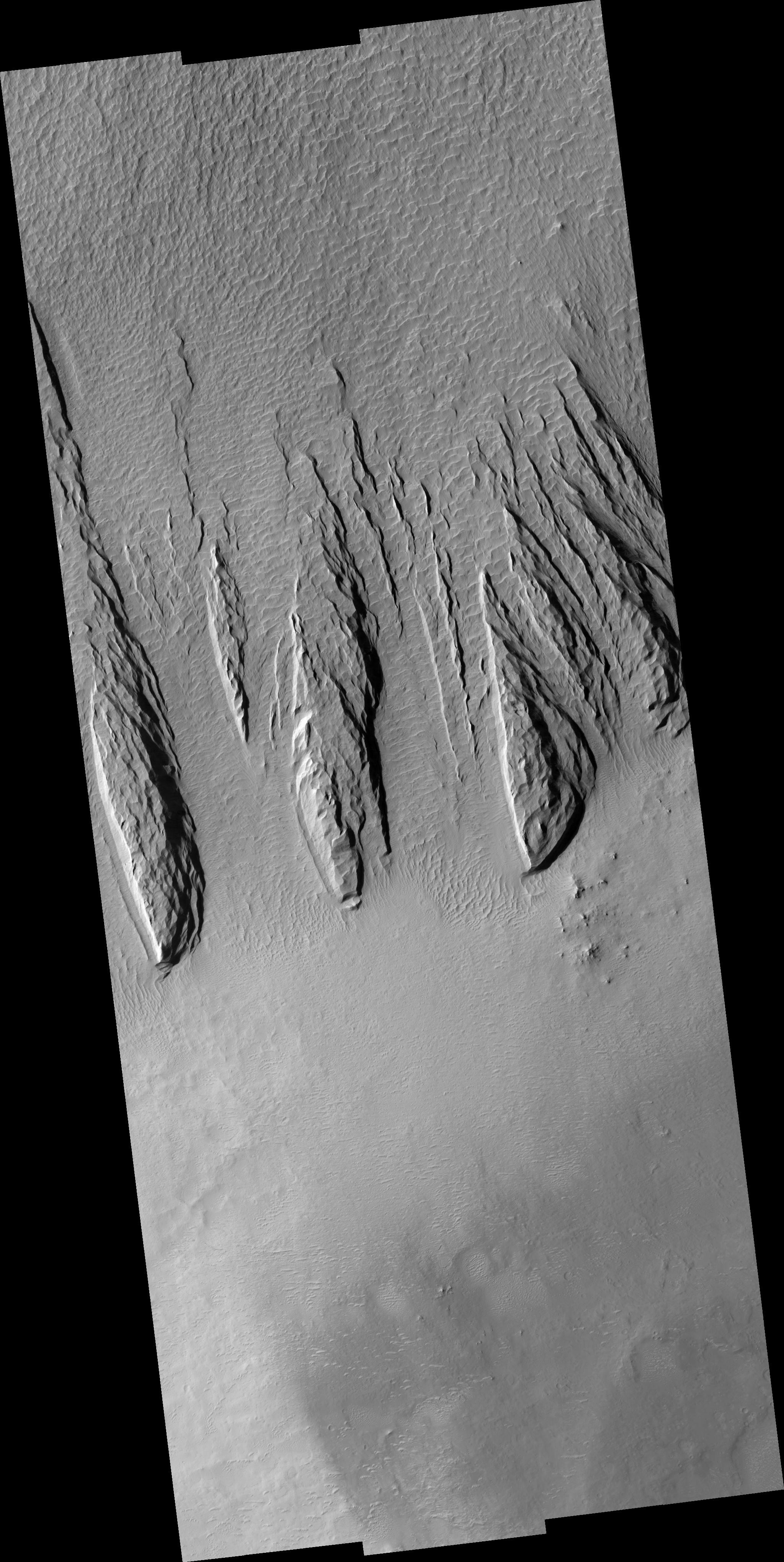
Click on image for larger versionThis HiRISE image (PSP_001545_1885) shows a part of a central mound in an impact crater in Arabia Terra. At low resolution, the mound is relatively smooth and featureless, although elsewhere in the mound a Mars Orbiter Camera (MOC) image shows fine layers.
The mound is broad, filling much of the crater, although it now appears to be eroding. Images like this can be used to explore the nature of the deposit, and provide clues about how it formed. At high resolution the material still appears relatively uniform and featureless, without boulders or obvious fine layers. This indicates a relatively weak, fine-grained material.
The large, elongated features in the image are yardangs. These are characteristic of aeolian (wind) erosion. They form roughly parallel with the direction of the prevailing wind, and the streamlined shape (often compared with the hull of a boat) is created by persistent flow from this direction.
Yardangs on Earth often form from relatively unconsolidated material, supporting the inference made from the appearance of the deposit.
Observation Toolbox
Acquisition date: 11 November 2006
Local Mars time: 3:31 PM
Degrees latitude (centered): 8.3°
Degrees longitude (East): 21.0°
Range to target site: 273.1 km (170.7 miles)
Original image scale range: from 27.3 cm/pixel (with 1 x 1 binning) to 109.3 cm/pixel (with 4 x 4 binning)
Map-projected scale: 25 cm/pixel and north is up
Map-projection: EQUIRECTANGULAR
Emission angle: 0.1°
Phase angle: 51.9°
Solar incidence angle: 52°, with the Sun about 38° above the horizon
Solar longitude: 140.4°, Northern Summer
NASA's Jet Propulsion Laboratory, a division of the California Institute of Technology in Pasadena, manages the Mars Reconnaissance Orbiter for NASA's Science Mission Directorate, Washington. Lockheed Martin Space Systems, Denver, is the prime contractor for the project and built the spacecraft. The High Resolution Imaging Science Experiment is operated by the University of Arizona, Tucson, and the instrument was built by Ball Aerospace and Technology Corp., Boulder, Colo.

