Figure 1
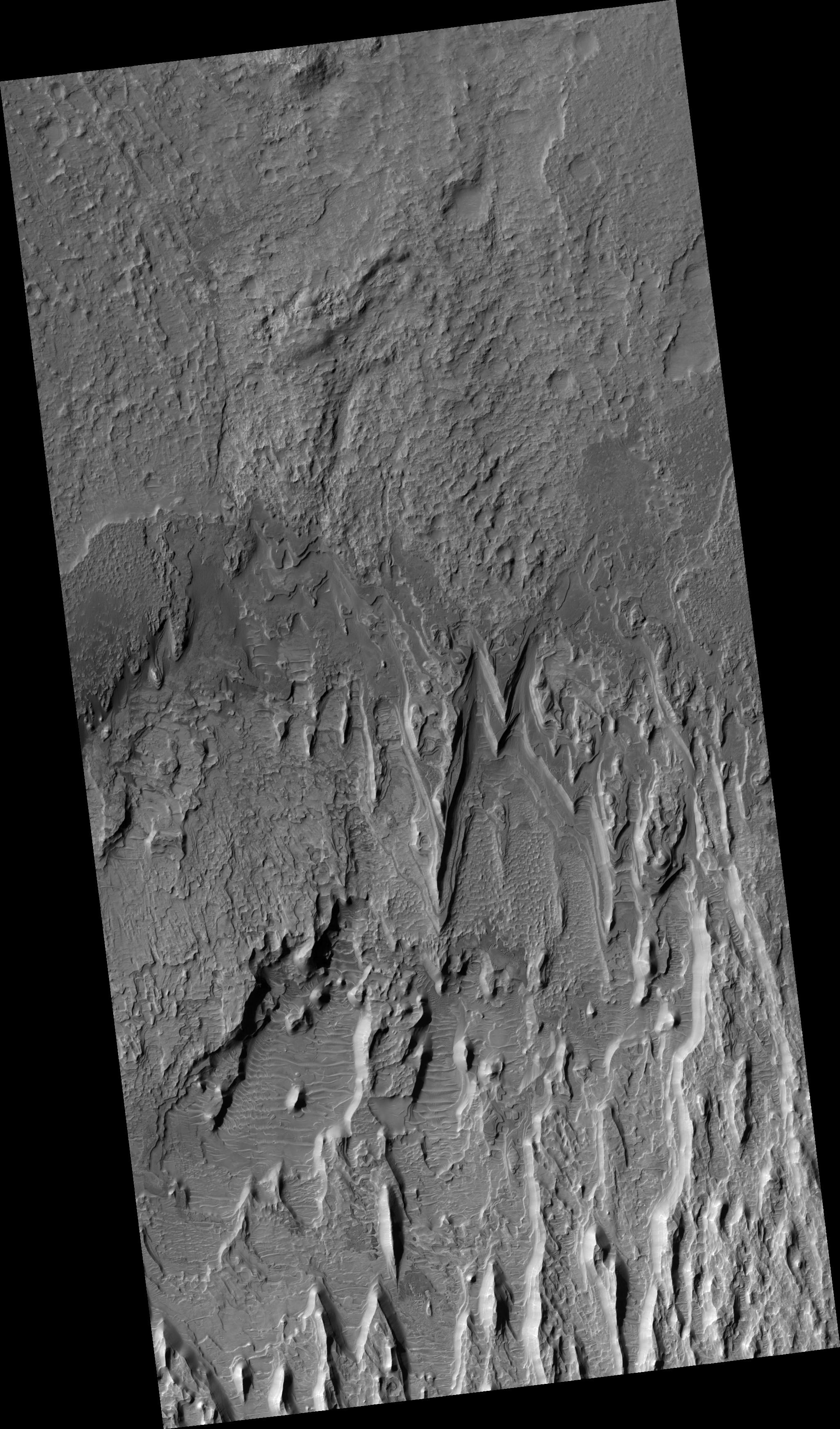
Click on image for larger versionThis HiRISE image shows a stack of layers on the floor of an impact crater roughly 30 km across. Many of the layers appear to be extremely thin, and barely resolved.
In broad view, it is clear that the deposit is eroding into a series of ridges, likely due to the wind. Below the ridges, additional dark-toned layered deposits crop out. These exhibit a variety of textures, some of which may be due to transport of material.
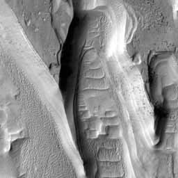
The light ridges are often capped by thin dark layers, and similar layers are exposed on the flanks of the ridges. These layers are likely harder than the rest of the material, and so armor the surface against erosion. They are shedding boulders which roll down the slope, as shown in the subimage (figure 1). Although these cap layers are relatively resistant, the boulders do not seem to accumulate at the base of the slope, so it is likely that they also disintegrate relatively quickly.
The subimage shown is 250 meters wide. The light is from the left. Boulders can be seen on the slopes of the ridges along with thin dark layers including the cap layer, but they are absent on the spurs where the resistant cover has been eroded. This demonstrates that the boulders come only from the dark layers, and are not embedded in the rest of the deposit.
Observation Geometry
Image PSP_001503_1645 was taken by the High Resolution Imaging Science Experiment (HiRISE) camera onboard the Mars Reconnaissance Orbiter spacecraft on 21-Nov-2006. The complete image is centered at -15.3 degrees latitude, 89.7 degrees East longitude. The range to the target site was 256.3 km (160.2 miles). At this distance the image scale is 25.6 cm/pixel (with 1 x 1 binning) so objects ~77 cm across are resolved. The image shown here has been map-projected to 25 cm/pixel and north is up. The image was taken at a local Mars time of 03:35 PM and the scene is illuminated from the west with a solar incidence angle of 62 degrees, thus the sun was about 28 degrees above the horizon. At a solar longitude of 138.7 degrees, the season on Mars is Northern Summer.
NASA's Jet Propulsion Laboratory, a division of the California Institute of Technology in Pasadena, manages the Mars Reconnaissance Orbiter for NASA's Science Mission Directorate, Washington. Lockheed Martin Space Systems, Denver, is the prime contractor for the project and built the spacecraft. The High Resolution Imaging Science Experiment is operated by the University of Arizona, Tucson, and the instrument was built by Ball Aerospace and Technology Corp., Boulder, Colo.

