Figure 1
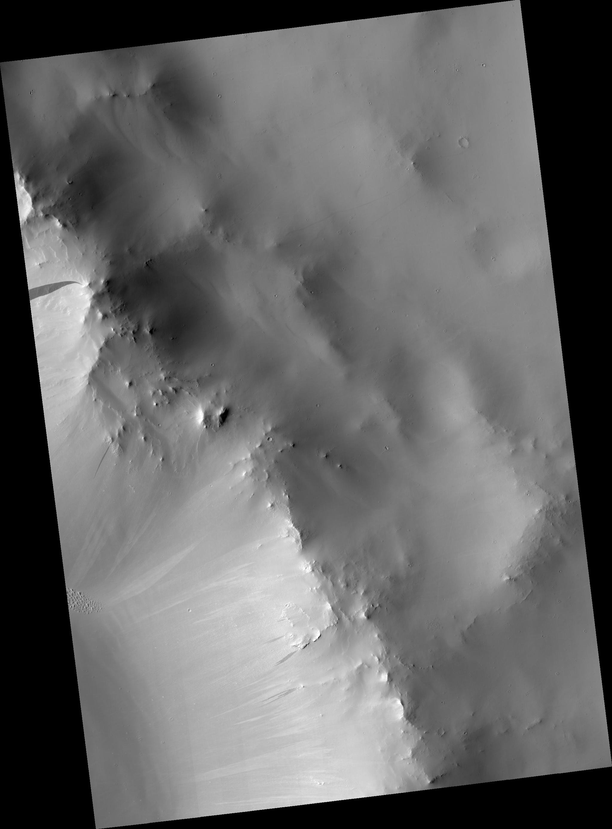
Click on image for larger versionThis HiRISE image shows the rim of a crater in the region of Terra Sabaea in the northern hemisphere of Mars.
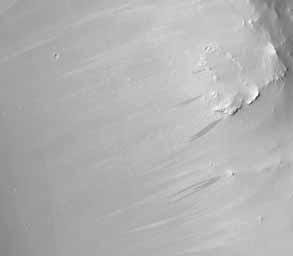
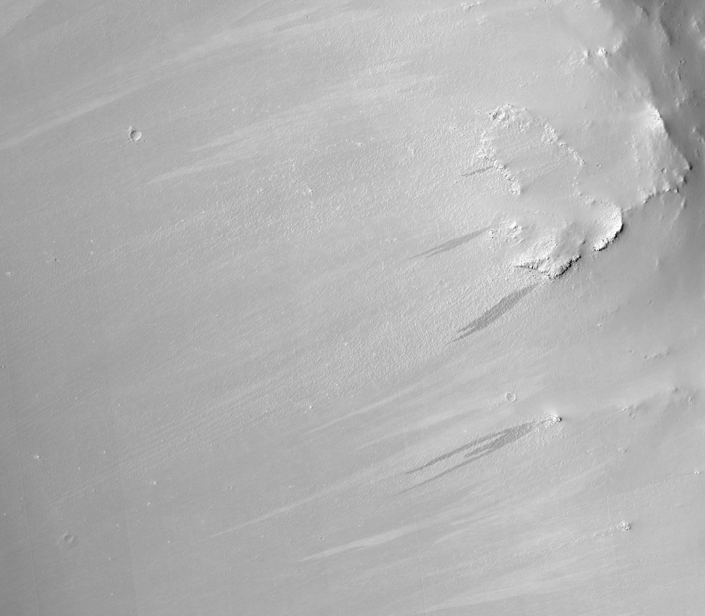
The subimage (figure 1) is a close-up view of the crater rim revealing dark and light-toned slope streaks. Slope streak formation is among the few known processes currently active on Mars. While their mechanism of formation and triggering is debated, they are most commonly believed to form by downslope movement of extremely dry sand or very fine-grained dust in an almost fluidlike manner (analogous to a terrestrial snow avalanche) exposing darker underlying material.
Other ideas include the triggering of slope streak formation by possible concentrations of near-surface ice or scouring of the surface by running water from aquifers intercepting slope faces, spring discharge (perhaps brines), and/or hydrothermal activity.
Several of the slope streaks in the subimage, particularly the three longest darker streaks, show evidence that downslope movement is being diverted around obstacles such as large boulders. Several streaks also appear to originate at boulders or clumps of rocky material.
In general, the slope streaks do not have large deposits of displaced material at their downslope ends and do not run out onto the crater floor suggesting that they have little reserve kinetic energy. The darkest slope streaks are youngest and can be seen to cross cut and superpose older and lighter-toned streaks. The lighter-toned streaks are believed to be dark streaks that have lightened with time as new dust is deposited on their surface.
Observation Geometry
Image PSP_001808_1875 was taken by the High Resolution Imaging Science Experiment (HiRISE) camera onboard the Mars Reconnaissance Orbiter spacecraft on 15-Dec-2006. The complete image is centered at 7.4 degrees latitude, 47.0 degrees East longitude. The range to the target site was 272.1 km (170.1 miles). At this distance the image scale is 54.4 cm/pixel (with 2 x 2 binning) so objects ~163 cm across are resolved. The image shown here has been map-projected to 50 cm/pixel and north is up. The image was taken at a local Mars time of 03:36 PM and the scene is illuminated from the west with a solar incidence angle of 53 degrees, thus the sun was about 37 degrees above the horizon. At a solar longitude of 150.7 degrees, the season on Mars is Northern Summer.
NASA's Jet Propulsion Laboratory, a division of the California Institute of Technology in Pasadena, manages the Mars Reconnaissance Orbiter for NASA's Science Mission Directorate, Washington. Lockheed Martin Space Systems, Denver, is the prime contractor for the project and built the spacecraft. The High Resolution Imaging Science Experiment is operated by the University of Arizona, Tucson, and the instrument was built by Ball Aerospace and Technology Corp., Boulder, Colo.
