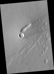
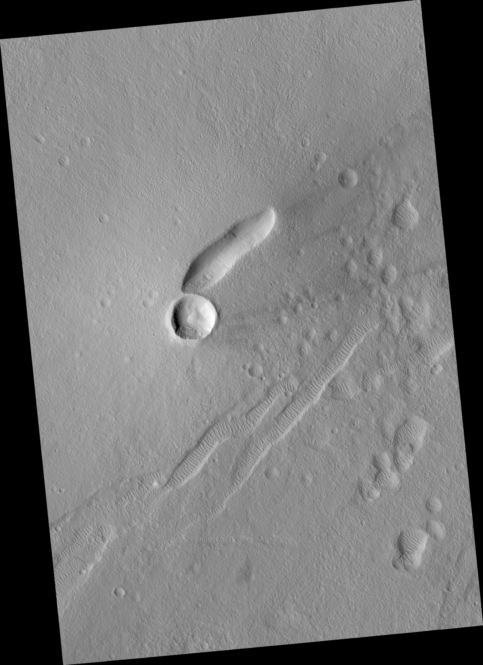
Click on image for larger versionEast Mareotis Tholus is a small volcano in Tempe Terra, Mars. This area is on the northeast edge of the Tharsis bulge that was built up by many large and small volcanoes.
One of the many questions we hope to address with HiRISE is the relative roles of the giant shield volcanoes (such as Olympus Mons) and smaller volcanic features (such as East Mareotis Tholus).
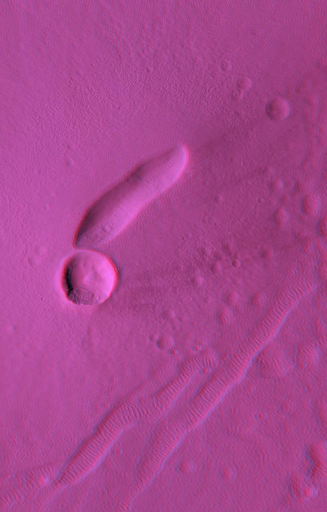
The anaglyph covers 4.4x6.9 km (2.7x4.9 miles) and the topography can be viewed using red-blue glasses. The elongated pit at the summit of the volcano is where the lava issued forth. The large circular hole just to the SW of the vent is an impact crater. The gouges in the ground to the SE of the volcano are tectonic fissures (called graben) that are now filled with sand dunes. The area is covered with large amounts of wind-blown dust, so it is not surprising that lava flows and other smaller volcanic features are not visible.
However, the smooth shape of the volcano, and the lack of lava layers exposed in the impact crater, allow for the possibility that this volcano is composed largely of ash, rather than lava flows.
Observation Geometry
Image PSP_001760_2160 was taken by the High Resolution Imaging Science Experiment (HiRISE) camera onboard the Mars Reconnaissance Orbiter spacecraft on 11-Dec-2006. The complete image is centered at 35.9 degrees latitude, 274.9 degrees East longitude. The range to the target site was 312.2 km (195.1 miles). At this distance the image scale is 62.5 cm/pixel (with 2 x 2 binning) so objects ~187 cm across are resolved. The image shown here has been map-projected to 50 cm/pixel and north is up. The image was taken at a local Mars time of 03:36 PM and the scene is illuminated from the west with a solar incidence angle of 54 degrees, thus the sun was about 36 degrees above the horizon. At a solar longitude of 148.8 degrees, the season on Mars is Northern Summer.
NASA's Jet Propulsion Laboratory, a division of the California Institute of Technology in Pasadena, manages the Mars Reconnaissance Orbiter for NASA's Science Mission Directorate, Washington. Lockheed Martin Space Systems, Denver, is the prime contractor for the project and built the spacecraft. The High Resolution Imaging Science Experiment is operated by the University of Arizona, Tucson, and the instrument was built by Ball Aerospace and Technology Corp., Boulder, Colo.
