Figure 1
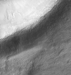
Click on image for larger versionThe mid-latitude Martian gullies are found on slopes of many varieties, including crater walls, crater central peaks, trough walls, valley network walls, and mesas.
Rarely are gullies found on the exterior walls of craters as seen in the subimage (figure 1). This might be related to a paucity of craters fresh enough to have raised rims during the geologically recent epoch in which gullies formed.
The gullies are clearly incised into the exterior wall, and their channels are not linear suggesting a fluvial, rather than mass wasting, origin. They do not have noticeable debris aprons, but there are dunes nearby that might contain material from the gullies' debris aprons that was deposited then subsequently transported by the wind.
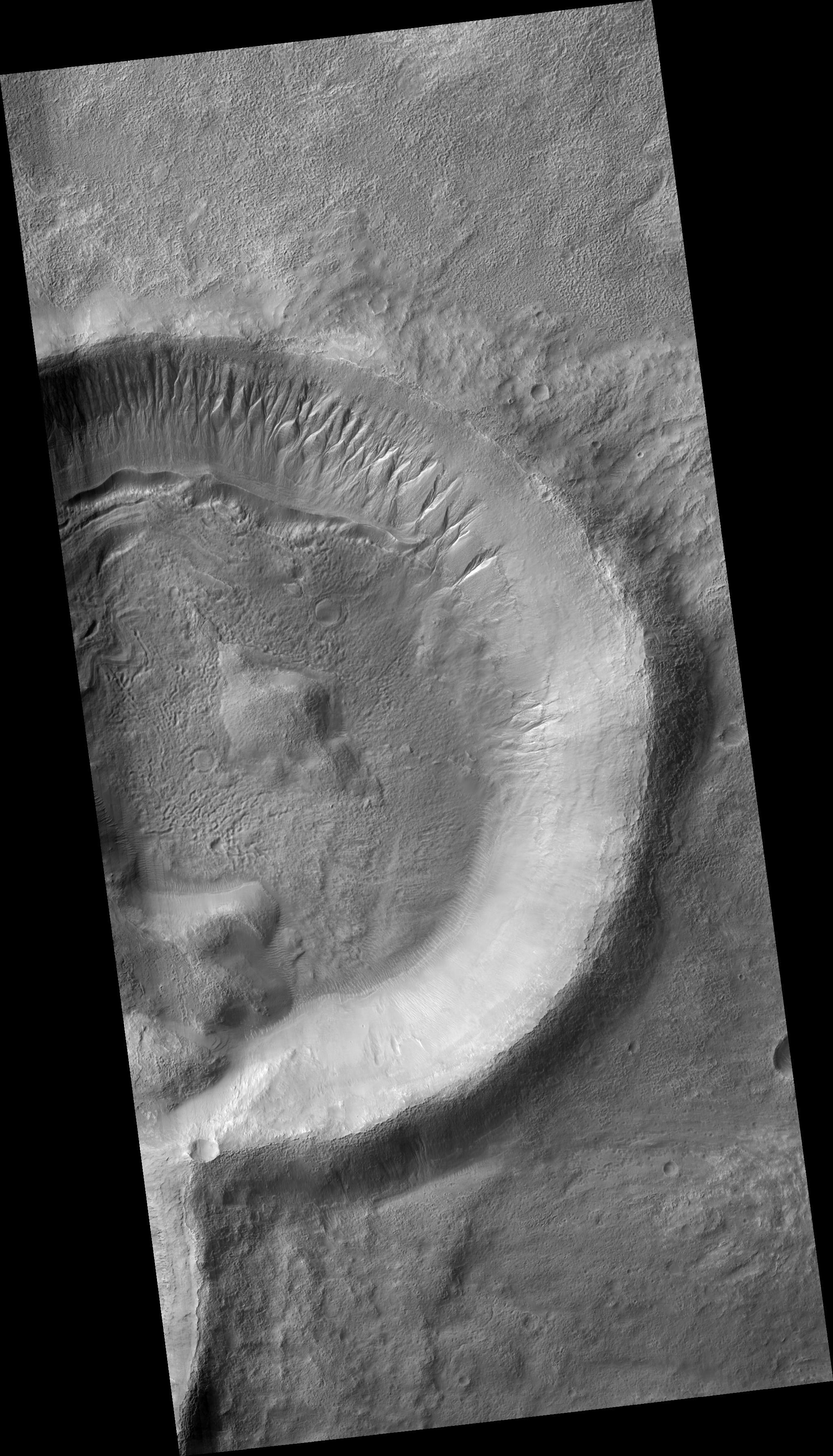
The crater shown in PSP_001908_1405 is the right half of an overlapping pair of craters in which the left crater formed most recently. The craters have fluidized ejecta which imply that volatiles, possibly including water, were present at the time of their formation.
Gullies are proposed to be formed by liquid water, and the origin of this water is much debated. Current leading theories include breakout from a subsurface aquifer, melt from near-surface ground ice, and melt from under a snowpack.
It is interesting to note that there are no gullies on the interior wall of the crater directly opposite the gullies on the exterior wall. This suggests that, if subsurface water formed these gullies, then the subsurface structure of the crater rim is responsible for the gullies being only on the exterior wall. If surface water did formed these gullies, then insolation likely played a role in the gullies' location.
Observation Geometry
Image PSP_001908_1405 was taken by the High Resolution Imaging Science Experiment (HiRISE) camera onboard the Mars Reconnaissance Orbiter spacecraft on 23-Dec-2006. The complete image is centered at -39.3 degrees latitude, 202.8 degrees East longitude. The range to the target site was 255.2 km (159.5 miles). At this distance the image scale is 25.5 cm/pixel (with 1 x 1 binning) so objects ~77 cm across are resolved. The image shown here has been map-projected to 25 cm/pixel and north is up. The image was taken at a local Mars time of 03:47 PM and the scene is illuminated from the west with a solar incidence angle of 72 degrees, thus the sun was about 18 degrees above the horizon. At a solar longitude of 154.7 degrees, the season on Mars is Northern Summer.
NASA's Jet Propulsion Laboratory, a division of the California Institute of Technology in Pasadena, manages the Mars Reconnaissance Orbiter for NASA's Science Mission Directorate, Washington. Lockheed Martin Space Systems, Denver, is the prime contractor for the project and built the spacecraft. The High Resolution Imaging Science Experiment is operated by the University of Arizona, Tucson, and the instrument was built by Ball Aerospace and Technology Corp., Boulder, Colo.

