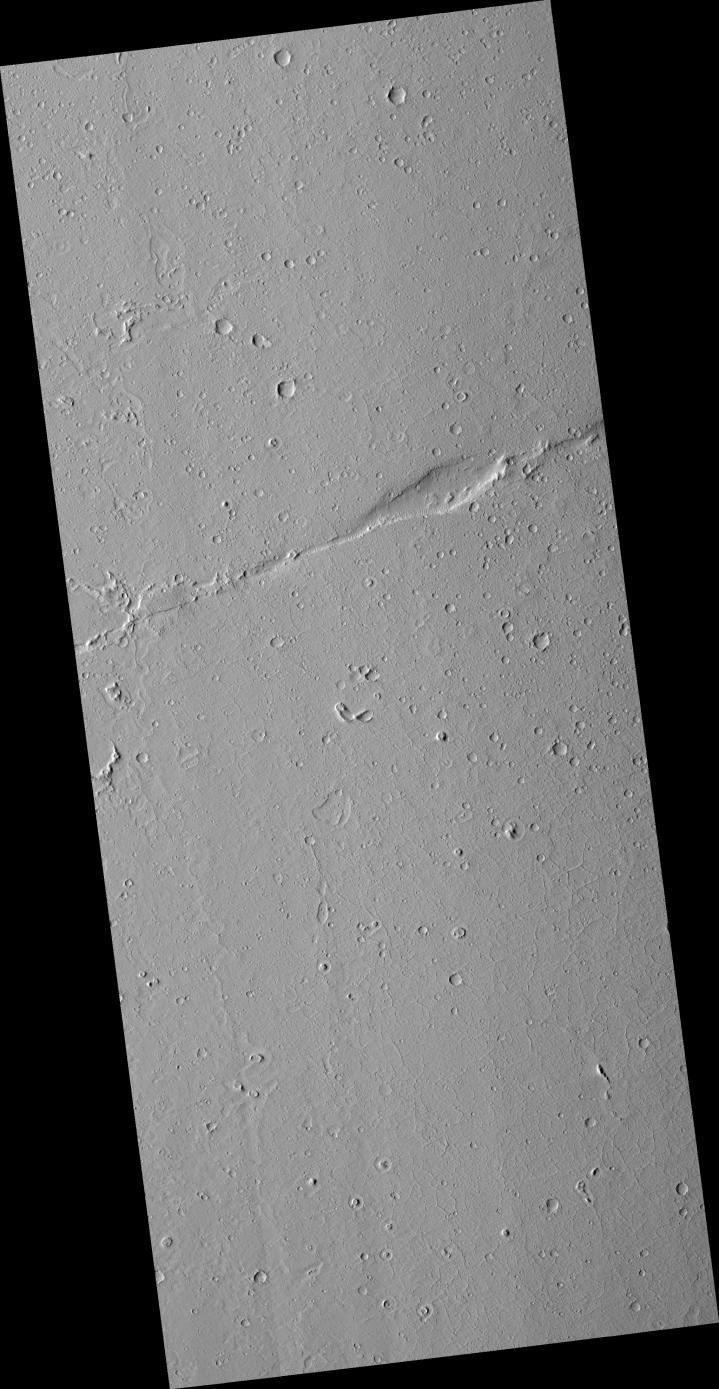
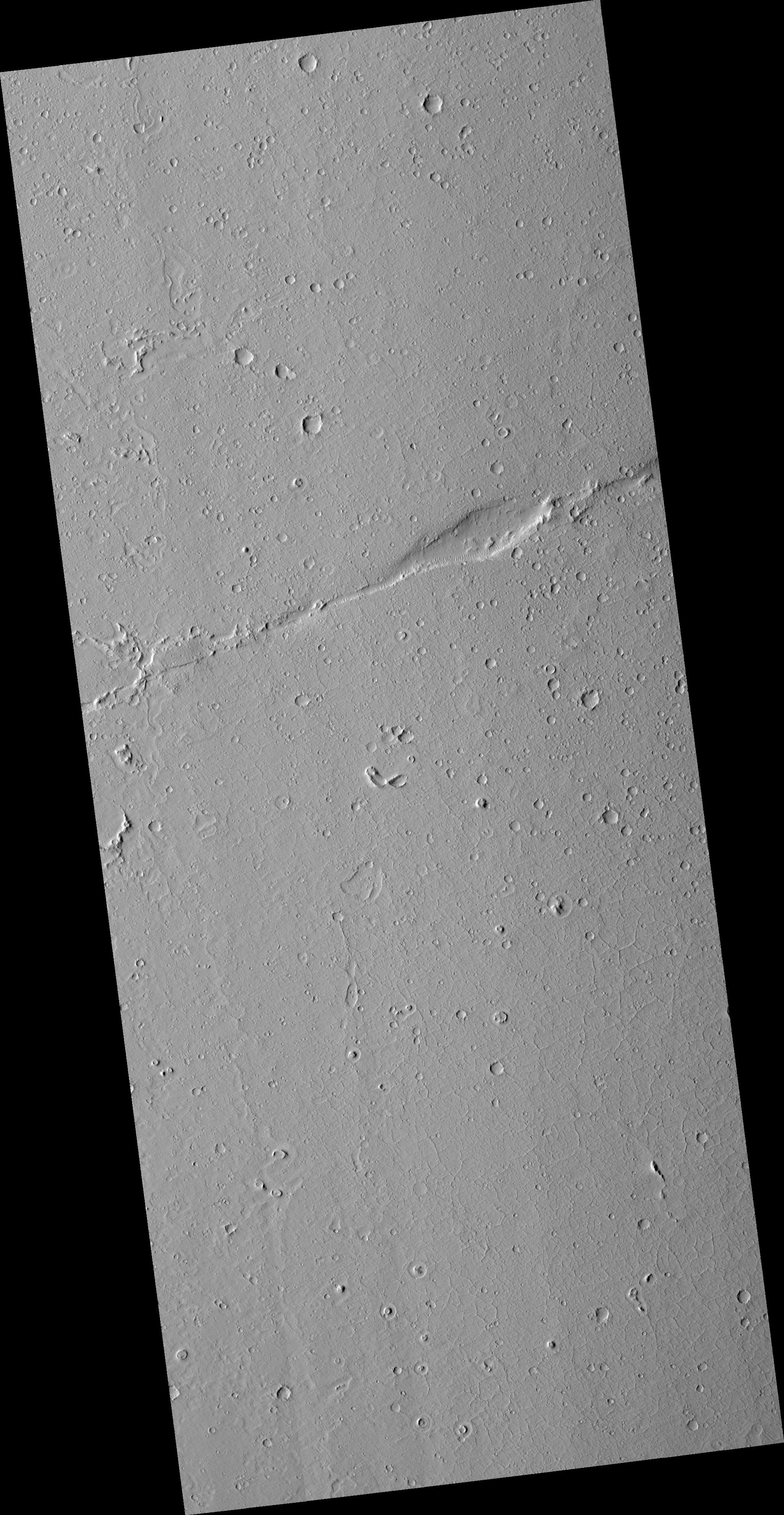
This HiRISE image is centered on a long "strike-slip" fault on the young plains in the Amazonis region of Mars. The most famous example of a strike-slip fault on the Earth is probably the San Andreas Fault in California. The smooth plains here have few large craters, indicating that it has been resurfaced relatively recently. The fact that the faults have cut these plains indicates that tectonic processes (and Mars-quakes) have occurred even more recently. Of course, "recently" on Mars is a relative term; it is likely that both the surfaces and the faulting are more than a billion years old. Other interesting features are the moats around knobs and craters in the plains (most prominently near the southern edge of the image) and convoluted depressions that might mark a channel along the western edge of the image.
Image PSP_001578_2000 was taken by the High Resolution Imaging Science Experiment (HiRISE) camera onboard the Mars Reconnaissance Orbiter spacecraft on November 27, 2006. The complete image is centered at 19.7 degrees latitude, 198.7 degrees East longitude. The range to the target site was 286.9 km (179.3 miles). At this distance the image scale is 57.4 cm/pixel (with 2 x 2 binning) so objects ~172 cm across are resolved. The image shown here has been map-projected to 50 cm/pixel and north is up. The image was taken at a local Mars time of 3:26 PM and the scene is illuminated from the west with a solar incidence angle of 49 degrees, thus the sun was about 41 degrees above the horizon. At a solar longitude of 141.7 degrees, the season on Mars is Northern Summer.
NASA's Jet Propulsion Laboratory, a division of the California Institute of Technology in Pasadena, manages the Mars Reconnaissance Orbiter for NASA's Science Mission Directorate, Washington. Lockheed Martin Space Systems, Denver, is the prime contractor for the project and built the spacecraft. The High Resolution Imaging Science Experiment is operated by the University of Arizona, Tucson, and the instrument was built by Ball Aerospace and Technology Corp., Boulder, Colo.