Figure 1
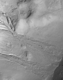
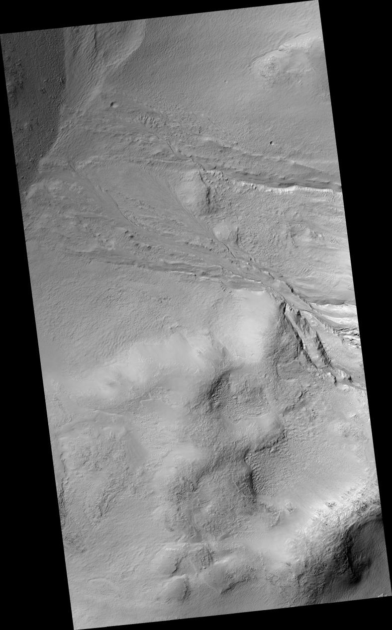
Click on image for larger versionThis HiRISE image of gullies in Wirtz Crater reveals fine structural details of these fluvial landforms. In the upper regions (near the middle left of figure 1), the gullies have cut deep V-shaped valley forms into the steep crater walls. Downhill, where the slope flattens somewhat, the gullies have cut less deeply into the crater floor and are braided in appearance. In some places bedforms -- or features typically found in terrestrial rivers and streams -- can be discerned, particularly small, streamlined features or bars along more braided sections. Finally, as the gullies reach the crater floor, near the center of the image, they form fan deposits where transported sediment accumulates.
Image PSP_001349_1310 was taken by the High Resolution Imaging Science Experiment (HiRISE) camera onboard the Mars Reconnaissance Orbiter spacecraft on November 9, 2006. The complete image is centered at -48.6 degrees latitude, 335.3 degrees East longitude. The range to the target site was 250.4 km (156.5 miles). At this distance the image scale is 50.1 cm/pixel (with 2 x 2 binning) so objects ~150 cm across are resolved. The image shown here has been map-projected to 50 cm/pixel and north is up. The image was taken at a local Mars time of 3:42 PM and the scene is illuminated from the west with a solar incidence angle of 83 degrees, thus the sun was about 7 degrees above the horizon. At a solar longitude of 132.9 degrees, the season on Mars is Northern Summer.
NASA's Jet Propulsion Laboratory, a division of the California Institute of Technology in Pasadena, manages the Mars Reconnaissance Orbiter for NASA's Science Mission Directorate, Washington. Lockheed Martin Space Systems, Denver, is the prime contractor for the project and built the spacecraft. The High Resolution Imaging Science Experiment is operated by the University of Arizona, Tucson, and the instrument was built by Ball Aerospace and Technology Corp., Boulder, Colo.
