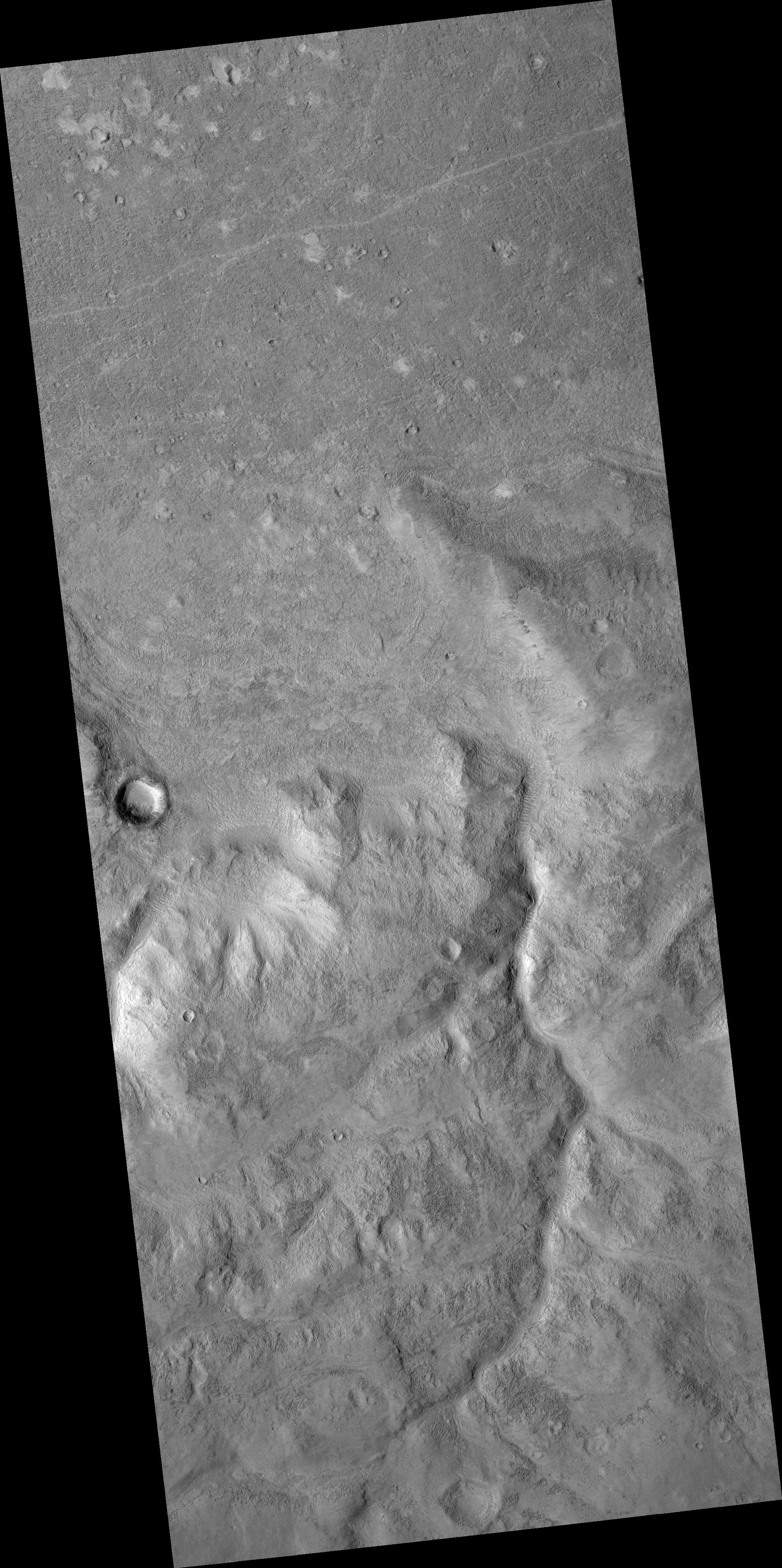
This HiRISE image crosses over a part of the hemispheric dichotomy boundary on Mars which separates low-lying northern plains from older southern highlands. In the northern part of the scene, much of the surface is covered with small boulders, most only 1-2 meters wide (1 meter is approximately 1 yard). In other areas, it appears that sand or dust has accumulated in depressions, forming light patches. These areas also show short sinuous or linear features, likely ripples formed from wind-blown material. The southern part contains an old valley, now mantled by later deposits, and has a pitted texture due to erosion. It has been proposed that the lowland was once filled by an ocean. In this case several arcuate or linear features along the boundary slope could be old shorelines, but this interpretation is still debated. The features have been modified by erosion, and in some cases appear to slope towards the highlands.
Image PSP_001414_2165 was taken by the High Resolution Imaging Science Experiment (HiRISE) camera onboard the Mars Reconnaissance Orbiter spacecraft on November 14, 2006. The complete image is centered at 36.1 degrees latitude, 351.2 degrees East longitude. The range to the target site was 293.6 km (183.5 miles). At this distance the image scale is 58.7 cm/pixel (with 2 x 2 binning) so objects ~176 cm across are resolved. The image shown here has been map-projected to 50 cm/pixel and north is up. The image was taken at a local Mars time of 3:24 PM and the scene is illuminated from the west with a solar incidence angle of 49 degrees, thus the sun was about 41 degrees above the horizon. At a solar longitude of 135.3 degrees, the season on Mars is Northern Summer.
NASA's Jet Propulsion Laboratory, a division of the California Institute of Technology in Pasadena, manages the Mars Reconnaissance Orbiter for NASA's Science Mission Directorate, Washington. Lockheed Martin Space Systems, Denver, is the prime contractor for the project and built the spacecraft. The High Resolution Imaging Science Experiment is operated by the University of Arizona, Tucson, and the instrument was built by Ball Aerospace and Technology Corp., Boulder, Colo.
