Figure 1
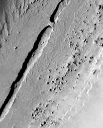
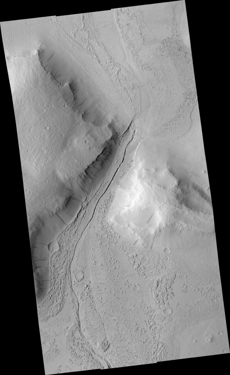
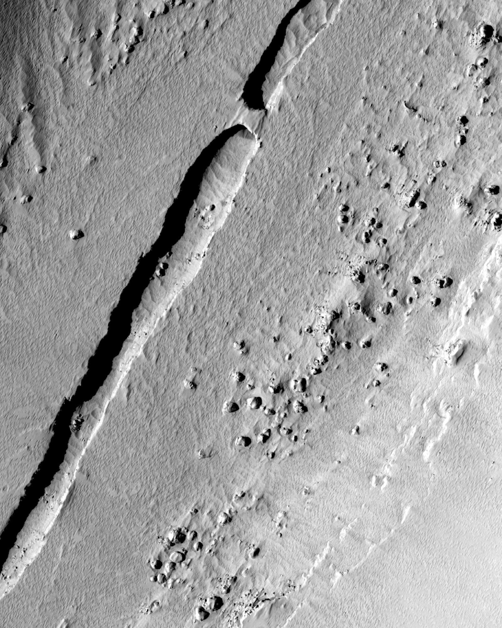
Click on image for larger versionThis HiRISE image shows a narrow trough running down the center of a valley that lies between two hills in the Tartarus Colles region of Mars. Lower resolution images acquired by earlier spacecraft showed that a platy-ridged flow, perhaps of lava, ran through this valley before solidifying. However at HiRISE resolution, the dominant textures on the valley floor are not rafted plates and arcuate ridges but scallops in the dust that blankets the surface and rocky knobs that poke through much of the dust. Several of the knobs are boulders that tumbled downhill in a process known as mass wasting, which has widened the valley over time. The prominent trough in the middle of the valley is about 40 m (130 feet) wide, and it is not entirely continuous. In the upper part of the sub-image (see figure 1), two trough segments terminate in blunt ends that are separated by a natural bridge or wall of material 23 meters (75 feet) wide. Given the broader geologic context, it is likely that this trough formed as a lava tube and that its roof has mostly caved in over time, leaving only a small section standing. Lava tubes form when the top and sides of a "river" of lava freeze while molten rock continues to flow through its interior. After the eruption ceases, molten lava flows out of the tube leaving it empty. Tubes require a steady and sustained flow of lava to form, and they allow the lava to be transported a considerable distance without losing too much heat. HiRISE images like this one are helping to decipher the different types of volcanism that have occurred on Mars.
Image PSP_001420_2045 was taken by the High Resolution Imaging Science Experiment (HiRISE) camera onboard the Mars Reconnaissance Orbiter spacecraft on November 15, 2006. The complete image is centered at 24.5 degrees latitude, 188.1 degrees East longitude. The range to the target site was 288.9 km (180.6 miles). At this distance the image scale ranges from 28.9 cm/pixel (with 1 x 1 binning) to 57.8 cm/pixel (with 2 x 2 binning). The image shown here [below] has been map-projected to 25 cm/pixel and north is up. The image was taken at a local Mars time of 3:23 PM and the scene is illuminated from the west with a solar incidence angle of 48 degrees, thus the sun was about 42 degrees above the horizon. At a solar longitude of 135.6 degrees, the season on Mars is Northern Summer.
NASA's Jet Propulsion Laboratory, a division of the California Institute of Technology in Pasadena, manages the Mars Reconnaissance Orbiter for NASA's Science Mission Directorate, Washington. Lockheed Martin Space Systems, Denver, is the prime contractor for the project and built the spacecraft. The High Resolution Imaging Science Experiment is operated by the University of Arizona, Tucson, and the instrument was built by Ball Aerospace and Technology Corp., Boulder, Colo.