- Original Caption Released with Image:
-
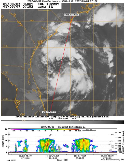
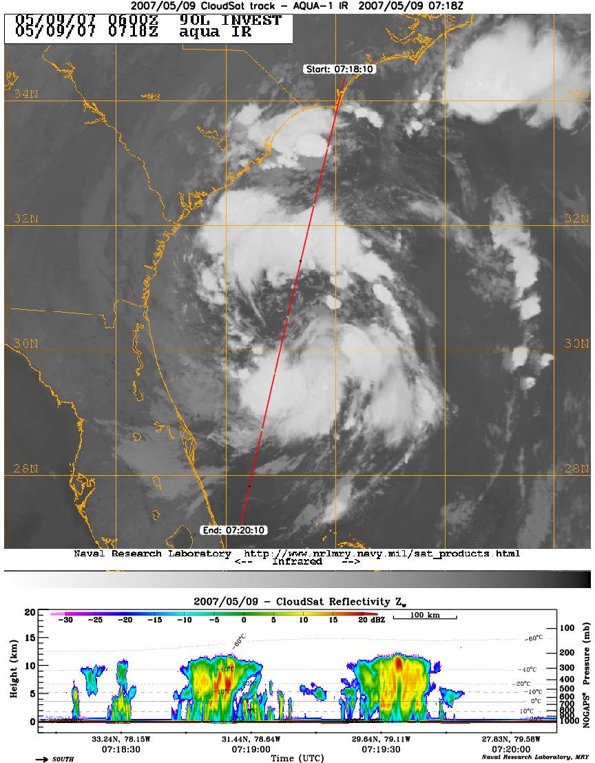
CloudSat's Cloud Profiling Radar captured a profile across Tropical Storm Andrea on Wednesday, May 9, 2007, near the South Carolina/Georgia/Florida Atlantic coast. The upper image shows an infrared view of Tropical Storm Andrea from the Moderate Resolution Imaging Spectroradiometer instrument on NASA's Aqua satellite, with CloudSat's ground track shown as a red line. The lower image is the vertical cross section of radar reflectivity along this path, where the colors indicate the intensity of the reflected radar energy. CloudSat orbits approximately one minute behind Aqua in a satellite formation known as the A-Train.
- Image Credit:
-
NASA/JPL/Colorado State University/Naval Research Laboratory-Monterey
Image Addition Date: -
2007-05-10
|