
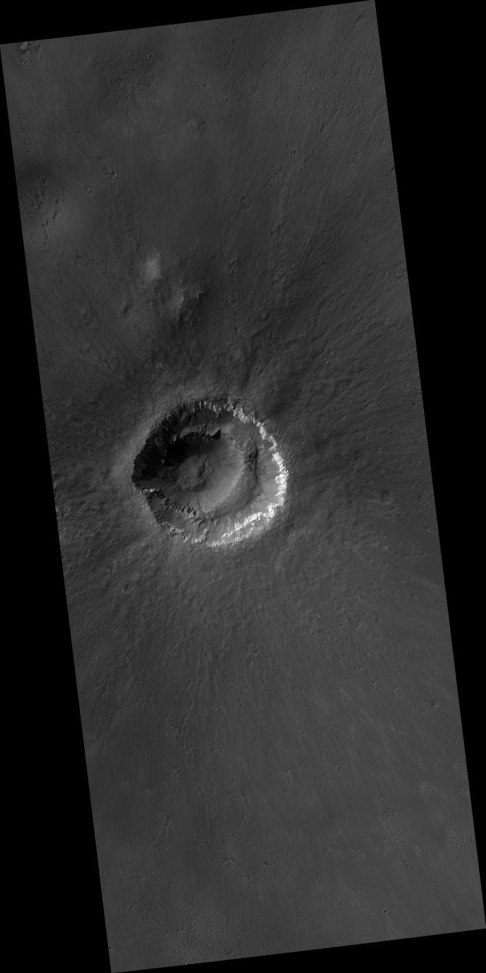
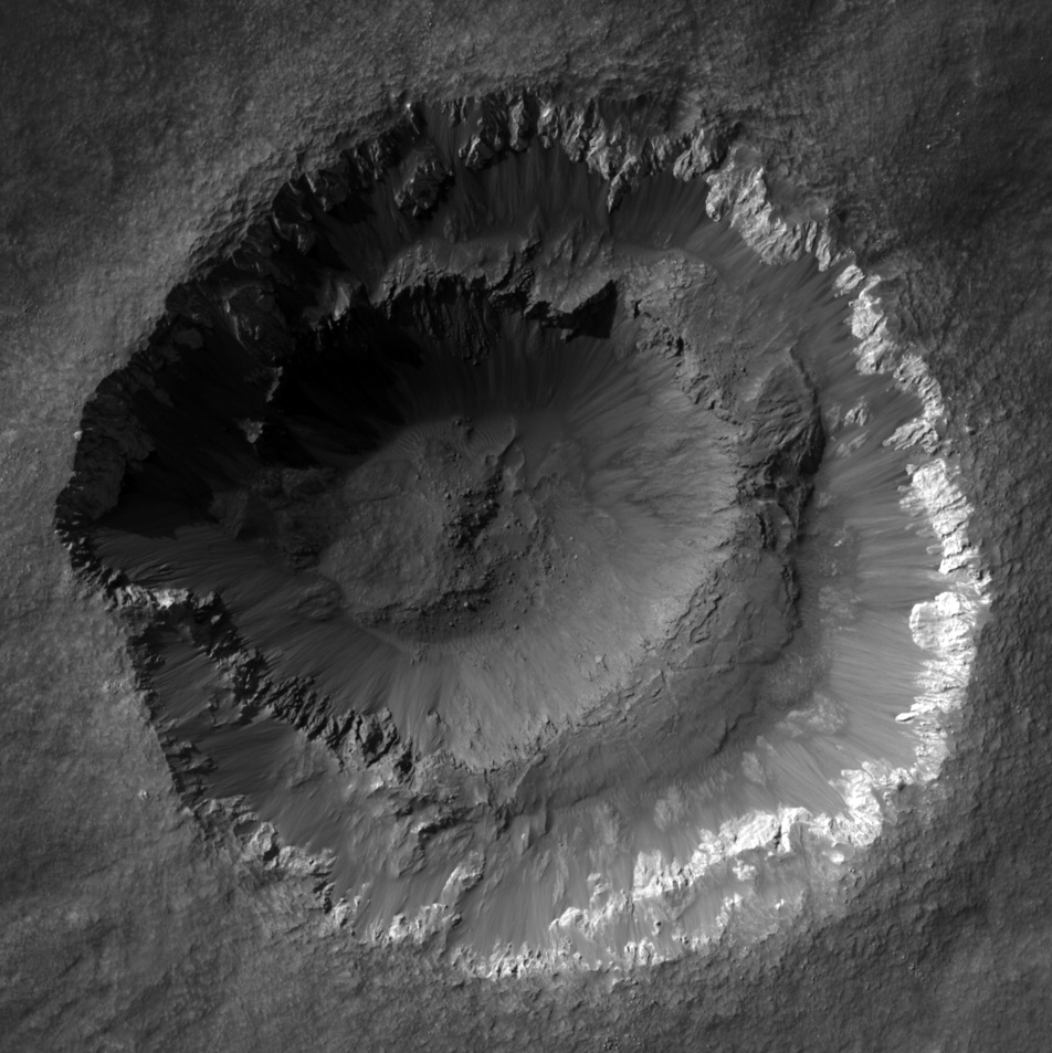
Click on image for larger versionThis HiRISE image covers the youthful and enigmatic Ada crater and its fresh ejecta situated on the southern bounds of Meridiani Planum. Ada crater has an approximate diameter of 2 kilometers.
Prior to HiRISE targeting, the crater's freshness was suspected from Mars Orbital Camera (MOC) images showing primary structures in the ejecta, from Thermal Emission Spectrometer (TES) and Thermal Emission Imaging System (THEMIS) mapping. THEMIS showed that the crater possesses a thermally distinct ejecta blanket, and TES spectral mapping demonstrated that the area surrounding the crater had been extensively swept clean of the surface deposit (possessing a Fe-rich mineral known as hematite) known to drape Meridiani Planum. The HiRISE sub-image shows that the crater has well-developed and sharp crater morphologic features with no discernible superimposed impact craters -- a clear testament to the crater's youthfulness. The interior crater morphology is what makes Ada so enigmatic, as it appears that it consists of two craters (i.e., a smaller crater nested in a larger one). Another idea explaining this "nested" crater-in-crater appearance is that the interior ledge may have been bedrock that slid down the crater wall. However, the darker tone of this interior "exposure" does not appear to match the light-toned bedrock exposed in the upper crater wall. This suggests that the crater sampled two distinct rock types from the subsurface. The presence of these two distinct rock types is an important clue with the difference in strength between these two rock types possibly causing the strange appearance of Ada crater. The other enigmatic aspect is the "scalloped" appearance of the wall rock/rim of the crater. This morphology is more pronounced at other craters in Meridiani Planum, such as Victoria Crater (see TRA_000873_1780) indicating that the more pronounced morphology results from erosion and continued downslope movement of material off the crater wall/rim.
Image PSP_001348_1770 was taken by the High Resolution Imaging Science Experiment (HiRISE) camera onboard the Mars Reconnaissance Orbiter spacecraft on November 9, 2006. The complete image is centered at -3.1 degrees latitude, 356.8 degrees East longitude. The range to the target site was 265.9 km (166.2 miles). At this distance the image scale is 26.6 cm/pixel (with 1 x 1 binning) so objects ~80 cm across are resolved. The image shown here [below] has been map-projected to 25 cm/pixel and north is up. The image was taken at a local Mars time of 3:32 PM and the scene is illuminated from the west with a solar incidence angle of 56 degrees, thus the sun was about 34 degrees above the horizon. At a solar longitude of 132.8 degrees, the season on Mars is Northern Summer.
NASA's Jet Propulsion Laboratory, a division of the California Institute of Technology in Pasadena, manages the Mars Reconnaissance Orbiter for NASA's Science Mission Directorate, Washington. Lockheed Martin Space Systems, Denver, is the prime contractor for the project and built the spacecraft. The High Resolution Imaging Science Experiment is operated by the University of Arizona, Tucson, and the instrument was built by Ball Aerospace and Technology Corp., Boulder, Colo.