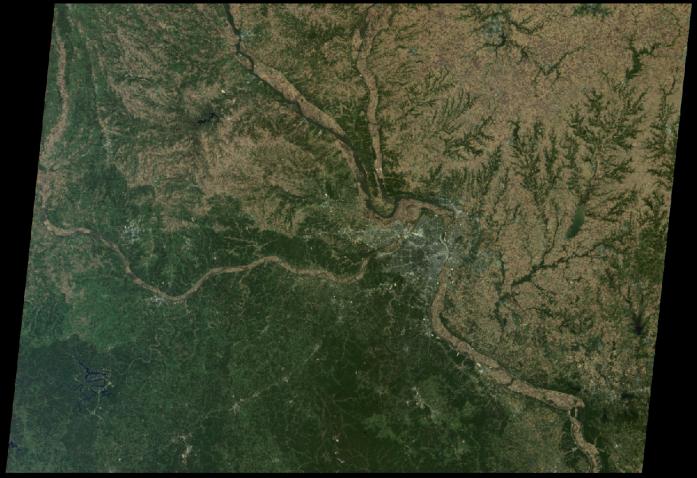
St. Louis is tucked in a bend of the Mississippi River, just south of the point at which the Illinois River joins the larger Mississippi, and where the Missouri River flows in from the west. Drainage patterns to the east, on the Illinois side, are highlighted with green vegetation. Meandering rivers in the verdant Ozark Plateau appear to the south and west.
This true-color view from NASA's Multi-angle Imaging SpectroRadiometer (MISR) was taken with the instrument's downward looking (nadir) camera on October 15, 2005. The urban areas of greater St. Louis show up as grey-white, including nearby Kirkwood, Webster Groves, Clayton, University City, Ferguson, St. Ann, St. Charles, and East St. Louis. The region is home to nearly three million people.
MISR was built and is managed by NASA's Jet Propulsion Laboratory, Pasadena, Calif., for NASA's Science Mission Directorate, Washington, DC. The Terra satellite is managed by NASA's Goddard Space Flight Center, Greenbelt, Md. JPL is a division of the California Institute of Technology.