 | 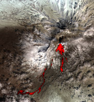 |
Klyuchevskoy Stratovolcano
Click on the image for
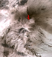
full resolution TIFF | Sheveluch Stratovolcano
Click on the image for
full resolution TIFF |
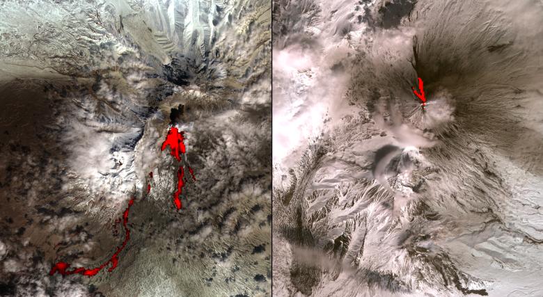
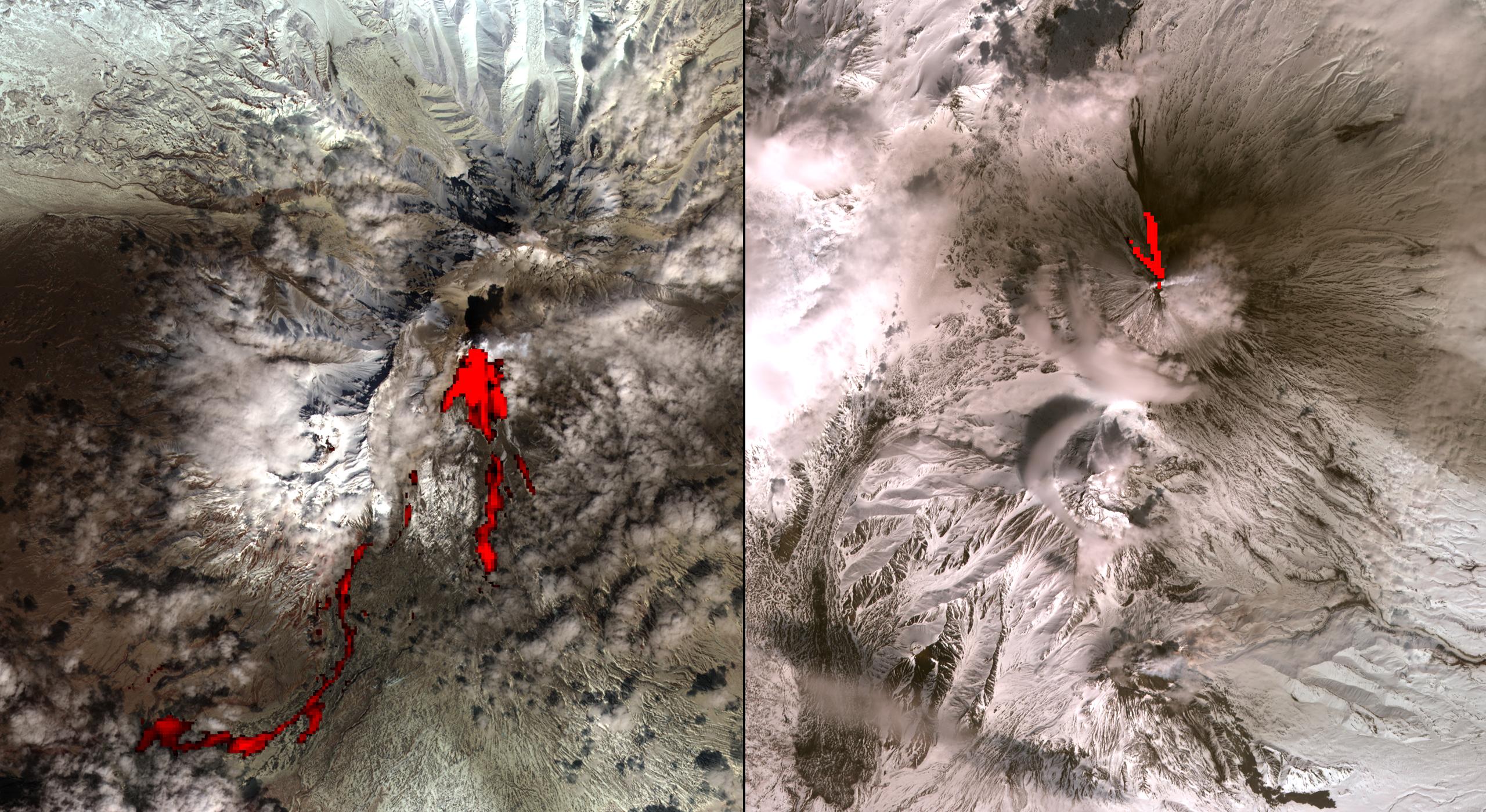
One of the most volcanically active regions of the world is the Kamchatka Peninsula in eastern Siberia, Russia. It is not uncommon for several volcanoes to be erupting at the same time. On April 26, 2007, the Advanced Spaceborne Thermal Emission and Reflection Radioneter (ASTER) on NASA's Terra spacecraft captured these images of the Klyuchevskoy and Sheveluch stratovolcanoes, erupting simultaneously, and 80 kilometers (50 miles) apart. Over Klyuchevskoy, the thermal infrared data (overlaid in red) indicates that two open-channel lava flows are descending the northwest flank of the volcano. Also visible is an ash-and-water plume extending to the east. Sheveluch volcano is partially cloud-covered. The hot flows highlighted in red come from a lava dome at the summit. They are avalanches of material from the dome, and pyroclastic flows.
With its 14 spectral bands from the visible to the thermal infrared wavelength region, and its high spatial resolution of 15 to 90 meters (about 50 to 300 feet), ASTER images Earth to map and monitor the changing surface of our planet.
ASTER is one of five Earth-observing instruments launched December 18, 1999, on NASA's Terra spacecraft. The instrument was built by Japan's Ministry of Economy, Trade and Industry. A joint U.S./Japan science team is responsible for validation and calibration of the instrument and the data products.
The broad spectral coverage and high spectral resolution of ASTER provides scientists in numerous disciplines with critical information for surface mapping, and monitoring of dynamic conditions and temporal change. Example applications are: monitoring glacial advances and retreats; monitoring potentially active volcanoes; identifying crop stress; determining cloud morphology and physical properties; wetlands evaluation; thermal pollution monitoring; coral reef degradation; surface temperature mapping of soils and geology; and measuring surface heat balance.
The U.S. science team is located at NASA's Jet Propulsion Laboratory, Pasadena, Calif. The Terra mission is part of NASA's Science Mission Directorate.
Size: 19.2 by 21 kilometers (11.9 by 13.0 miles)
Location: 57 degrees North latitude, 161 degrees East longitude
Orientation: North at top
Image Data: ASTER Bands 3, 2, and 1, and 12 in red
Original Data Resolution: ASTER 15 meters (49.2 feet) visible; 90 meters (295.2 feet) thermal infrared
Date Acquired: April 26, 2007