- Original Caption Released with Image:
-
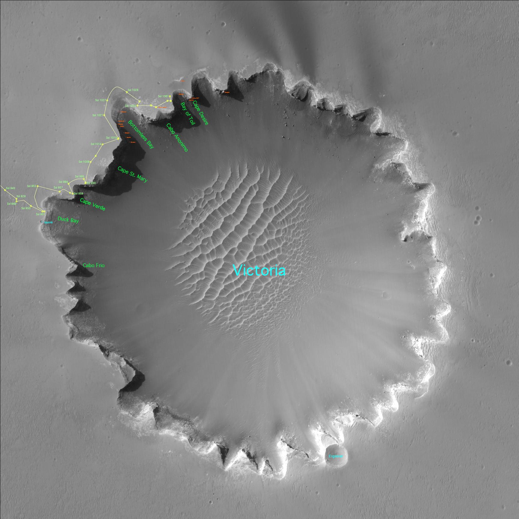
Three years after embarking on a historic exploration of the red planet and six miles away from its landing site, NASA's Mars Exploration Rover Opportunity is traversing "Victoria Crater" ridge by ridge, peering at layered cliffs in the interior. To identify various alcoves and cliffs along the way, science team members are using names of places visited by the 16th-century Earth explorer Ferdinand Magellan and his crew aboard the ship Victoria, who proved the Earth is round. (All names are unofficial unless approved by the International Astronomical Union.) This orbital view of "Victoria Crater" was taken by NASA's Mars Reconnaissance Orbiter.
- Image Credit:
-
NASA/JPL-Caltech/Univ. of Arizona
Image Addition Date: -
2007-01-23
|
