Since their discovery early during the Mars Global Surveyor's Mars Orbiter Camera investigation, as first reported in June 2000, Martian gullies have presented a puzzle for the Mars science community: what fluid was responsible for the erosion that created the channels, and where did it come from? The gullies seem to be quite young in a geologic sense (millions of years or less), yet modern and geologically-recent Mars is an extremely dry place, where water ice sublimates directly to gas when the temperature is warm enough.
Since June 2000, many hypotheses have been discussed at scientific meetings, in the scientific journals and elsewhere. The original June 2000 hypothesis held that the fluid was liquid water (either pure, salty, acidic, etc.) that came to the surface where slopes intersected conduits of groundwater. Such slopes include crater walls, valley walls, hills, massifs and crater central peaks. Later investigators explored the possibility that rather than liquid groundwater, the source was ground ice, which, under some climate conditions, melted to produce liquid runoff. Still others noted that thick mantles covered a fraction of the gully-bearing slopes, suggesting that the mantles were ancient, dust-covered snow or ice packs that might melt at the base to make liquid water runoff. Water was not the only fluid considered by various colleagues; carbon dioxide can be fluid at some pressures and temperatures. Fluid carbon dioxide was also proposed as a candidate fluidizing agent. Even dry mass movement, or land sliding, of unconsolidated granular material can exhibit some fluid-like behavior. Such mass movements were considered as an explanation for the gullies.
The presence of channels primarily formed by erosion but also displaying features representing along-channel deposition, such as levees and meanders, and terminal depositional aprons consisting of dozens to hundreds of individual flow lobes, contributed to the general acceptance of the hypothesis that gullies involved the action of liquid water.
Throughout the Mars Global Surveyor mission, the Mars Orbiter Camera team continued to image gullies at every opportunity, looking for new gullies, taking higher resolution images of previously identified gullies, and monitoring the gullies for changes that might occur. Among the results of this extensive survey are numerous examples of gullies that have geological relations to other things in their vicinity. This provides support for the hypothesis that the fluid responsible for the gullies came from beneath the ground, either as groundwater or melting of ice in the Martian subsurface. Three of the best examples are presented here.
Figure A: The first picture shows a pair of gully channels that emerge, fully-born at nearly their full width, from beneath small overhangs on the north wall of Dao Vallis. These overhangs are probably created by the presence of a hard-rock layer. Liquid, probably water, percolated through permeable layers just beneath these harder, more resistant rock layers. The arrow points to the place where one of the two neighboring channels emerges. This is a sub-frame of an image acquired on Jan. 10, 2006, located near 34.2 degrees south latitude, 268.1 degrees west longitude. The 150-meter scale bar is about 164 yards wide.
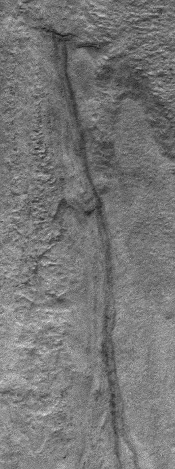
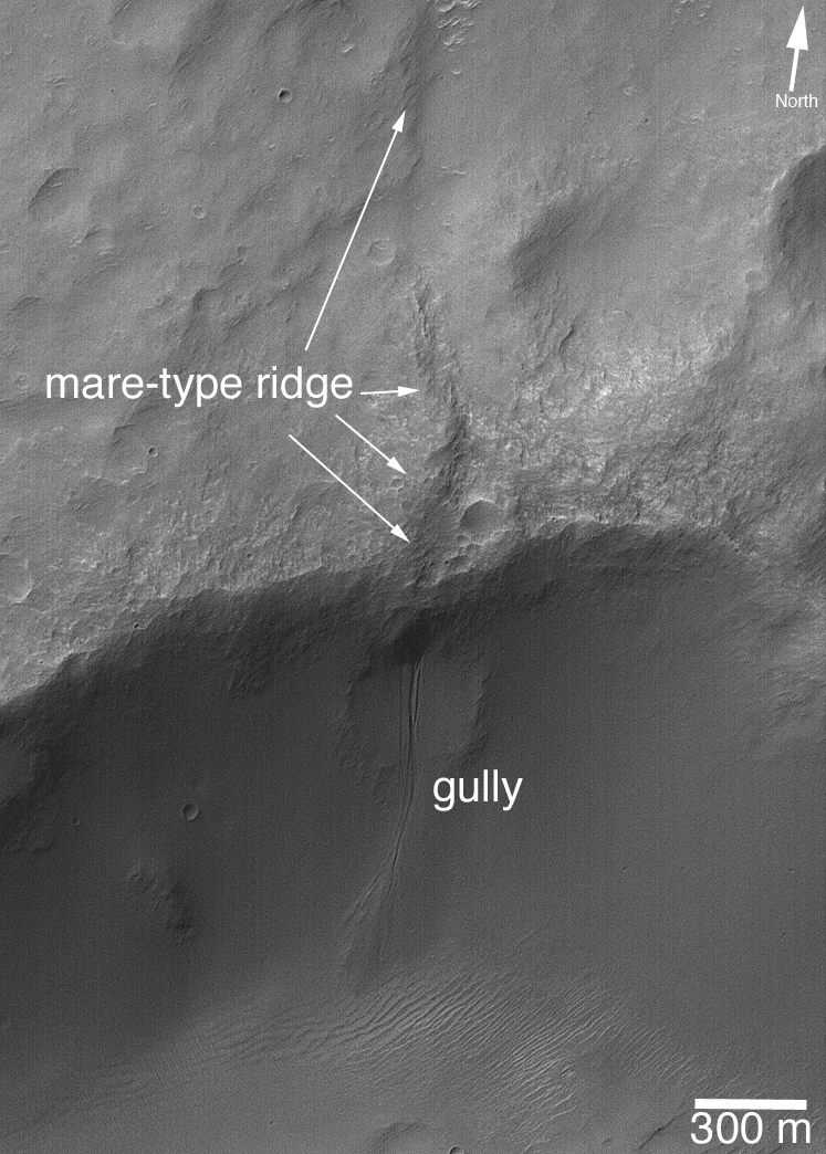
Figure B: The second picture shows a gully that formed on the wall of a crater that intersected a mare-type ridge. The term, mare, is from the dark volcanic plains of Earth's moon, for example Mare Tranquilitatis was the plain on which the Apollo 11 crew landed in 1969. The lunar maria (maria is the plural form of mare), when viewed from above, have many "wrinkle" ridges. These ridges are the surface expression of thrust faults. The mare-type ridge in the picture shown here is thus the product of faulting, as rocks on the west (left) side of the image were thrust toward the east (right). Finding a gully associated with a fault is excellent evidence for the groundwater hypothesis, because ground water percolates through cracks and pores in the ground. On Earth, springs (where groundwater comes to the surface) are often found along fault lines. What is most important about this particular Martian gully is that it occurs equatorward of 30 degrees south, which is extremely unusual. The only gully in this crater is the one associated with the fault. It is essentially the site of a spring, now dried up perhaps. This picture is a sub-frame of an image located near 29.1 degrees south latitude, 207.5 degrees west longitude, acquired on Jan. 17, 2005.
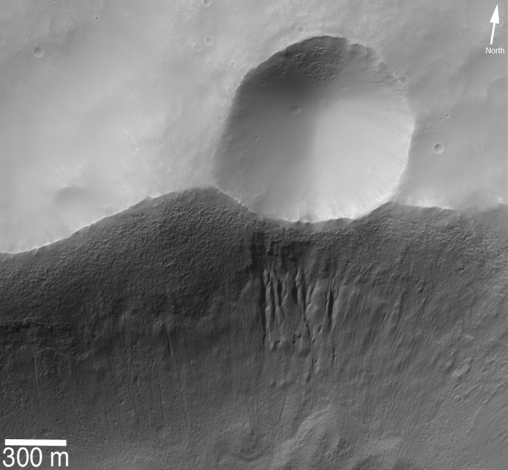
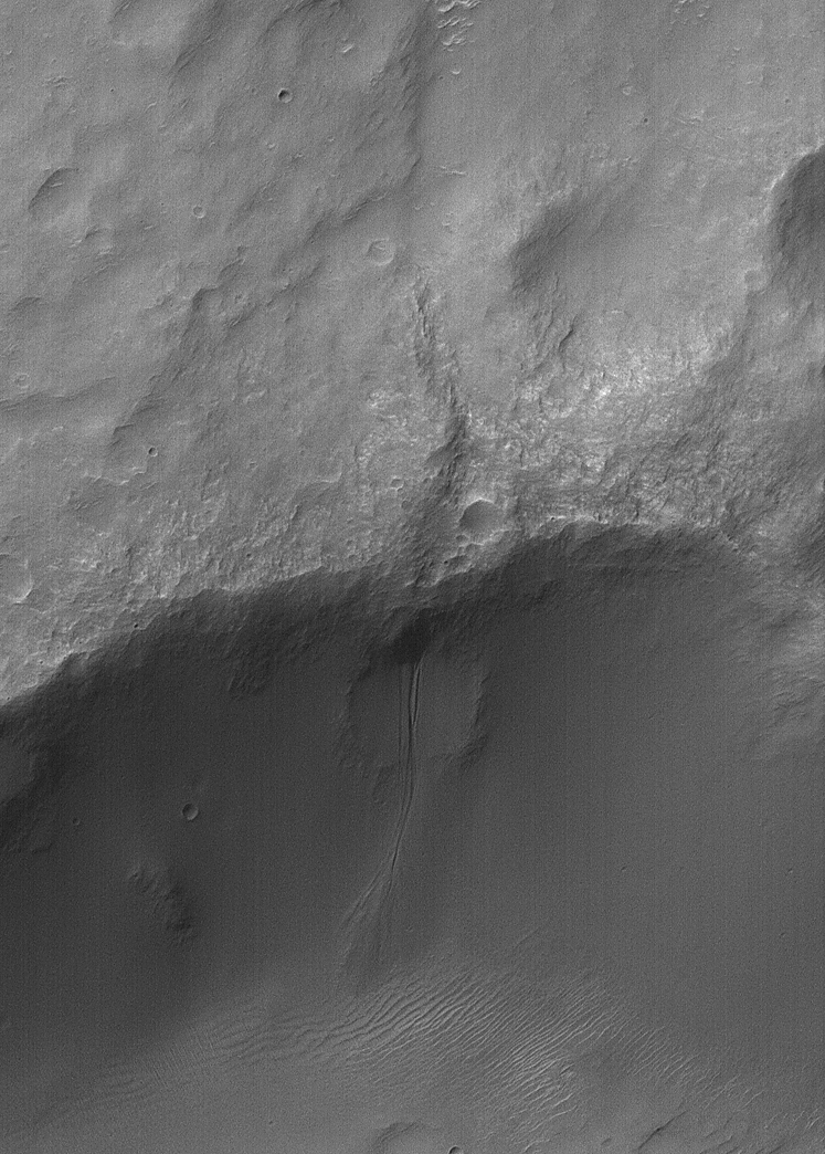
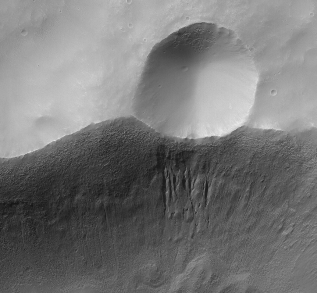
Figure C: The third picture shows a small crater on the rim of a larger crater. Only a small portion of the wall of this larger crater is captured in the image. Immediately beneath the small crater occurs a group of gullies. The presence of these gullies also supports the groundwater hypothesis because impacting meteors will fracture the rocks into which they form a crater. In this case, there would be an initial set of subsurface fractures caused by the large impact that created the original, large crater. Then, when the smaller crater formed, it would have created additional fractures in its vicinity. These extra fractures would then have provided pathways, or conduits, through which ground water would come to the surface on the wall of the larger crater, thus creating the gullies observed. One might speculate that the group of gullies was formed by the impact that made the small crater, because of the heat and fracturing of rock during the impact process. However, the gullies are much younger than the small crater; the ejecta from the small crater has been largely eroded away or buried, and the crater partially filled, while the gullies appear sharp, crisp and fresh. This is a portion of an image located near 33.9 degrees south latitude, 160 degrees west longitude, acquired on March 31, 2006.
The Mars Global Surveyor mission is managed for NASA's Office of Space Science, Washington, by NASA's Jet Propulsion Laboratory, Pasadena, Calif., a division of the California Institute of Technology, also in Pasadena. Lockheed Martin Space Systems, Denver, developed and operates the spacecraft. Malin Space Science Systems, San Diego, Calif., built and operates the Mars Orbiter Camera.
For more information about images from the Mars Orbiter Camera, see http://www.msss.com/mgs/moc/index.html.
