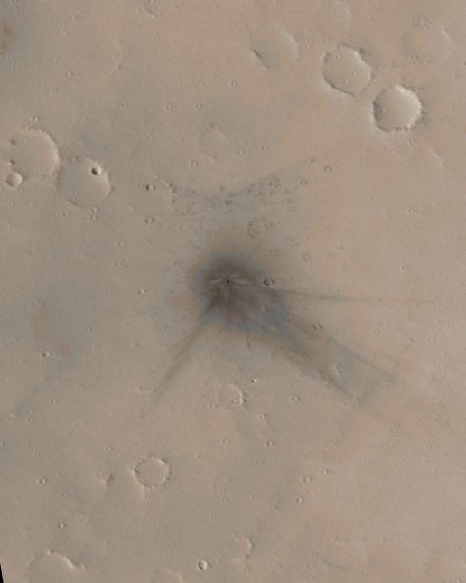
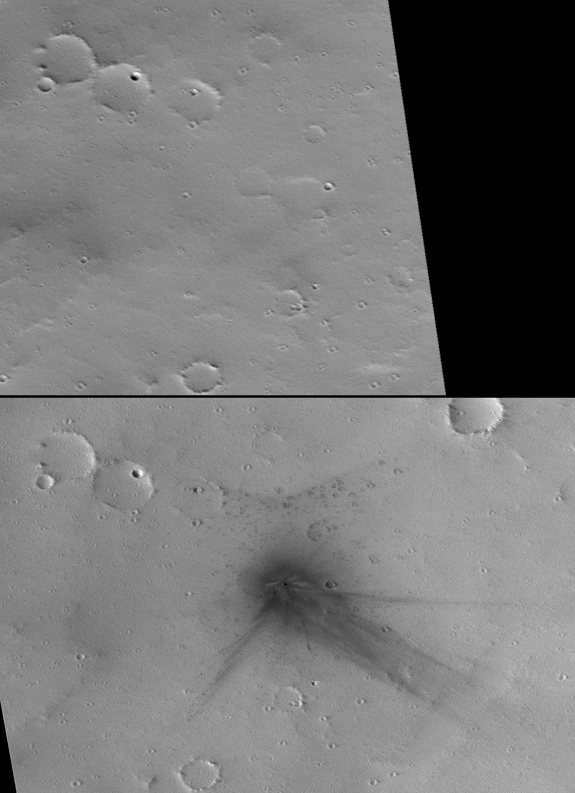
Two of the 20 new impact craters determined by the Mars Global Surveyor's Mars Orbiter Camera science operations team to have formed between May 1999 and March 2006 occur at a location that the narrow-angle camera imaged previously. This is surprising given that the narrow-angle camera, with its 3-kilometer-wide (1.9-mile-wide) field of view, has only covered about 5.2 percent of the Martian surface. One of the two craters that formed where the camera had already taken a narrow-angle image is featured here.
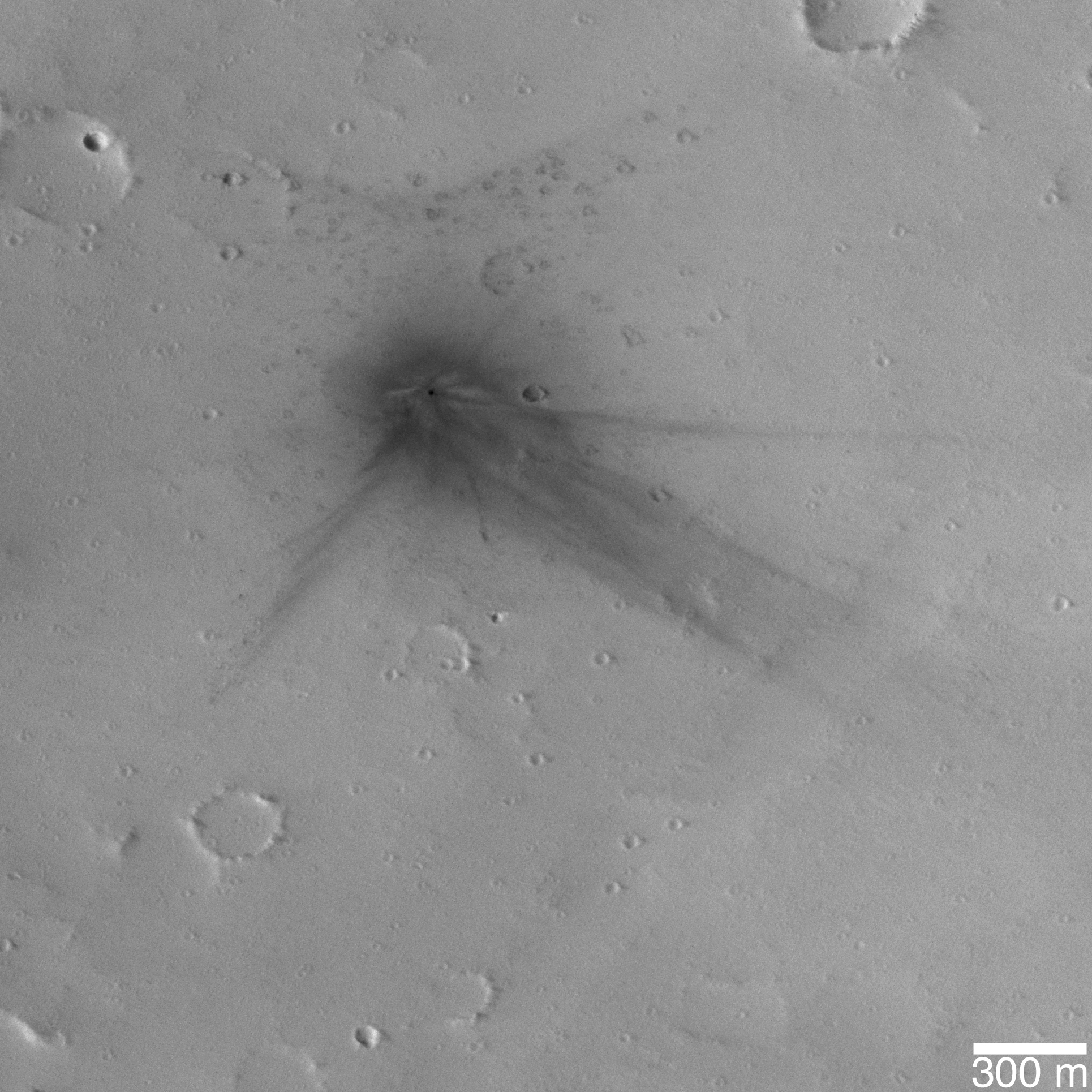
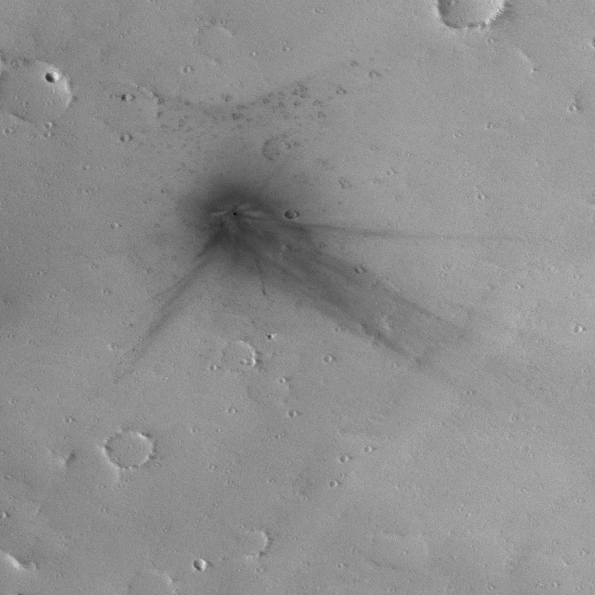
Figure A: The colorized image and figure A show sub-frames of an image acquired on March 13, 2006. This image has been colorized using a table derived from the colors of Mars as seen by the Mars Reconnaissance Orbiter's High Resolution Imaging Science Experiment camera. The impact site is located near 27.3 degrees north latitude, 91.8 degrees west longitude, on the upper north flank of the Martian volcano Ulysses Patera. Fine details are evident at the impact site, showing how the blast moved dust around and interacted with craters and other small obstacles on the ground. The crater has a diameter of about 19.8 meters (about 65 feet).
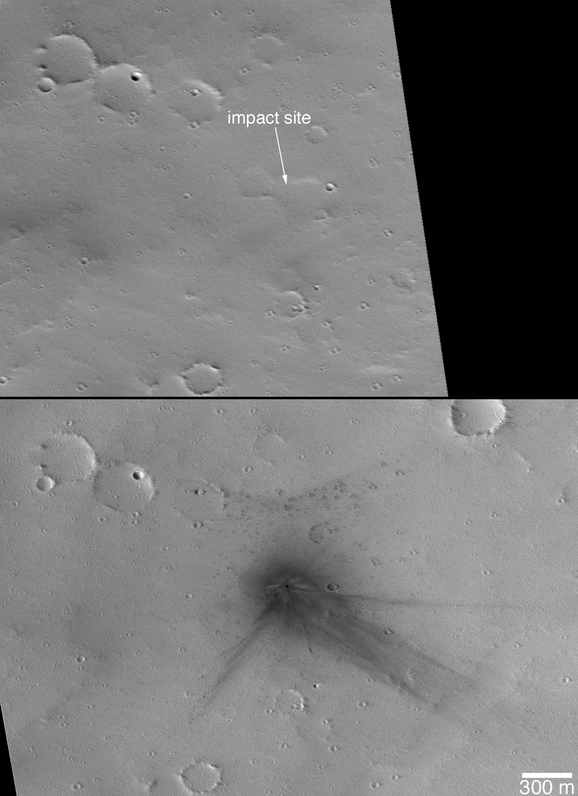
Figure B: The second figure shows before-and-after narrow-angle camera views of the impact site. The before image was acquired on Feb. 24, 2002. The after image was acquired on March 13, 2006.
Other images from Mars-orbiting spacecraft cover this location and show the impact site, including data from the Mars Express High Resolution Stereo Camera and Mars Odyssey Thermal Emission Imaging System. These other data help constrain when the impact occurred. The last orbiter image obtained before the impact was taken on April 18, 2003. The first orbiter image that showed the impact feature was obtained on Feb. 7, 2004. Thus, the impact occurred between those dates, April 18, 2003, and Feb. 7, 2004.
The Mars Global Surveyor mission is managed for NASA's Office of Space Science, Washington, by NASA's Jet Propulsion Laboratory, Pasadena, Calif., a division of the California Institute of Technology, also in Pasadena. Lockheed Martin Space Systems, Denver, developed and operates the spacecraft. Malin Space Science Systems, San Diego, Calif., built and operates the Mars Orbiter Camera.
For more information about images from the Mars Orbiter Camera, see http://www.msss.com/mgs/moc/index.html.
 Planetary Data System


