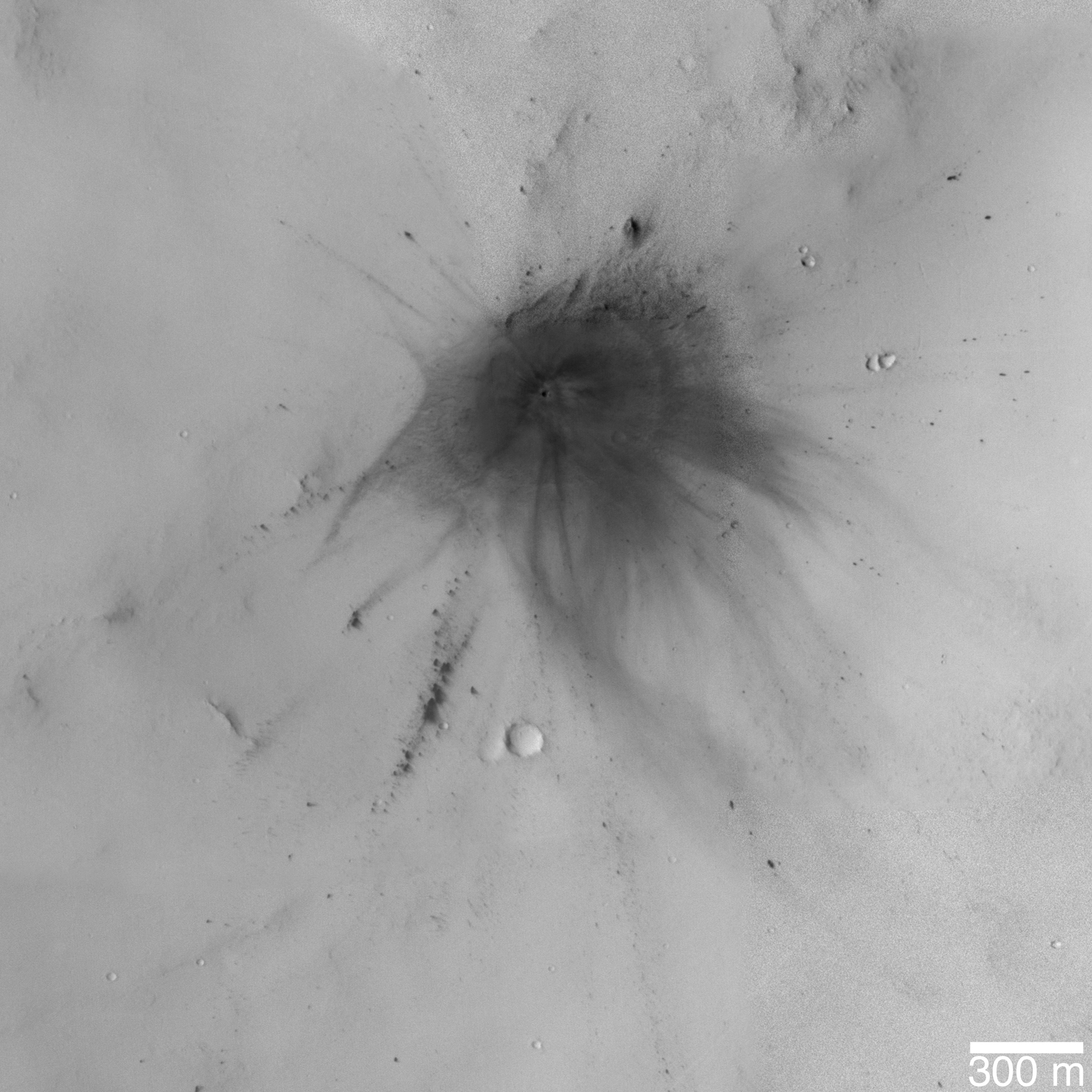
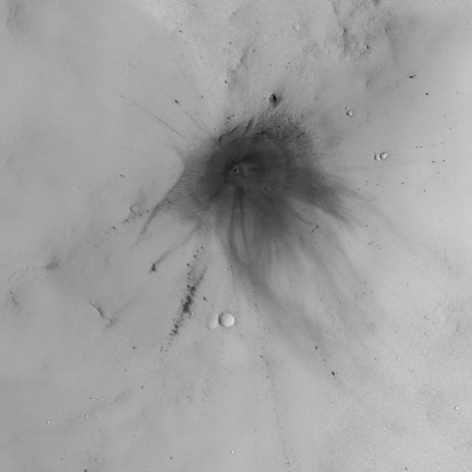
The images of new martian impact craters reveal many details about the impact event that result from the manner in which the impact process interacted with the dusty surface and thin planetary atmosphere; these data are sure to keep scientists busy for years. Of the 20 new impact craters found on Mars by the Mars Global Surveyor (MGS) Mars Orbiter Camera (MOC) in 2006, the one shown here is perhaps the prettiest. The darkened "blast zone" around the crater exhibits considerable details about how the energy transferred from the impact to the surrounding atmosphere and dust-mantled surface interacted. Wispy dark rays and dark, annular (nearly-circular) zones surround the crater, while several chains of dark spots formed by secondary impact radiate away for hundreds of meters from the tiny crater.
This impact site has a single crater of about 22.6 ± 1.7 meters (about 75 feet) in diameter. Compare this with the typical 100 yard U.S.-style football field: 75 feet is about 24.7 yards. The crater is located in Arabia Terra near 26.4°N, 336.5°W.
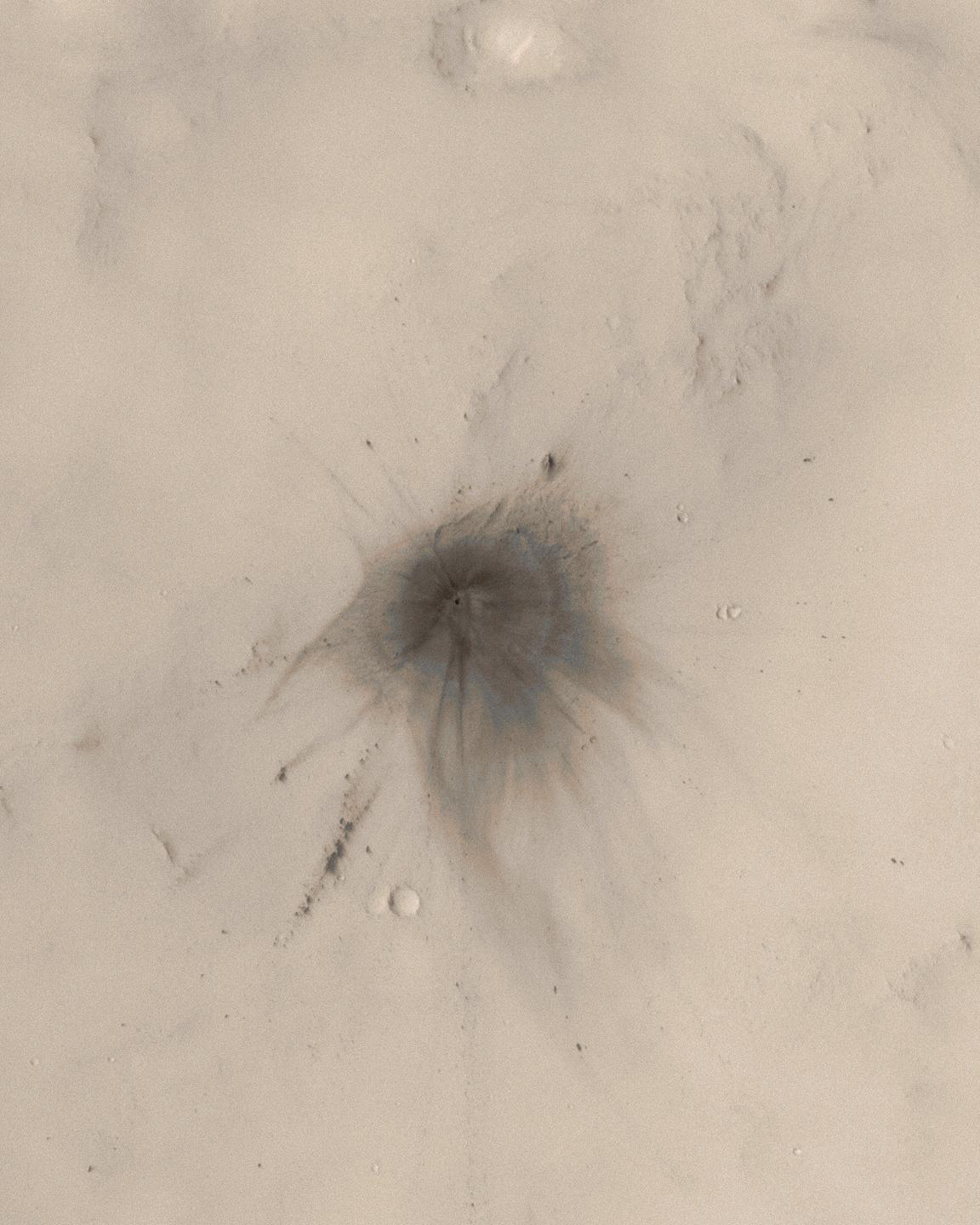
This picture is a colorized view of the crater. The image is a sub-frame of MOC narrow angle camera image S16-01674, obtained on 20 March 2006. The color comes from a look-up table derived from the colors of Mars as seen by the Mars Reconnaissance Orbiter's High Resolution Stereo Camera (HRSC).
Figures A and B: These pictures are grayscale composites of portions of MOC images S16-01674, S17-00795, S17-02191, and S18-01407, showing the impact site and the extensive rays developed during the impact event. These data were acquired during March, April, and May 2006.
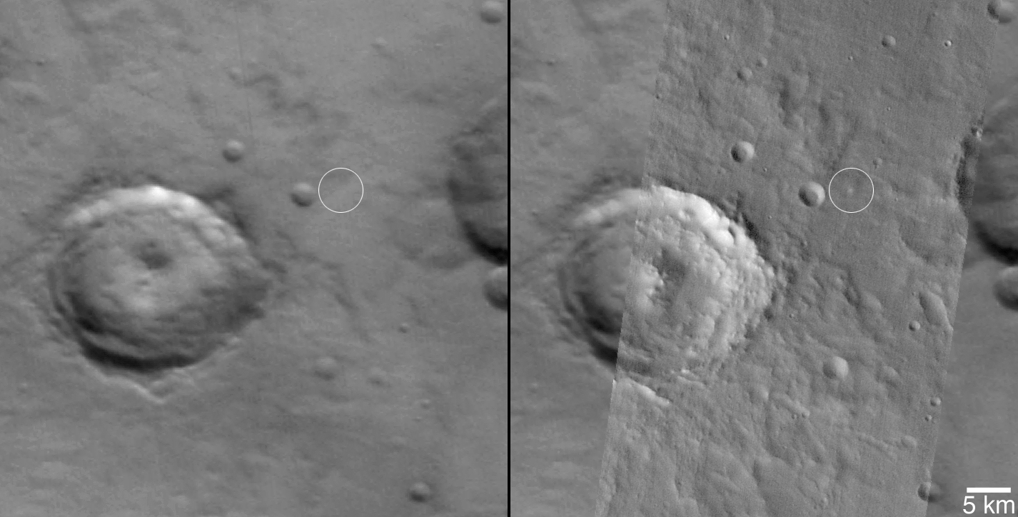
Figure C: This picture shows how the age of the crater was constrained. The first (left) is a portion of MOC red wide angle camera image R12-00786, acquired on 8 December 2003. The white circle indicates the location of the impact site, but the impact had not yet occurred. The second picture (right) shows the same MOC red wide angle image, overlain by a portion of an image from the Mars Odyssey Thermal Emission Imaging System (THEMIS). The THEMIS image is an infrared picture (I17523014, band 9, ~12.6 micrometers) acquired on 26 November 2005. In the infrared image, the impact site shows up as a bright spot because it is warmer than its surroundings during the day. These two pictures, thus, tell us that the impact occurred some time between 8 December 2003 and 26 November 2005.
The Mars Global Surveyor mission is managed for NASA's Office of Space Science, Washington, by the Jet Propulsion Laboratory, a division of the California Institute of Technology, Pasadena. Lockheed Martin Space Systems, Denver, developed and operates the spacecraft. Malin Space Science Systems, San Diego, Calif., built and operates the Mars Orbiter Camera.
For more information about images from the Mars Orbiter Camera, see http://www.msss.com/mgs/moc/index.html.

