- Original Caption Released with Image:
-

Click on the image for movie of
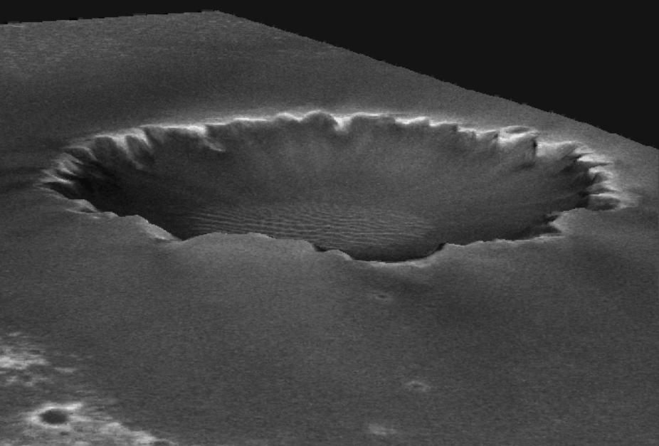
Animated Elevation Model of 'Victoria Crater'After driving more than 9 kilometers (5.6 miles) from the site where it landed in January 2004, NASA's Mars Exploration Rover Opportunity approached "Victoria Crater" in September 2006. The crater is about 750 meters (half a mile) across. That is about six times wider than "Endurance Crater," which Opportunity spent six months examining in 2004, and about 35 times wider than "Eagle Crater," where Opportunity first landed. The walls of Victoria hold the scientific allure of much taller stacks of geological layers -- providing the record of a longer span of the area's environmental history -- than Opportunity has been able to inspect on the Meridiani plains or at smaller craters. This animation created by the U.S. Geological Survey uses a digital elevation model generated from computer analysis of three images taken by the Mars Orbiter Camera aboard NASA's Mars Global Surveyor orbiter. The vertical dimension is not exaggerated relative to the horizontal dimensions. The crater is about 70 meters (230 feet) deep.The images used for providing the stereo information to calculate relative elevation were taken on Feb. 1, 2004 (http://www.msss.com/moc_gallery/r10_r15/images/R14/R1401689.html) and April 16, 2005 (http://www.msss.com/moc_gallery/s05_s10/images/S05/S0500863.html). The animation begins and ends with the view looking from the northwest toward the southeast. Opportunity is approaching Victoria from the northwest.
- Image Credit:
-
NASA/JPL/MSSS/USGS
Image Addition Date: -
2006-09-08
|
